Category:Maps of Bessarabia Governorate
Jump to navigation
Jump to search
Wikimedia category | |||||
| Upload media | |||||
| Instance of | |||||
|---|---|---|---|---|---|
| Category combines topics | |||||
| Bessarabia Governorate | |||||
governorate of the Russian Empire | |||||
| Instance of |
| ||||
| Location |
| ||||
| Capital | |||||
| Inception |
| ||||
| Dissolved, abolished or demolished date |
| ||||
| Population |
| ||||
| Area |
| ||||
| Replaced by | |||||
 | |||||
Subcategories
This category has only the following subcategory.
Media in category "Maps of Bessarabia Governorate"
The following 32 files are in this category, out of 32 total.
-
1897 Gov Bessarab ethno.jpg 969 × 594; 240 KB
-
Allgemeine Post- und Strassen-Karte des Russischen Reichs in Europa 10.jpg 5,534 × 4,633; 8.47 MB
-
Armenians in Bessarabia Governorate before 1850 (map).svg 1,807 × 1,230; 323 KB
-
Basic map of Bessarabia Governorate.svg 1,164 × 1,229; 204 KB
-
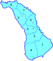
Besarab gub belcy.png 356 × 407; 8 KB
-
Bessarab gub Bendery.png 1,185 × 1,356; 52 KB
-
Bessarab gub.png 1,185 × 1,356; 56 KB
-
Bessarabia Governorate (1913).png 4,549 × 5,764; 15.03 MB
-
Bessarabia governorate 1821.jpg 4,876 × 4,722; 4.6 MB
-
Bessarabia Governorate 1871.jpeg 2,664 × 3,145; 2.64 MB
-
Bessarabia Governorate blank map.png 356 × 407; 8 KB
-
Bessarabia in Russian Empire (1914).svg 581 × 343; 310 KB
-
Bessarabia map BE.JPG 2,552 × 3,472; 1.79 MB
-
Brockhaus and Efron Encyclopedic Dictionary b6 602-0.jpg 2,552 × 3,472; 2.88 MB
-
Brockhaus and Efron Jewish Encyclopedia e4 371-0.jpg 1,143 × 1,705; 487 KB
-
Im578xAny-besarabskaya nar res.jpg 578 × 407; 42 KB
-
Lev S. Berg - Ethnographic map of Bessarabia.jpg 4,556 × 6,816; 12.53 MB
-
Map of Bessarabia region, 1835.gif 1,431 × 1,885; 941 KB
-
Map of railways in Russia, SouthWest, 1918.gif 999 × 1,058; 514 KB
-
Russia in Europe, Edward Stanford, 1864.jpg 1,088 × 1,558; 496 KB
-
Russian Bessarabia, 1883.jpg 2,262 × 3,497; 1.43 MB
-
Tarile romanesti la 1812.jpg 584 × 483; 144 KB
-
Ukrainian language in Bessarabia Governorate, 1897.png 1,185 × 1,356; 68 KB
-
Volostul Comrat (1856-1918).jpg 1,966 × 2,251; 164 KB
-
Vsya Rossiya 1902 page 46 Bessarabskaya Guberniya.jpg 1,365 × 2,012; 345 KB
-
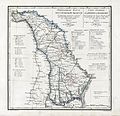
Карта Бессарабской области 1843.GIF 3,398 × 2,463; 3.1 MB
-
Карта волостей Бессарабской губернии.jpg 1,966 × 2,743; 900 KB
-
Почтовые трактыСорокского земства.png 1,012 × 1,630; 212 KB
-
Почтовые трактыЯсского земства.png 1,107 × 1,695; 214 KB


