Category:Maps of Berlin-Friedrichshain
Jump to navigation
Jump to search
Wikimedia category | |||||
| Upload media | |||||
| Instance of | |||||
|---|---|---|---|---|---|
| Category combines topics | |||||
| Friedrichshain | |||||
locality of Berlin | |||||
| Pronunciation audio | |||||
| Instance of | |||||
| Named after | |||||
| Location | Friedrichshain-Kreuzberg, Berlin, Germany | ||||
| Located in or next to body of water | |||||
| Population |
| ||||
| Area |
| ||||
| Elevation above sea level |
| ||||
| Different from | |||||
 | |||||
Media in category "Maps of Berlin-Friedrichshain"
The following 21 files are in this category, out of 21 total.
-
Andreasstrasse Plan Berlin Osten BusB 1896.jpg 791 × 738; 328 KB
-
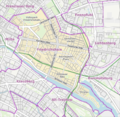
Berlin Friedrichshain-Kreuzberg Friedrichshain.png 410 × 281; 26 KB
-
Berlin Markthalle VIII Lageplan.jpg 2,118 × 1,659; 878 KB
-
Berlin platz der vereinten nationen skizze grundriss.jpg 752 × 478; 169 KB
-
Berlin-Friedrichshain Karte.png 882 × 859; 737 KB
-
Berlin-Stralau Karte von 1784 (FoP-Germany).jpg 577 × 883; 150 KB
-
BlnVerbindungsb.jpg 935 × 653; 232 KB
-
Friedhöfe LA Lageplan gesamt 2012-04-23 ama fec (21).JPG 2,103 × 1,382; 824 KB
-
Friedrichshain.jpg 2,000 × 2,754; 1.54 MB
-
Friedrichshain.png 1,264 × 1,056; 541 KB
-
Kaserne des Telegraphenbataillons Pharus-Plan Berlin von 1902.jpg 686 × 506; 165 KB
-
Lage Stralau.png 2,917 × 2,409; 323 KB
-
Lage-alter-ostbahnhof.jpg 626 × 497; 324 KB
-
Lichtenberg-Friedrichsberg 1902.jpg 1,000 × 1,011; 564 KB
-
OSM Ortsteil Friedrichshain.png 552 × 564; 441 KB
-
StB Samariterviertel Karte.jpg 2,408 × 1,271; 1,021 KB
-
Plan HI Stralau - Wasserstadt Friedrichshain AMA fec (44) stitch.jpg 6,153 × 3,033; 2.79 MB
-
OSM Stralauer Platz mit histor. Darstellg 2012-02-29.png 832 × 699; 462 KB
-
Straube-Plan IIB Ecke Rüdersdorfer-Memeler Straße v2.jpg 1,500 × 760; 453 KB
-
ZLB-Berliner Ansichten-August-Boxhagen.jpg 1,058 × 913; 506 KB


