Category:Maps of Belgrade
Jump to navigation
Jump to search
Wikimedia category | |||||
| Upload media | |||||
| Instance of | |||||
|---|---|---|---|---|---|
| Category combines topics | |||||
| Belgrade | |||||
capital of Serbia | |||||
| Pronunciation audio | |||||
| Instance of | |||||
| Location | City of Belgrade, Serbia | ||||
| Located in or next to body of water | |||||
| Official language | |||||
| Head of government | |||||
| Present in work |
| ||||
| Organizational divisions |
| ||||
| Has part(s) |
| ||||
| Significant event |
| ||||
| Population |
| ||||
| Area |
| ||||
| Elevation above sea level |
| ||||
| Different from | |||||
| official website | |||||
 | |||||
Subcategories
This category has the following 9 subcategories, out of 9 total.
E
M
- Maps of New Belgrade (7 F)
- Maps of Zemun (9 F)
O
- Old maps of Belgrade (1 P, 38 F)
P
R
- Road maps of Belgrade (4 F)
Media in category "Maps of Belgrade"
The following 38 files are in this category, out of 38 total.
-
Beogradvaszove.jpg 800 × 600; 214 KB
-
Administrativna mapa srbije-beograd.png 243 × 346; 21 KB
-
Balkans2010.png 1,128 × 1,040; 135 KB
-
Banjica Forest.svg 1,053 × 744; 16 KB
-
Belgrade in Serbia and Europe.png 1,500 × 900; 528 KB
-
Belgrade urban developement 19th century.jpg 3,400 × 4,400; 1.92 MB
-
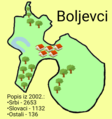
Boljevci mapa.png 812 × 866; 215 KB
-
Borca mz.png 1,459 × 1,160; 55 KB
-
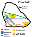
Crno Brdo (Surčin).png 447 × 517; 49 KB
-
Dobanovci mapa.png 4,084 × 4,096; 1.61 MB
-
Gradska Opština Surčin.png 4,084 × 4,096; 1.66 MB
-
Jakovo mapa.png 1,406 × 1,365; 285 KB
-
Kineski most sat.jpg 1,273 × 893; 289 KB
-
Ledine - naselja.png 540 × 930; 84 KB
-
Local communities in New Belgrade 2019.svg 838 × 418; 45 KB
-
Location of Belgrade.png 1,019 × 1,383; 1.35 MB
-
Location of Beograd.gif 1,019 × 1,383; 15 KB
-
Map Belgrade transportation.jpg 4,445 × 3,130; 2.57 MB
-
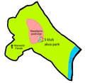
Mapa MZ Novi Surčin.png 800 × 600; 57 KB
-
Palilula mz.png 2,286 × 1,737; 146 KB
-
Pancevacki rit map.png 729 × 934; 71 KB
-
Prokop map with layers.jpg 2,125 × 2,750; 1.47 MB
-
Railway junction belgrade map.jpg 4,471 × 3,155; 1.84 MB
-
Relijef Beograd i toponima urednik P. Cikovac.jpg 1,672 × 2,358; 740 KB
-
Roman belgrade.jpg 4,250 × 2,750; 975 KB
-
Serbia Belgrade.png 400 × 565; 24 KB
-
Situacija.jpg 2,726 × 3,890; 1.24 MB
-
Situacija2.jpg 2,726 × 3,890; 1.25 MB
-
Situacija3.jpg 2,726 × 3,890; 1.41 MB
-
Statistical regions of Serbia.png 2,000 × 2,828; 677 KB
-
Statistical regions of Serbia.svg 744 × 1,052; 392 KB
-
Statistickiregioni.png 960 × 1,362; 195 KB
-
Statistički regioni Republike Srbije mk.svg 744 × 1,052; 388 KB
-
Statistički regioni Republike Srbije.svg 744 × 1,052; 392 KB
-
Sv sava topography P.Cikovac.jpg 1,587 × 2,381; 834 KB
-
Vojvoda Vuk Park, Belgrade, map.jpg 678 × 678; 115 KB
-
Zemun mz.png 1,968 × 1,461; 125 KB
-
Школа на мапи.png 470 × 524; 291 KB


