Category:Maps of Bayonne
Jump to navigation
Jump to search
Wikimedia category | |||||
| Upload media | |||||
| Instance of | |||||
|---|---|---|---|---|---|
| Category combines topics | |||||
| Bayonne | |||||
commune in Pyrénées-Atlantiques, France | |||||
| Instance of | |||||
| Part of | |||||
| Location | |||||
| Located in or next to body of water | |||||
| Head of government |
| ||||
| Significant event |
| ||||
| Population |
| ||||
| Area |
| ||||
| Elevation above sea level |
| ||||
| Different from | |||||
| official website | |||||
 | |||||
Media in category "Maps of Bayonne"
The following 51 files are in this category, out of 51 total.
-
64-AAV2020-Bayonne (partie française).png 3,519 × 2,643; 1.67 MB
-
64-Bayonne (partie française)-AAV2020.png 3,519 × 2,930; 1.6 MB
-
64102-Bayonne-argile.jpg 3,057 × 2,480; 871 KB
-
64102-Bayonne-Routes-Hydro.png 3,507 × 2,480; 6.25 MB
-
64102-Bayonne-Sols.png 3,270 × 2,598; 5.94 MB
-
64102-Bayonne-ZNIEFF1.png 3,057 × 2,480; 8.58 MB
-
64102-Bayonne-ZNIEFF2.png 5,866 × 4,133; 19.87 MB
-
Admiralty Chart No 1343 Adour River from the entrance to Bayonne, Published 1923.jpg 16,183 × 11,078; 46.36 MB
-
Admiralty Chart No 1343 Plans in the Bay of Biscay, Published 1961.jpg 16,199 × 11,064; 62.93 MB
-
Admiralty Chart No 2728 Spain north coast Bidassoa River to Cape Peñas, Published 1887.jpg 12,204 × 8,287; 10.5 MB
-
Baiona kokapena lapurdi.jpg 354 × 239; 26 KB
-
Baiona udalerria OSM 2016.png 1,046 × 1,077; 1.3 MB
-
Baiona, Euskal Herria.png 913 × 699; 503 KB
-
Baionako auzoak 1.png 640 × 682; 72 KB
-
Baionako udalerri mugakideak.png 640 × 682; 169 KB
-
Bayonne - btv1b105676748.jpg 3,742 × 2,950; 1.45 MB
-
Bayonne - btv1b8440561k.jpg 8,230 × 5,856; 5.59 MB
-
Bayonne - btv1b8469457p.jpg 8,851 × 6,488; 7.88 MB
-
Bayonne - btv1b84938556.jpg 11,024 × 8,218; 9.23 MB
-
Bayonne - btv1b8493856m.jpg 8,176 × 5,500; 6.91 MB
-
Bayonne - Sites inscrits ou classés.png 961 × 966; 290 KB
-
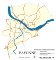
Bayonne - Voies de communication (2).png 1,068 × 1,132; 650 KB
-
Bayonne - Voies de communication.png 1,067 × 1,133; 650 KB
-
Bayonne 1657 Zeiller 15212.jpg 3,927 × 2,475; 6.24 MB
-
Bayonne communes limitrophes 10092014.png 2,266 × 2,415; 665 KB
-
Bayonne communication avec noms 10092014.png 2,266 × 2,415; 748 KB
-
Bayonne communication complete 10092014.png 2,266 × 2,415; 804 KB
-
Bayonne communication muette 10092014.png 2,266 × 2,415; 609 KB
-
Bayonne complete 10092014.svg 2,266 × 2,415; 130 KB
-
Bayonne ferroviaire.png 2,266 × 2,415; 446 KB
-
Bayonne Limite administrative.jpg 958 × 576; 185 KB
-
Bayonne Limite communale.jpg 952 × 575; 218 KB
-
Bayonne OSM 01.png 619 × 611; 314 KB
-
Bayonne OSM 02.png 619 × 611; 511 KB
-
Bayonne.- Bayonne - btv1b8440437k.jpg 8,302 × 5,712; 5.22 MB
-
Bayonne.- Plan de la ville et citadelle de Bayonne. Numéro troisième - Salmon - btv1b530620179.jpg 11,623 × 7,481; 12.12 MB
-
Bayonne.- Plan des ville et citadelle de Bayonne - btv1b8441588j.jpg 8,411 × 6,697; 10.07 MB
-
Bayonne.-Plan des ville et citadelle de Bayonne - btv1b8440591q.jpg 8,734 × 7,091; 10.87 MB
-
Carte des costes de France depuis Brest jusqu'a Bayone - par le S.B. - btv1b8593305t.jpg 4,056 × 5,928; 3.75 MB
-
Diocèse Bayonne 1789.svg 2,000 × 1,922; 801 KB
-
FMIB 36799 Embouchure de l'Adour et Port de Bayonne.jpeg 899 × 873; 232 KB
-
Map commune FR insee code 64102.png 756 × 605; 92 KB
-
Model of Bayonne - Musée des plans-reliefs.jpg 4,032 × 3,024; 3.17 MB
-
Quartiers de Bayonne 2014.svg 2,266 × 2,415; 47 KB
-
Quartiers de Bayonne.png 1,854 × 2,252; 407 KB
-
Southern France, including Corsica- handbook for travellers (1902) (14581124669).jpg 1,358 × 2,060; 1.14 MB
-
巴约讷街区地图.png 528 × 538; 38 KB


