Category:Maps of Bath, Somerset
Jump to navigation
Jump to search
Wikimedia category | |||||
| Upload media | |||||
| Instance of | |||||
|---|---|---|---|---|---|
| Category combines topics | |||||
| Bath | |||||
city in Somerset, England, United Kingdom | |||||
| Instance of |
| ||||
| Part of | |||||
| Location | Bath and North East Somerset, Somerset, South West England, England | ||||
| Heritage designation |
| ||||
| Inception |
| ||||
| Population |
| ||||
| Area |
| ||||
| Elevation above sea level |
| ||||
| Follows | |||||
| Different from | |||||
| official website | |||||
 | |||||
Subcategories
This category has only the following subcategory.
O
Media in category "Maps of Bath, Somerset"
The following 28 files are in this category, out of 28 total.
-
Ordnance Survey One-Inch Sheet 156 Bristol & Stroud, Published 1953.jpg 8,245 × 9,924; 10.47 MB
-
Bath Electric Tramways.png 960 × 590; 42 KB
-
Bath Tramways 1880 network.png 600 × 420; 19 KB
-
Bath tramways network.png 960 × 590; 50 KB
-
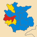
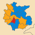
Bath UK local election 1976 map.svg 465 × 465; 174 KB
-
Bath UK local election 1978 map.svg 465 × 465; 173 KB
-
Bath UK local election 1979 map.svg 465 × 465; 173 KB
-
Bath UK local election 1980 map.svg 465 × 465; 173 KB
-
Bath UK local election 1982 map.svg 465 × 465; 173 KB
-
Bath UK local election 1983 map.svg 465 × 465; 173 KB
-
Bath UK local election 1984 map.svg 465 × 465; 173 KB
-
Bath UK local election 1986 map.svg 465 × 465; 173 KB
-
Bath UK local election 1987 map.svg 465 × 465; 173 KB
-
Bath UK local election 1988 map.svg 465 × 465; 173 KB
-
Bath UK local election 1990 map.svg 465 × 465; 173 KB
-
Bath UK local election 1991 map.svg 465 × 465; 173 KB
-
Bath UK local election 1992 map.svg 465 × 465; 173 KB
-
Bath UK local election 1994 map.svg 465 × 465; 173 KB
-
Bath UK ward map 1975 (blank).svg 496 × 496; 174 KB
-
Bath unparished area UK locator map.svg 1,425 × 982; 873 KB
-
Bath2010Constituency.svg 744 × 558; 458 KB
-
Location of Bath in England.png 2,165 × 2,670; 238 KB
-
Map of Bath, England.png 1,433 × 1,761; 1.22 MB
-
Ordnance Survey One-Inch Sheet 156 Bristol & Stroud, Published 1946.jpg 10,939 × 12,823; 18.14 MB
-
Ordnance Survey One-Inch Sheet 166 Frome, Published 1946.jpg 8,176 × 9,595; 11.4 MB
-
Ordnance Survey One-Inch Sheet 166 Frome, Published 1959.jpg 8,375 × 9,996; 12 MB
-
Ordnance Survey One-Inch Sheet 166 Frome, Published 1972.jpg 11,015 × 13,214; 42.98 MB
-
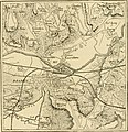
The earth and its inhabitants (1881) (14597776077).jpg 1,828 × 1,884; 628 KB


