Category:Maps of Barnstaple
Jump to navigation
Jump to search
Media in category "Maps of Barnstaple"
The following 17 files are in this category, out of 17 total.
-

-

-
 Admiralty Chart No 1160 Barnstaple and Bideford Published 1953.jpg 7,989 × 6,146; 5.8 MB
-

-
 Barnstablemap 1937.jpg 2,544 × 3,504; 1.67 MB
-
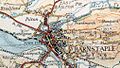 Barnstablemap.jpg 506 × 288; 52 KB
-
 Barnstaple.png 1,280 × 1,241; 244 KB
-
 Ordnance Survey One-Inch Sheet 118 Barnstaple & Exmoor, Published 1918r.jpg 11,955 × 8,925; 10.5 MB
-
 Ordnance Survey One-Inch Sheet 118 Barnstaple and Exmoor, Published 1919.jpg 12,146 × 8,428; 11.35 MB
-
 Ordnance Survey One-Inch Sheet 163 Barnstaple, Published 1946.jpg 8,183 × 9,579; 10.79 MB
-
 Ordnance Survey One-Inch Sheet 163 Barnstaple, Published 1960.jpg 8,282 × 9,945; 11.25 MB
-
 Ordnance Survey One-Inch Sheet 163 Barnstaple, Published 1972.jpg 11,066 × 13,207; 46.11 MB
-
 Ordnance Survey Sheet SS 43 53 Barnstaple, Published 1970.jpg 14,868 × 7,025; 38.71 MB
-
 River Yeo (Barnstaple) map.png 1,506 × 1,497; 311 KB
-

-

-

.jpg)
.jpg)


_map.png)
.jpg)
.jpg)
.jpg)