Category:Maps of Balhae
Jump to navigation
Jump to search
Wikimedia category | |||||
| Upload media | |||||
| Instance of | |||||
|---|---|---|---|---|---|
| Category combines topics | |||||
| Balhae | |||||
ancient kingdom in Asia (698–926) | |||||
| Instance of | |||||
| Named after | |||||
| Capital |
| ||||
| Inception |
| ||||
| Dissolved, abolished or demolished date |
| ||||
| Religion or worldview | |||||
| Replaced by |
| ||||
| |||||
Media in category "Maps of Balhae"
The following 23 files are in this category, out of 23 total.
-
Balhae Kingdom.png 1,276 × 936; 554 KB
-
Balhae Map.jpg 1,024 × 799; 201 KB
-
Balhae map.png 1,024 × 1,024; 272 KB
-
Balhae-Territory in 830 jp.png 1,045 × 868; 1.25 MB
-
Balhae-Territory in 830.JPG 1,045 × 868; 737 KB
-
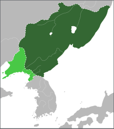
Balhae.svg 512 × 580; 8 KB
-
BalhaeHeight.png 581 × 588; 37 KB
-
Great Balhae (1116).svg 600 × 900; 25 KB
-
Heungyo.svg 600 × 900; 25 KB
-
Jeongan.svg 600 × 900; 26 KB
-
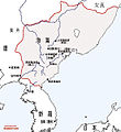
Largest Area of Balhe-zh-classical.png 713 × 777; 244 KB
-
Largest Area of Balhe.jpeg 550 × 599; 89 KB
-
Largest Area of Balhe.png 550 × 599; 99 KB
-
Later Three Kingdoms (後三國).jpg 4,026 × 5,787; 830 KB
-
Little Goguryeo.svg 600 × 900; 56 KB
-
Map of Bohai (渤海國).jpg 3,953 × 5,120; 1.13 MB
-
Map of The east barbarian 5.png 1,077 × 936; 469 KB
-
Northeast Asia at 900 Khitan Bohai border.png 492 × 305; 345 KB
-
Teritorio de Balhae.png 1,185 × 759; 2.11 MB
-
Troitskoe group of Mohe culture.jpg 1,024 × 782; 171 KB
-
Бохай улсын Киданы хавсралт.png 440 × 350; 288 KB
-
南北国时代.jpg 550 × 599; 87 KB
-
渤海国.jpg 550 × 599; 84 KB


