Category:Maps of Båstad Municipality
Jump to navigation
Jump to search
Media in category "Maps of Båstad Municipality"
The following 22 files are in this category, out of 22 total.
-
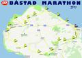 BM Karta banan 2011.pdf 1,752 × 1,239; 402 KB
-
 Båstad Kommunalval 2014 (Skala från rödgrönt till borgerligt).png 732 × 525; 15 KB
-
 Båstad Kommunalval 2015 (Skala från rödgrönt till borgerligt).png 732 × 523; 15 KB
-
 Båstad Municipality in Scania County.png 607 × 507; 44 KB
-
 Båstad Municipality in Scania.png 320 × 311; 6 KB
-
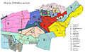
 Båstads distrikt i Båstads kommun med distriktsetiketter.svg 995 × 716; 310 KB
-
 Båstads distrikt i Båstads kommun med relief.svg 995 × 716; 537 KB
-
 Båstads distrikt i Båstads kommun med tätorter.svg 995 × 716; 1.3 MB
-

-
 Båstads distrikt i Båstads kommun.svg 995 × 716; 195 KB
-
 Forslovsocken.JPG 607 × 374; 148 KB
-
 Greviebackar.jpg 1,131 × 737; 53 KB
-
 Hemmeslöv Map.png 1,306 × 1,060; 448 KB
-
 Map of Eskilstorpsstrand, Båstad.png 856 × 894; 231 KB
-
 Map of Hemmeslöv.png 820 × 819; 282 KB
-
 Map of Hemmeslövsstrand, Båstad.png 1,035 × 938; 226 KB
-
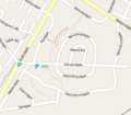 Map of Petersberg, Båstad.png 342 × 300; 66 KB
-
 Map of Riviera, Båstad.png 1,254 × 1,131; 338 KB
-
 Map of Åstad, Båstad.png 1,008 × 499; 121 KB
-
 Socknar Bastad.png 546 × 414; 7 KB
-
 Tom karta över Båstads kommun med relief.svg 995 × 716; 538 KB
-
 Tom karta över Båstads kommun.svg 995 × 716; 184 KB
.png)
.png)


