Category:Maps of Avilés
Jump to navigation
Jump to search
Municipalities in Asturias: Allande · Aller · Amieva · Avilés · Belmonte de Miranda · Bimenes · Boal · Cabrales · Cabranes · Candamo · Cangas de Onís · Cangas del Narcea · Caravia · Carreño · Caso · Castrillón · Castropol · Coaña · Colunga · Corvera · Cudillero · Degaña · El Franco · El Valle Altu de Peñamellera · Gijón · Gozón · Grado · Grandas de Salime · Ibias · Illano · Illas · Langreo · Laviana · Lena · Llanera · Llanes · Mieres · Oviedo · Parres · Piloña · Ribadesella · Salas · San Martín del Rey Aurelio · Somiedo · Taramundi · Teverga · Tineo · Vegadeo · Villanueva de Oscos · Villaviciosa · Villayón · Yernes y Tameza ·
Wikimedia category | |||||
| Upload media | |||||
| Instance of | |||||
|---|---|---|---|---|---|
| Category combines topics | |||||
| Avilés | |||||
city and municipality (concejo) in Asturias, Spain | |||||
| Instance of | |||||
| Part of | |||||
| Location | Province of Asturias, Asturias, Spain | ||||
| Located in or next to body of water | |||||
| Capital |
| ||||
| Head of government |
| ||||
| Population |
| ||||
| Area |
| ||||
| Elevation above sea level |
| ||||
| official website | |||||
 | |||||
Media in category "Maps of Avilés"
The following 14 files are in this category, out of 14 total.
-
Admiralty Chart No 77 Plans on the North Coast of Spain, Published 1932.jpg 11,117 × 16,215; 51.58 MB
-
Aviles Asturies map.svg 778 × 413; 292 KB
-
Avilés (situación).jpg 750 × 350; 50 KB
-
AVILÉS color.jpg 300 × 300; 36 KB
-
Avilés.png 454 × 181; 6 KB
-
Karte Gemeinde Avilés 2022.png 2,999 × 1,804; 617 KB
-
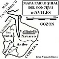
Mapa Parroquial Avilés.jpg 300 × 300; 34 KB
-
MTN25-0013c4-1982-Aviles.jpg 7,775 × 5,413; 7.51 MB
-
MTN25-0013c4-1998-Aviles.jpg 7,775 × 5,413; 8.02 MB
-
MTN25-0013c4-2015-Aviles.jpg 7,579 × 5,142; 21.41 MB
-
Ortofotomapa Asturias 2010-AVILES.jpg 13,244 × 9,354; 21.22 MB
-
Paradas.PNG 502 × 407; 371 KB
-
PlanoSalinas.jpg 578 × 509; 214 KB
-
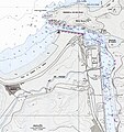
Portulano Aviles.jpg 1,772 × 1,886; 1.18 MB


