Category:Maps of Athens County, Ohio
Jump to navigation
Jump to search
Wikimedia category | |||||
| Upload media | |||||
| Instance of | |||||
|---|---|---|---|---|---|
| Category combines topics | |||||
| Athens County | |||||
county in Ohio, United States | |||||
| Instance of | |||||
| Named after | |||||
| Location | Ohio | ||||
| Capital | |||||
| Headquarters location | |||||
| Inception |
| ||||
| Population |
| ||||
| Area |
| ||||
| official website | |||||
 | |||||
Athens County is in Ohio in the United States. Its county seat is Athens.
Subcategories
This category has the following 3 subcategories, out of 3 total.
Media in category "Maps of Athens County, Ohio"
The following 39 files are in this category, out of 39 total.
-
2020 United States Presidential Election in Athens County, Ohio.svg 654 × 552; 25 KB
-
Athens county farm.png 1,167 × 785; 32 KB
-
Carbondale ohio.jpg 2,448 × 1,583; 190 KB
-
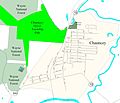
Chauncey Ohio.jpg 2,973 × 2,550; 589 KB
-
Desonier 7-2006.jpg 2,258 × 1,591; 1.12 MB
-
Detailed map of Buchtel, Ohio.png 575 × 425; 25 KB
-
Gislayers.jpg 997 × 657; 300 KB
-
Glouster ohio.JPG 3,841 × 2,458; 779 KB
-
Guysville ohio.jpg 1,868 × 1,262; 195 KB
-
Jacksonville Ohio.jpg 4,320 × 2,880; 692 KB
-
Map of Ohio highlighting Athens County.svg 1,050 × 1,141; 37 KB
-
Mineral.jpg 944 × 828; 52 KB
-
New marshfield, ohio.jpg 1,345 × 1,971; 178 KB
-
OHMap-doton-Albany.png 274 × 300; 10 KB
-
OHMap-doton-Amesville.png 274 × 300; 10 KB
-
OHMap-doton-Buchtel.png 274 × 300; 10 KB
-
OHMap-doton-Carbondale.png 309 × 352; 17 KB
-
OHMap-doton-Chauncey.png 274 × 300; 10 KB
-
OHMap-doton-Coolville.png 274 × 300; 10 KB
-
OHMap-doton-Glouster.png 274 × 300; 10 KB
-
OHMap-doton-Guysville.png 309 × 352; 17 KB
-
OHMap-doton-Hockingport.png 309 × 352; 17 KB
-
OHMap-doton-Jacksonville-Trimble.png 274 × 300; 10 KB
-
OHMap-doton-Millfield.png 309 × 352; 17 KB
-
OHMap-doton-Nelsonville.png 274 × 300; 10 KB
-
OHMap-doton-New Marshfield.png 309 × 352; 17 KB
-
OHMap-doton-Shade.png 309 × 352; 17 KB
-
OHMap-doton-Sharpsburg.png 309 × 352; 17 KB
-
OHMap-doton-Stewart.png 309 × 352; 17 KB
-
OHMap-doton-The Plains.png 274 × 300; 10 KB
-
Riddlepreserve.jpg 1,008 × 760; 342 KB
-
Shade River map.png 2,763 × 2,378; 273 KB
-
Stewart Ohio.jpg 2,159 × 1,440; 175 KB
-
Trimble community forest.gif 1,124 × 774; 56 KB
-
Trimble ohio.jpg 2,923 × 2,490; 516 KB
-
Trimbletwpcomfor0409.gif 4,608 × 3,456; 1.72 MB
-
Waterloo wildlife locator.gif 495 × 729; 33 KB


