Category:Maps of Arusha Region
Jump to navigation
Jump to search
Wikimedia category | |||||
| Upload media | |||||
| Instance of | |||||
|---|---|---|---|---|---|
| Category combines topics | |||||
| Arusha Region | |||||
region of Tanzania | |||||
| Instance of | |||||
| Named after | |||||
| Location | Tanzania | ||||
| Capital | |||||
| Population |
| ||||
| Area |
| ||||
| official website | |||||
 | |||||
Media in category "Maps of Arusha Region"
The following 21 files are in this category, out of 21 total.
-
Arumeru.png 280 × 232; 6 KB
-
Arusha City in Arusha 2022.svg 670 × 633; 468 KB
-
Arusha District in Arusha 2022.svg 670 × 633; 468 KB
-
Arusha1.png 280 × 232; 7 KB
-
Arusha2.png 280 × 232; 6 KB
-
Karatu District in Arusha 2022.svg 670 × 633; 468 KB
-
Karatu.GIF 280 × 232; 5 KB
-
Longido District in Arusha 2022.svg 670 × 633; 470 KB
-
Meru District in Arusha 2022.svg 670 × 633; 468 KB
-
Monduli District in Arusha 2022.svg 670 × 633; 468 KB
-
Monduli.GIF 280 × 232; 5 KB
-
Ngorongoro District in Arusha 2022.svg 670 × 633; 468 KB
-
Ngorongoro.GIF 280 × 232; 5 KB
-
Northern Tanzania map.gif 525 × 321; 22 KB
-
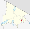
Tanzania Arumeru location map.svg 135 × 120; 1.46 MB
-
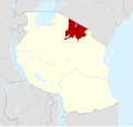
Tanzania Arusha (Tanzania) location map.svg 135 × 120; 1.46 MB
-
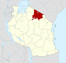
Tanzania Arusha location map.svg 3,302 × 3,143; 1.04 MB
-
Tanzania Arusha location map2.svg 135 × 120; 1.46 MB
-
Tanzania Karatu location map.svg 135 × 120; 1.46 MB
-
Tanzania Monduli location map.svg 135 × 120; 1.46 MB
-
Tanzania Ngorongoro location map.svg 135 × 120; 1.46 MB


