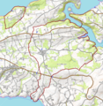
Category:Maps of Argol (Finistère)
Jump to navigation
Jump to search
Media in category "Maps of Argol (Finistère)"
The following 7 files are in this category, out of 7 total.
-
29001-Argol-Hydro.jpeg 5,846 × 4,133; 3 MB
-
29001-Argol-Sols.png 3,270 × 2,598; 3.12 MB
-
Map-France-Finistère-Commune-Argol.svg 1,468 × 1,246; 209 KB
-
Argol (Finistère) OSM 01.png 805 × 823; 367 KB
-
Argol (Finistère) OSM 02.png 805 × 823; 591 KB
-
Carte Bois du Loc'h et anse de Poulmic.jpg 1,492 × 834; 622 KB
-
Map commune FR insee code 29001.png 756 × 605; 92 KB


