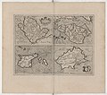
Category:Maps of Anglesey and Channel Islands by Gerardus Mercator
Jump to navigation
Jump to search
Media in category "Maps of Anglesey and Channel Islands by Gerardus Mercator"
The following 19 files are in this category, out of 19 total.
-
Anglesey - btv1b53056468d (1 of 2).jpg 2,672 × 2,152; 1.05 MB
-
Atlas Cosmographicae (Mercator) 077.jpg 2,523 × 1,906; 1.76 MB
-
Anglesey - btv1b53010589r.jpg 2,516 × 1,939; 1.11 MB
-
Cosmographicae (10534075).jpg 12,142 × 8,257; 27.26 MB
-
Atlas ou Representation du Monde Universel t. 1. 1633 (109104383).jpg 16,727 × 11,650; 32.61 MB
-
Anglesey; Wight Vectis olim ; Garnesay ; Iarsay (5384789005).jpg 2,000 × 1,684; 3.19 MB
-
Garnesay - (Gerard Mercator) - btv1b85919058 (1 of 2).jpg 3,441 × 2,927; 2.16 MB
-
Garnesay - btv1b53012722k.jpg 2,602 × 1,969; 1.19 MB
-
Iarsay - (Gerhard Mercator) - btv1b8591901m (1 of 2).jpg 3,656 × 2,690; 2.1 MB
-
Iarsay - btv1b530128382.jpg 2,662 × 1,905; 1.13 MB
-
Wight Vectis olim - (Per Gerardum Mercatorem) - btv1b530565032 (1 of 2).jpg 2,880 × 2,264; 1.41 MB
-
Wight Vectis olim - btv1b53010510t.jpg 2,711 × 1,946; 1.29 MB
-
Atlas Minor Gerardi Mercatoris 1609 (106753347).jpg 6,157 × 4,523; 5.08 MB


