Category:Maps of Allgäu
Jump to navigation
Jump to search
Wikimedia category | |||||
| Upload media | |||||
| Instance of | |||||
|---|---|---|---|---|---|
| Category combines topics | |||||
| Allgäu | |||||
German region and landscape in southern Swabia, Bavaria, and southern Württemberg, Baden-Württemberg   | |||||
| Instance of | |||||
| Location | |||||
| Has part | |||||
| Different from | |||||
 | |||||
Subcategories
This category has the following 2 subcategories, out of 2 total.
M
- Maps of Mindelheim (9 F)
O
- Old maps of Allgäu (4 F)
Media in category "Maps of Allgäu"
The following 27 files are in this category, out of 27 total.
-
 Algöw nach Sebastian Münster 1541.png 2,130 × 2,292; 547 KB
-
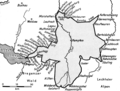
 AllgaeuBusNet.png 1,181 × 1,482; 173 KB
-
 Allgau-Express.png 2,000 × 1,428; 215 KB
-
 Allgäu nach Philipp Jakob Karrer 1847.png 2,954 × 2,245; 656 KB
-
 Allgäuer Alpen Karte.png 1,920 × 1,055; 1.41 MB
-
 Allgäuer Haufen.png 2,956 × 2,381; 204 KB
-
 Allgöw nach Michael Praun 1690.png 2,940 × 2,148; 1.81 MB
-
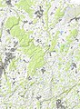 Altdorfer Wald Topografische Karte.jpg 7,100 × 9,650; 30.08 MB
-
 BudS - Aitrach Topo.jpg 9,230 × 9,690; 41.6 MB
-
 BudS - Allgäu Topo.jpg 7,850 × 8,200; 42.09 MB
-
 BudS - Westallgäu Topo.jpg 5,710 × 8,380; 30.16 MB
-
 Das Allgäu nach Franz Ludwig von Baumann mit Anpassungen von Otto Merkt 1833 1936.png 2,958 × 2,193; 1.52 MB
-
 Fuessen.JPG 464 × 341; 52 KB
-
 Karte Allgäu.png 1,073 × 1,272; 231 KB
-
 Karte Allgäuer Alpen.png 3,488 × 2,013; 2.61 MB
-
 Karte des Allgäus.png 1,994 × 1,617; 12.32 MB
-
 Karte Oberallgäu.jpg 4,120 × 6,030; 16.86 MB
-
 Karte Westallgäu.png 185 × 235; 5 KB
-
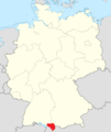
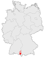
 Lage Allgäu in Oberschwaben - breiter.jpg 794 × 726; 104 KB
-
 Lage Allgäu in Oberschwaben.jpg 800 × 501; 143 KB
-
 Map Upper Swabia (Oberschwaben).png 975 × 611; 128 KB
-
 Meteorit Neuschwanstein.jpg 518 × 522; 134 KB
-
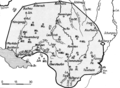
 Naturpark Nagelfluhkette Karte.png 1,600 × 1,272; 3.48 MB
-
 RR Uebersichtskarte.jpg 13,984 × 14,882; 74.5 MB
-
 Topografische Karte Allgäu.jpg 7,850 × 8,200; 42.3 MB
-
 Touristical map of the Allgäu.gif 1,278 × 1,278; 409 KB
-
 Übersichtskarte der Schlossparkradrunde im Allgäu.jpg 2,948 × 3,408; 3.17 MB


.png)


