Category:Maps of Adelaide
Jump to navigation
Jump to search
Wikimedia category | |||||
| Upload media | |||||
| Instance of | |||||
|---|---|---|---|---|---|
| Category combines topics | |||||
| Adelaide | |||||
capital city of South Australia | |||||
| Pronunciation audio | |||||
| Instance of | |||||
| Named after | |||||
| Location | South Australia, AUS | ||||
| Inception |
| ||||
| Population |
| ||||
| Area |
| ||||
| Elevation above sea level |
| ||||
| Different from | |||||
| Maximum temperature record |
| ||||
| Minimum temperature record |
| ||||
| official website | |||||
 | |||||
Maps of w: Adelaide
Subcategories
This category has the following 6 subcategories, out of 6 total.
Media in category "Maps of Adelaide"
The following 39 files are in this category, out of 39 total.
-
Adelaide Australia Street Map SVG free.svg 5,303 × 7,247; 13.14 MB
-
Adelaide CoB dots.png 463 × 635; 25 KB
-
Adelaide Councils Blank.png 600 × 544; 23 KB
-
Adelaide divisions overview 2016.png 900 × 1,065; 133 KB
-
Adelaide locator map.svg 1,539 × 916; 22.89 MB
-
Adelaide locator-MJC-alt.png 563 × 476; 20 KB
-
Adelaide locator-MJC.png 563 × 476; 12 KB
-
Adelaide metropolitan area map.svg 974 × 2,373; 298 KB
-
Adelaide, Australia ESA384290.jpg 5,755 × 7,655; 9.82 MB
-
Adelaide-international.JPG 1,115 × 515; 52 KB
-
Adelaide-LGA-Adelaide-MJC.png 600 × 544; 14 KB
-
Anstey Hill Recreation Park map.svg 1,394 × 1,554; 242 KB
-
Anzac Highway adelaide map.svg 974 × 2,373; 336 KB
-
Australia Greater Adelaide location map.svg 437 × 1,154; 4.18 MB
-
Australia locator Adelaide.png 210 × 196; 10 KB
-
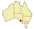
Australia SA locator Adelaide.png 169 × 196; 7 KB
-
Barker Inlet location.png 591 × 544; 401 KB
-
Cleland-conservation-park.svg 834 × 667; 197 KB
-
Cobbler creek reserve south australia.svg 1,495 × 1,268; 179 KB
-
Elizabeth Vale Adelaide streetmap.svg 838 × 732; 154 KB
-
Free vector map of Adelaide Australia Level 12 G View.svg 1,491 × 1,968; 7.61 MB
-
Grand junction road adelaide map.svg 974 × 2,373; 336 KB
-
Hinduism in Adelaide.png 600 × 544; 42 KB
-
Location map -- Tramway Museum, St Kilda, South Australia.png 925 × 1,041; 1.31 MB
-
Location Ship Pt Adelaide.png 767 × 762; 172 KB
-
Map of Adelaide with Hutt Street highlighted.tif 2,032 × 1,609; 12.48 MB
-
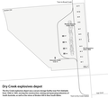
Map of the Dry Creek explosives magazines in Adelaide.png 2,802 × 2,539; 272 KB
-
Newton Adelaide.PNG 529 × 586; 237 KB
-
NSC Area Map.png 973 × 2,373; 415 KB
-
Parahills-streetmap.png 692 × 852; 183 KB
-
Parahills-streetmap.svg 459 × 564; 157 KB
-
Port road adelaide map.svg 974 × 2,373; 336 KB
-
Rymill park adelaide.svg 2,129 × 1,201; 103 KB
-
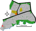
St-Kilda-suburb-layout.png 516 × 597; 57 KB
-
Streetmap of Adelaide and North Adelaide.png 1,000 × 1,070; 315 KB
-
Streetmap of Adelaide and North Adelaide.svg 681 × 729; 67 KB
-
Television license area - Adelaide.svg 763 × 838; 119 KB
-
Torrens catchment map.png 1,195 × 846; 129 KB


