Category:Maps of Abyei
Jump to navigation
Jump to search
Media in category "Maps of Abyei"
The following 12 files are in this category, out of 12 total.
-
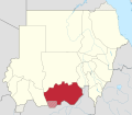
 South Kurdufan in Sudan (+claims hatched).svg 1,654 × 1,450; 347 KB
-
 South Kurdufan in Sudan (+claims hatched) (Kafia Kingi disputed).svg 1,654 × 1,450; 348 KB
-
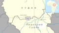
 Abyei Administrative Area Map.png 849 × 826; 17 KB
-
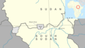
 Abyei in South Sudan 2015.svg 1,561 × 1,133; 244 KB
-
 Map of Abyei Area en.png 1,534 × 871; 218 KB
-
 Map of Abyei Area ru.png 1,534 × 871; 219 KB
-
 Map of Abyei Area uk.png 1,534 × 871; 246 KB
-
 Political Regions of Sudan - July 2006.svg 600 × 704; 647 KB
-
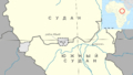
 Sudan district map Abyei.svg 744 × 1,052; 155 KB
-
 West Kurdufan in Sudan (+claims hatched).svg 1,654 × 1,450; 360 KB
-
 West Kurdufan in Sudan (+claims solid).svg 1,654 × 1,450; 359 KB
-
 West Kurdufan in Sudan.svg 1,654 × 1,450; 354 KB
.svg)
_(Kafia_Kingi_disputed).svg)


.svg)
.svg)
