Category:Maps of Abbaye de la Sauve Majeure
Jump to navigation
Jump to search
Media in category "Maps of Abbaye de la Sauve Majeure"
The following 7 files are in this category, out of 7 total.
-
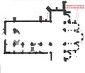
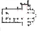
Emplacements Chevet.jpg 3,666 × 1,493; 588 KB
-
Emplacements Extérieur.jpg 4,635 × 3,988; 1.55 MB
-
Emplacements Nef sud.jpg 4,635 × 3,988; 1.55 MB
-
Emplacements Transept nord.jpg 4,635 × 3,988; 1.49 MB
-
L'abbaye de la Sauve (Lacourrière 1851) a.png 959 × 1,277; 105 KB
-
La Sauve-Majeure (Brutails 1912).jpg 4,635 × 3,988; 1.46 MB
-
Plan de l'abbaye (Drouyn 1851).png 1,050 × 526; 179 KB


