Category:Maps of A Coruña
Jump to navigation
Jump to search
Municipalities in the province of A Coruña: Abegondo · Ames · Aranga · Arteixo · Arzúa · A Baña · Bergondo · Betanzos · Boimorto · Boiro · Boqueixón · Brión · Cabana de Bergantiños · Cabanas · Camariñas · Cambre · A Capela · Carballo · Cariño · Carnota · Carral · Cedeira · Cee · Cerceda · Cerdido · Coirós · Corcubión · Coristanco · A Coruña · Culleredo · Curtis · Dodro · Dumbría · Fene · Ferrol · Fisterra · Frades · Irixoa · A Laracha · Laxe · Lousame · Malpica de Bergantiños · Mañón · Mazaricos · Melide · Mesía · Miño · Moeche · Monfero · Mugardos · Muros · Muxía · Narón · Neda · Negreira · Noia · Oleiros · Ordes · Oroso · Ortigueira · Outes · Oza-Cesuras · Paderne · Padrón · O Pino · A Pobra do Caramiñal · Ponteceso · Pontedeume · As Pontes de García Rodríguez · Porto do Son · Rianxo · Ribeira · Rois · Sada · San Sadurniño · Santa Comba · Santiago de Compostela · Santiso · Sobrado · As Somozas · Teo · Toques · Tordoia · Touro · Trazo · Val do Dubra · Valdoviño · Vedra · Vilarmaior · Vilasantar · Vimianzo · Zas
Wikimedia category | |||||
| Upload media | |||||
| Instance of | |||||
|---|---|---|---|---|---|
| Category combines topics | |||||
| A Coruña | |||||
city and municipality in the province of A Coruña, Galicia, Spain | |||||
| Instance of | |||||
| Part of |
| ||||
| Location | A Coruña Province, Galicia | ||||
| Located in or next to body of water | |||||
| Capital |
| ||||
| Head of government |
| ||||
| Population |
| ||||
| Area |
| ||||
| Elevation above sea level |
| ||||
| Replaces |
| ||||
| Partially coincident with |
| ||||
| official website | |||||
 | |||||
Subcategories
This category has the following 3 subcategories, out of 3 total.
Pages in category "Maps of A Coruña"
This category contains only the following page.
Media in category "Maps of A Coruña"
The following 72 files are in this category, out of 72 total.
-
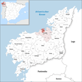
255px-La Coruna, Spain location2.png 255 × 357; 97 KB
-
255px-La Coruna, Spain location3.png 255 × 311; 105 KB
-
A Cabana, SCV.jpg 4,488 × 6,083; 971 KB
-
A Costa, VIS.jpg 4,488 × 6,083; 938 KB
-
A Cova, SCV.jpg 4,488 × 6,083; 969 KB
-
A Gramela, VIS.jpg 4,488 × 6,083; 946 KB
-
A Granxa Agrícola Experimental (1891).jpg 1,024 × 689; 93 KB
-
A Madosa, OZA.jpg 4,488 × 6,083; 483 KB
-
A Moura, SCV.jpg 4,488 × 6,083; 906 KB
-
A Pedra da Barca, VIS.jpg 4,488 × 6,083; 937 KB
-
A Silva, SCV.jpg 4,488 × 6,083; 906 KB
-
Agramonte, OZA.jpg 4,488 × 6,083; 897 KB
-
Anillos coruna.jpg 687 × 629; 56 KB
-
Area metropolitana coruna 11 municipios.png 2,000 × 2,059; 1.44 MB
-
Area metropolitana coruna coronas.png 2,000 × 2,059; 1.45 MB
-
Area metropolitana coruna.jpg 726 × 649; 57 KB
-
Area metropolitana Coruña.svg 664 × 580; 28 KB
-
As Bouzas, VIS.jpg 4,488 × 6,083; 938 KB
-
As Pedreiras, VIS.jpg 4,488 × 6,083; 936 KB
-
As Xubias, OZA.jpg 4,488 × 6,083; 910 KB
-
Battle of Corunna.jpg 1,944 × 2,592; 1.9 MB
-
Caldemoreiras, VIS.jpg 4,488 × 6,083; 939 KB
-
Cances, SCV.jpg 4,488 × 6,083; 905 KB
-
Casabranca, OZA.jpg 4,488 × 6,083; 908 KB
-
Casanova de Eirís, OZA.jpg 4,488 × 6,083; 939 KB
-
Castaño de Eirís, OZA.jpg 4,488 × 6,083; 939 KB
-
Castro, ELV.jpg 4,488 × 6,083; 964 KB
-
Cidade Vella, A Coruña.jpg 2,518 × 3,533; 693 KB
-
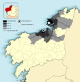
Conurbacion de A Coruña y Ferrol.png 2,000 × 1,844; 785 KB
-
Curramontes, OZA.jpg 4,488 × 6,083; 944 KB
-
Eirís de Abaixo, OZA.jpg 4,488 × 6,083; 941 KB
-
Eirís de Arriba, OZA.jpg 4,488 × 6,083; 938 KB
-
Elviña, ELV.jpg 4,488 × 6,083; 962 KB
-
Entrecasas, VIS.jpg 4,488 × 6,083; 940 KB
-
Fontenova, SCV.jpg 4,488 × 6,083; 902 KB
-
Gatón, VIS.jpg 4,488 × 6,083; 900 KB
-
Karte Gemeinde A Coruña 2022.png 3,000 × 3,000; 1.13 MB
-
La Coruna Crecimiento-1998-2008.png 1,000 × 998; 143 KB
-
La Coruna Crecimiento-2008-2018.png 1,000 × 998; 140 KB
-
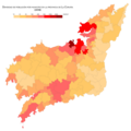
La Coruna Densidad-2018.png 1,000 × 998; 132 KB
-
La Coruna Población-2018.png 1,000 × 998; 132 KB
-
Localizacion Ria da Coruña.Galicia.png 1,000 × 533; 404 KB
-
Lonzas, SCV.jpg 4,488 × 6,083; 987 KB
-
Loureiro, VIS.jpg 4,488 × 6,083; 941 KB
-
Mazaído, VIS.jpg 4,488 × 6,083; 906 KB
-
Monserrat, OZA.jpg 4,488 × 6,083; 948 KB
-
Monte Mero, OZA.jpg 4,488 × 6,083; 948 KB
-
O Bosque, SCV.jpg 4,488 × 6,083; 971 KB
-
O Coidal, VIS.jpg 4,488 × 6,083; 939 KB
-
O Corgo, OZA.jpg 4,488 × 6,083; 897 KB
-
O Lagar, ELV.jpg 4,488 × 6,083; 948 KB
-
O Río, VIS.jpg 4,488 × 6,083; 940 KB
-
O Souto, ELV.jpg 4,488 × 6,083; 948 KB
-
Palavea e Fontaíña, ELV.jpg 4,488 × 6,083; 923 KB
-
Pardiñas, VIS.jpg 4,488 × 6,083; 937 KB
-
Pasaxe ao Burgo, ELV.jpg 4,488 × 6,083; 907 KB
-
PaseomarAC.svg 773 × 507; 378 KB
-
Pedralonga, ELV.jpg 4,488 × 6,083; 921 KB
-
Pedro Fernández, ELV.jpg 4,488 × 6,083; 903 KB
-
Region urbana artabra centros autovias y autopistas.png 2,000 × 2,059; 1.5 MB
-
Region Urbana Artabra densidad poblacion.png 2,000 × 1,844; 790 KB
-
Río de Quintas, ELV.jpg 4,488 × 6,083; 902 KB
-
San Cristovo das Viñas, SCV.jpg 4,488 × 6,083; 980 KB
-
San Pedro de Visma, VIS.jpg 4,488 × 6,083; 943 KB
-
San Xosé, SCV.jpg 4,488 × 6,083; 900 KB
-
Santa Xema, ELV.jpg 4,488 × 6,083; 909 KB
-
Situacion A Coruña.PNG 956 × 1,008; 84 KB
-
Someso, SCV.jpg 4,488 × 6,083; 986 KB
-
Spanien LaCoruna.PNG 258 × 220; 5 KB
-
Vío, ELV.jpg 4,488 × 6,083; 960 KB


