Category:Maps of 4th-century Europe
Jump to navigation
Jump to search
| Preceded by: 3rd century maps |
4th century maps of Europe of Europe 301 AD-400 AD |
Succeeded by: 5th-century maps of Europe |
Subcategories
This category has only the following subcategory.
Media in category "Maps of 4th-century Europe"
The following 50 files are in this category, out of 50 total.
-
 06-Britania-Siglo IV DC.png 456 × 579; 103 KB
-
 Europe en 300.pdf 1,752 × 1,239; 445 KB
-
 305 CE, Europe.svg 512 × 438; 1.71 MB
-
 362 CE, Europe.svg 512 × 438; 1.67 MB
-
 AD 0375 - Central Eastern Europe to Ural - EN.png 1,529 × 839; 2.91 MB
-
 Britain.Deisi.Laigin.jpg 1,880 × 2,386; 788 KB
-
 Campagnes-de-Constantin.svg 1,649 × 962; 2.07 MB
-
 Chernyakhov-pt.svg 737 × 452; 1.56 MB
-
 Chernyakhov.PNG 777 × 471; 10 KB
-
 Chernyakhov.svg 737 × 452; 1.56 MB
-
 Claustra Alpium Iuliarum locator map.jpg 398 × 294; 12 KB
-
 Claustra Alpium Iuliarum.jpg 1,160 × 671; 163 KB
-
 ConstantineEmpire.png 747 × 493; 27 KB
-
 Crossing of the Rhine map.jpg 5,476 × 3,310; 7.07 MB
-
 Diocese of Macedonia - AD 400.png 732 × 702; 572 KB
-
 East europe 3-4cc.png 3,935 × 3,033; 387 KB
-
 East Europe Archaeological Kievan-Chernyakhov.jpg 1,024 × 665; 350 KB
-
 East-Hem 400ad (cropped).jpg 1,079 × 574; 117 KB
-
 Europe en 301.pdf 1,752 × 1,239; 445 KB
-
 Europe in the Migration Period in the 4th and 5th centuries.jpg 5,476 × 3,310; 4.33 MB
-
 Gothic Kingdoms.png 608 × 342; 59 KB
-
 Gutthiuda.jpg 800 × 547; 460 KB
-
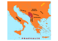
 Iliria.jpg 1,427 × 1,410; 153 KB
-
 Italia Annonaria ca 400 AD.png 690 × 518; 573 KB
-
 Litus Saxonicum.png 690 × 520; 237 KB
-
 Moesia - AD 400.png 860 × 596; 756 KB
-
 North.Sea.Periphery.250.500.jpg 2,031 × 2,463; 820 KB
-
 Ostrogoths, Antes, Huns and Alans in 380.jpg 612 × 316; 60 KB
-
 Pannonia03 en.png 1,001 × 898; 84 KB
-
 Pannonia03-sr.png 1,001 × 898; 84 KB
-
 Pannonia03.jpg 1,001 × 898; 92 KB
-
 Praetorian Prefectures of the Roman Empire 395 AD-ar.png 900 × 595; 161 KB
-
 Praetorian Prefectures of the Roman Empire 395 AD.png 900 × 595; 144 KB
-
 Praevalis 4 c AD.svg 1,052 × 744; 186 KB
-
 Prefecture of Illyricum map-sr.png 1,054 × 1,041; 92 KB
-
 Prefecture of Illyricum map-zh.png 1,054 × 1,041; 101 KB
-
 Prefecture of Illyricum map.png 1,054 × 1,041; 103 KB
-
 PrefectureIllyricum.png 1,054 × 1,041; 96 KB
-
 Public Schools Historical Atlas - Roman Britain 400.jpg 880 × 1,152; 364 KB
-
 Roman Britain - AD 400-zh.svg 914 × 568; 764 KB
-
 Roman Britain - AD 400.png 793 × 595; 271 KB
-
 Roman Gaul - AD 400-zh.svg 1,264 × 771; 1.43 MB
-
 Roman Gaul - AD 400.png 1,369 × 833; 1.13 MB
-
 Roman Italy - AD 400.png 1,162 × 1,446; 2.02 MB
-
 Roman.Britain.c370.coastal.defence.jpg 3,158 × 3,352; 945 KB
-
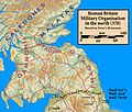
 Roman.Britain.north.370.jpg 1,703 × 2,162; 565 KB
-
 Roman.Scotland.370.jpg 2,211 × 1,877; 497 KB
-
 Russland BV042518433.jpg 1,201 × 1,329; 229 KB
-
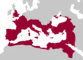 The Roman Empire of Constantine I.png 563 × 406; 32 KB
-
 Vatra.jpg 2,128 × 1,515; 203 KB


.jpg)


