Category:Maps of 15th-century Serbia
Jump to navigation
Jump to search
| Preceded by: Maps of 14th-century Serbia |
Maps of 15th-century Serbia 1401 AD-1500 AD |
Succeeded by: Maps of 17th-century Serbia |
Subcategories
This category has the following 2 subcategories, out of 2 total.
Media in category "Maps of 15th-century Serbia"
The following 26 files are in this category, out of 26 total.
-
 Venice1400.png 647 × 563; 195 KB
-
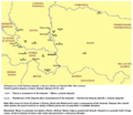
 1422.godina.jpg 622 × 732; 76 KB
-
 Albanian States.svg 699 × 522; 54 KB
-
 Despotovina Stefana Lazarevica 1422 godine.svg 845 × 1,620; 114 KB
-
 Despotski posedi-sr.png 1,220 × 1,060; 88 KB
-
 Despotski posedi.png 1,220 × 1,060; 116 KB
-
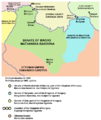
 Macvanska banovina-sr.png 667 × 790; 50 KB
-
 Macvanska banovina-vi.png 667 × 699; 39 KB
-
 Macvanska banovina.png 667 × 790; 73 KB
-

-
 Serbia 1422 map.gif 622 × 732; 157 KB
-
 Serbia in 15th century.png 479 × 365; 87 KB
-
 Serbian despotaatti 1422-fi.svg 943 × 844; 261 KB
-
 Serbian Despotate (1422)-ar.svg 943 × 844; 398 KB
-
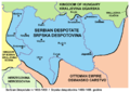
 Serbian Despotate (1422)-en.svg 943 × 844; 334 KB
-
 Serbian Despotate (1422)-es.svg 863 × 713; 797 KB
-
 Serbian Despotate (1422)-sr.svg 943 × 844; 355 KB
-
 Serbian Despotate 1423.png 1,624 × 1,711; 258 KB
-
 Serbian Despotate 1433.png 1,461 × 1,711; 225 KB
-
 Serbian Despotate 1451.png 1,461 × 1,711; 235 KB
-
 Serbian despotate 1455 1459-sr.png 785 × 553; 46 KB
-
 Serbian despotate 1455 1459.png 785 × 553; 58 KB
-
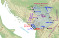 Serbian Despotate about 1450.png 1,597 × 1,022; 2.55 MB
-
 Srpske države sredinom 15. veka.png 828 × 797; 157 KB
-
 Stefan Lazarevic Despotate 1422.svg 823 × 389; 101 KB
-
 セルビア帝国-領土-1422.jpg 622 × 732; 183 KB


-ar.svg)
-en.svg)
-es.svg)
-sr.svg)


