Category:Maps made in the 21st century
Jump to navigation
Jump to search
- Maps made in the time span 1 Jan 2001 to 31 Dec 2100.
Wikimedia category | |||||
| Upload media | |||||
| Instance of | |||||
|---|---|---|---|---|---|
| Category combines topics | |||||
| 21st century | |||||
current century | |||||
| Instance of | |||||
| Part of | |||||
| Has part(s) | |||||
| Point in time |
| ||||
| Start time |
| ||||
| End time |
| ||||
| Follows | |||||
| Followed by | |||||
| Different from | |||||
| |||||
Subcategories
This category has the following 13 subcategories, out of 13 total.
*
-
2
A
M
Media in category "Maps made in the 21st century"
The following 19 files are in this category, out of 19 total.
-
Alpenbogen.jpg 13,666 × 6,117; 15.47 MB
-
BAUDINO EUROPA 2.JPG 798 × 570; 68 KB
-
BAZA EUROPA.JPG 797 × 551; 63 KB
-
Bolide events 1994-2013.jpg 1,486 × 853; 206 KB
-
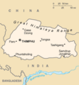
Bt-map.png 326 × 351; 7 KB
-
City Lights of the United States 2012.jpg 6,646 × 4,430; 5.46 MB
-
England-DeepCoalMining-1984-2010.svg 1,129 × 1,385; 107 KB
-
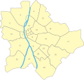
Hungary budapest districts-an.svg 562 × 537; 18 KB
-
Map of South Michigan as defined by Michigander901.png 1,374 × 1,375; 60 KB
-
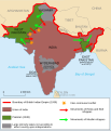
Partition of India-en.svg 718 × 838; 44 KB
-
Partition of India-sd.svg 718 × 838; 59 KB
-
Partition of India-ur.svg 718 × 838; 54 KB
-
PCC Wikidata Pilot participants v3.png 1,192 × 392; 176 KB
-
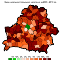
RuralChange2005-2010Bel.png 1,242 × 1,253; 119 KB
-
UrbanChange2005-2010Bel.png 1,242 × 1,253; 118 KB
-
Vs albers equal area kegel-projectie2.PNG 683 × 649; 119 KB
-
Vs equidistant azimuthaal 100 40.PNG 769 × 653; 129 KB
-
Vs robinson meridiaan is 0.PNG 855 × 644; 50 KB
-
Vs robinson meridiaan is 95WL.PNG 683 × 528; 41 KB


