Category:Maps in the Wellcome Collection
Jump to navigation
Jump to search
Media in category "Maps in the Wellcome Collection"
The following 200 files are in this category, out of 257 total.
(previous page) (next page)-
16th Century map of Asia Wellcome L0044808.jpg 3,510 × 2,646; 3.93 MB
-
16th Century map of Persia Wellcome L0044811.jpg 3,614 × 2,660; 3.54 MB
-
A general map of Eastern and Western Tartery Wellcome L0011547.jpg 1,660 × 1,182; 1.18 MB
-
A general plan of the layout of the Royal Naval Hospital, Gr Wellcome V0013338.jpg 3,100 × 2,211; 3.23 MB
-
A general plan of the layout of the Royal Naval Hospital, Gr Wellcome V0013339.jpg 3,100 × 2,223; 3.12 MB
-
A guardroom; an officer holds up a map to show to a man smok Wellcome V0040553.jpg 3,016 × 2,520; 4.29 MB
-
A map of India, showing Malabar, Madura and Cormeddel Wellcome L0038175.jpg 3,888 × 3,120; 3.34 MB
-
A map of Italy Wellcome V0049914.jpg 3,434 × 2,388; 4.01 MB
-
A map of London; showing sites of medical interest in Lambet Wellcome V0012880.jpg 3,332 × 2,440; 4.12 MB
-
A Map of the route of the Emin Pasha Relief Expedition Wellcome L0034226.jpg 7,770 × 4,512; 17.79 MB
-
A Map of the routes of The Emin Pasha Relief Expedition Wellcome L0034371.jpg 7,046 × 5,282; 22.6 MB
-
A map of the world showing the voyages of La Pérouse Wellcome V0049923.jpg 3,699 × 2,196; 2.32 MB
-
A map showing the caves and valleys of denudation in the dis Wellcome V0023180.jpg 2,541 × 3,309; 2.97 MB
-
A map taken from a report by Dr. John Snow Wellcome L0072917.jpg 4,757 × 4,418; 3.74 MB
-
A plan delineating Defoe's circuit. Wellcome L0005007.jpg 1,666 × 1,178; 1.02 MB
-
A plan of ancinet Cuzco, Peru Wellcome L0042062.jpg 3,936 × 2,440; 2.63 MB
-
A plan of the city of Pellacata with its Castle Wellcome L0038176.jpg 3,966 × 3,120; 5.2 MB
-
A plan of the Convent and church of Santo Domingo, Cuzco Wellcome L0042061.jpg 3,872 × 2,600; 2.14 MB
-
A town plan of the trading port Batavia Wellcome L0038151.jpg 3,888 × 3,156; 3.59 MB
-
A. De Humboldt, Atlas geographique Wellcome L0022471.jpg 1,505 × 1,261; 1.14 MB
-
A. W. Blyth; A dictionary of hygiene... Wellcome L0030938.jpg 1,638 × 1,258; 928 KB
-
Actual & supposed routes of Cholera from Hindoostan to Europe Wellcome L0041104.jpg 4,008 × 2,672; 2.54 MB
-
Actual & supposed routes of Cholera from Hindoostan to Europe Wellcome L0074539.jpg 5,802 × 4,145; 6.63 MB
-
Ancient provinces, France and departments that replaced them. Wellcome M0016661.jpg 3,780 × 2,992; 2.26 MB
-
Angelo Celli, Malaria according to the new researches Wellcome L0026233.jpg 1,255 × 1,624; 728 KB
-
Arca Noe, geography of world after flood, by A. Kircher. Wellcome L0013366.jpg 1,617 × 1,157; 897 KB
-
Archaeological map of Caddington and Dunstable district. Wellcome M0015598.jpg 3,750 × 2,929; 4.58 MB
-
Areas where Apothecaries were to be found. Wellcome L0004945.jpg 1,410 × 1,446; 220 KB
-
Astronomy explained upon Sir Isaac Newton's principles Wellcome L0069635.jpg 6,200 × 3,483; 6.03 MB
-
Cancer in England and Wales 1919-1923. Wellcome L0005800.jpg 1,250 × 1,544; 756 KB
-
Cavendish Square and environs, 1764.jpg 309 × 333; 455 KB
-
Chadwick's Bethnal Green Parish map. Wellcome L0009782.jpg 3,572 × 2,892; 4.15 MB
-
Chadwick's sanitary map of Leeds. Wellcome L0009781.jpg 3,804 × 2,580; 2.68 MB
-
Charles Booth, Life and labour in the people of London Wellcome L0027749.jpg 1,518 × 1,292; 1.27 MB
-
Charles Booth, Life and labour of the people in London Wellcome L0027742.jpg 3,544 × 3,121; 5.48 MB
-
Charles Booth, Life and labour of the people in London Wellcome L0027750.jpg 1,510 × 1,282; 1.19 MB
-
Charles Booth, Life and labour of the people in London Wellcome L0029443.jpg 2,510 × 4,464; 5.43 MB
-
Charles Booth, Life and labour of the people Wellcome L0027741.jpg 1,508 × 1,266; 1.28 MB
-
Charles Booth, Life and labour of the people Wellcome L0029442.jpg 3,622 × 3,102; 5.77 MB
-
Civil engineering; a plan to improve the silted-up harbour a Wellcome V0024378.jpg 2,102 × 3,321; 2.57 MB
-
Civilization and Climate, world map Wellcome L0029476.jpg 1,676 × 1,224; 944 KB
-
DELEPINE; Investigations in the Public Healt Wellcome L0032434.jpg 4,391 × 4,192; 7.29 MB
-
Density of population in Great Britain in 1841. Wellcome L0005187.jpg 1,031 × 1,887; 359 KB
-
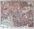
Descriptive map of London poverty, 1889 Wellcome L0027751.jpg 5,035 × 3,727; 10.36 MB
-
Descriptive map of London poverty, 1889 Wellcome L0074435.jpg 8,114 × 5,978; 17.48 MB
-
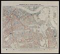
Descriptive map of London poverty, 1889 Wellcome L0074436.jpg 6,320 × 5,732; 13.59 MB
-
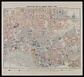
Descriptive map of London poverty, 1889 Wellcome L0074437.jpg 6,256 × 5,700; 12.71 MB
-
Descriptive map of London poverty, 1889. Wellcome L0074439.jpg 6,272 × 5,748; 13 MB
-
Detail of plate 11 showing Cambalu Wellcome L0071619.jpg 4,000 × 4,173; 3.8 MB
-
Detail of plate 11 showing Magnus Chan Wellcome L0071618.jpg 4,680 × 4,044; 5.55 MB
-
Detail of plate showing Porlok and Minhed Wellcome L0071620.jpg 3,600 × 4,500; 4.32 MB
-
Ecclesiastical divisions, France 1905. Wellcome M0016660.jpg 3,661 × 3,034; 2.64 MB
-
Estate records for Ticehurst Hospital Wellcome L0021189.jpg 4,336 × 3,639; 3.67 MB
-
Estate records for Ticehurst Hospital Wellcome L0021190.jpg 1,260 × 1,490; 1.08 MB
-
G. M. Wheeler, Geological atlas Wellcome L0027638.jpg 1,593 × 1,272; 993 KB
-
G. M. Wheeler, Geological atlas Wellcome L0027639.jpg 1,433 × 1,324; 998 KB
-
Geographical Distribution of Tropical Diseas Wellcome L0029475.jpg 1,626 × 1,286; 1.01 MB
-
Geological map of Maidenhead district Wellcome M0016957.jpg 2,792 × 3,924; 4.89 MB
-
German map showing the path of cholera in Poland, 1831. Wellcome L0076254.jpg 6,385 × 5,848; 12.68 MB
-
Guillaume Thomas Francois Raynal. Wellcome L0002250.jpg 1,166 × 1,688; 848 KB
-
Guillaume Thomas Francois Raynal. Wellcome L0002251.jpg 1,176 × 1,750; 934 KB
-
H. Burdett, Hospitals and asylums of the wor Wellcome L0029692.jpg 1,204 × 1,840; 755 KB
-
H. Chauncy, The historical antiquities of of Hertfordshire Wellcome L0020612.jpg 1,550 × 1,186; 1.2 MB
-
H. Sloane, A voyage to the islands Madera, B Wellcome L0031393.jpg 1,528 × 1,440; 1.28 MB
-
Hand-drawn map showing settlements in Belgian Congo Wellcome L0039133.jpg 3,966 × 3,186; 3.79 MB
-
Henry M. Stanley, In darkest Africa Wellcome L0027738.jpg 1,690 × 1,116; 909 KB
-
Histoire de la Société royale de médecine année 1776-1789 Wellcome L0068469.jpg 4,800 × 3,734; 2.76 MB
-
Islamic map of the world Wellcome L0035009.jpg 3,576 × 4,072; 2.54 MB
-
Island of Deshima, Dutch East India Company Wellcome L0035084.jpg 3,929 × 1,608; 1.37 MB
-
J. Kennedy, The History of the contagious Wellcome M0012982.jpg 3,756 × 2,826; 1.83 MB
-
Key Plan to Guy's Hospital Wellcome L0034562.jpg 3,624 × 2,632; 1.65 MB
-
A map showing the Islands off Batavia (Jakarta) Wellcome L0038170.jpg 3,990 × 3,126; 2.84 MB
-
Map charting the voyage of H.M.S. Beagle Wellcome L0051046.jpg 6,470 × 3,135; 2.33 MB
-
Malaria in England Wellcome L0024500.jpg 1,260 × 1,732; 926 KB
-
Map Exhibiting the Progress of the Late Epidemic Cholera... Wellcome L0071628.jpg 6,160 × 4,654; 5.43 MB
-
Map from "Letters and notes on the manners..." Vol II Wellcome L0073493.jpg 3,471 × 5,400; 4.98 MB
-
Map from the Ninevah expedition by Sir Henry Layards Wellcome M0004421.jpg 2,986 × 3,735; 1.34 MB
-
Map indicating public and private Sanatoria and Hospitals Wellcome L0001501.jpg 1,182 × 1,580; 812 KB
-
Map of "Ediniae" Wellcome L0021913.jpg 1,110 × 1,732; 971 KB
-
Map of 'S Gravenhage. Wellcome L0009566.jpg 1,610 × 1,238; 834 KB
-
Map of 'South African Republic' Wellcome L0021298.jpg 1,538 × 1,248; 1.02 MB
-
Map of 16th century Caribbean. Wellcome L0001228.jpg 1,734 × 1,186; 496 KB
-
Map of Africa marked with cattle areas. Wellcome M0018127.jpg 3,176 × 3,520; 529 KB
-
Map of Antilles and Windward Isles. Wellcome L0002630EC.jpg 1,130 × 1,686; 1 MB
-
Map of Antilles Isles. Wellcome L0002630EA.jpg 1,617 × 1,092; 959 KB
-
Map of Arabia, in Olfert Dapper Wellcome L0011010.jpg 1,482 × 1,290; 984 KB
-
Map of area around Kalhutti, R. Ross. Wellcome L0027602.jpg 1,120 × 1,637; 682 KB
-
Map of Assyria from the Ninevah expedition by Sir Layards Wellcome M0004422.jpg 2,928 × 3,774; 1.39 MB
-
Map of Bethel Hospital, Norwich 1906 Wellcome L0034820.jpg 4,008 × 3,424; 1.95 MB
-
Map of Bilston. Wellcome L0009563.jpg 1,830 × 1,104; 476 KB
-
Map of Britain in 626 A.D. Wellcome M0008071.jpg 2,616 × 4,061; 2.76 MB
-
Map of Britannia Wellcome L0051170.jpg 4,464 × 6,626; 11.19 MB
-
Map of Chiloe Wellcome L0051063.jpg 4,584 × 6,468; 5.03 MB
-
Map of Cincinnati Wellcome L0040478.jpg 3,954 × 2,284; 3.67 MB
-
Map of Circassia Wellcome L0040021.jpg 3,763 × 1,789; 1.73 MB
-
Map of Crimea. Wellcome L0004279.jpg 1,762 × 1,074; 1,015 KB
-
Map of Dominica Isle. Wellcome L0002630EB.jpg 1,620 × 1,106; 836 KB
-
Map of Emin Pasha's Province Wellcome L0034859.jpg 3,600 × 3,744; 2.66 MB
-
Map of England & Wales showing population in 1750. Wellcome M0000914.jpg 1,006 × 1,679; 482 KB
-
Map of England & Wales showing population in 1801. Wellcome M0000913.jpg 1,011 × 1,662; 545 KB
-
Map of England & Wales showing population, 1700s. Wellcome M0000912.jpg 1,025 × 1,646; 422 KB
-
Map of England and Wales Wellcome V0049911.jpg 2,494 × 2,815; 3.25 MB
-
Map of England showing prevalence of cholera, 1849 Wellcome L0039174.jpg 3,760 × 4,653; 9.8 MB
-
Map of Exeter, Great Britain. Wellcome L0009564.jpg 1,478 × 1,368; 739 KB
-
Map of France showing soil relief. Wellcome M0015461.jpg 2,906 × 3,638; 3.26 MB
-
Map of France Wellcome V0049915.jpg 3,033 × 2,497; 3.69 MB
-
Map of French Guiana. Wellcome L0002631EC.jpg 1,150 × 1,670; 889 KB
-
Map of Hudson River Line Steamers Wellcome L0046613.jpg 2,468 × 3,908; 3.48 MB
-
Map of Huoqing zhou, in Lijiang Prefecture, Yunnan Provonce Wellcome L0031302.jpg 3,664 × 3,028; 4.23 MB
-
Map of India, showing the chinchona plantations Wellcome L0025460.jpg 1,282 × 1,437; 717 KB
-
Map of London and Westminster before the Fire of London. Wellcome M0012069.jpg 4,728 × 2,262; 2.44 MB
-
Map of Lycia by Charles Fellows Wellcome L0022188.jpg 1,686 × 1,100; 1.14 MB
-
Map of Metlakahtla, Annette Island Wellcome M0013150.jpg 3,814 × 2,836; 2.11 MB
-
Map of mining districts of the U.K. 1842 Wellcome L0008343.jpg 1,194 × 1,584; 680 KB
-
Map of Mr Ives's journey Wellcome L0046622.jpg 3,516 × 2,632; 1.59 MB
-
Map of New Orleans Wellcome L0040476.jpg 2,432 × 3,944; 3.85 MB
-
Map of Newcastle. Wellcome L0009568.jpg 1,598 × 1,330; 221 KB
-
Map of Nikko, Japan and its surrounding vicinity Wellcome L0041423.jpg 3,856 × 2,660; 2.15 MB
-
Map of Northern Africa with a picture of African people Wellcome V0049910.jpg 4,061 × 1,813; 2.7 MB
-
Map of Oceania and Pacific Ocean. Wellcome M0005004.jpg 3,708 × 2,839; 2.8 MB
-
Map of Oxford and surroundings; Thomas Willis Wellcome L0011741.jpg 1,494 × 1,300; 796 KB
-
Map of Oxford; Thomas Willis Wellcome L0011739.jpg 1,620 × 1,272; 692 KB
-
Map of Padua Wellcome L0046157.jpg 2,644 × 3,772; 2.07 MB
-
Map of Paris, 1855 Wellcome L0013020.jpg 1,490 × 1,232; 924 KB
-
Map of part of Tierra del Fuego Wellcome L0051065.jpg 6,728 × 4,590; 5.09 MB
-
Map of Pontine marshes, from Lancisi, De noxiis..., 1717 Wellcome L0017845.jpg 1,941 × 978; 956 KB
-
Map of principal Mesolithic sites in Britain. Wellcome M0016326.jpg 2,598 × 4,120; 1,015 KB
-
Map of Russia lent by Dr. Schuster. Wellcome L0004274.jpg 1,238 × 1,512; 812 KB
-
Map of Scheveningen Wellcome L0009565.jpg 1,175 × 1,529; 717 KB
-
Map of Scotland Wellcome L0048593.jpg 3,648 × 4,062; 3.54 MB
-
Map of Scotland Wellcome V0049912.jpg 2,439 × 2,945; 3.66 MB
-
Map of Scotland, with rites in archaeology. Wellcome M0002544.jpg 1,345 × 1,583; 302 KB
-
Map of Soho showing deaths from Cholera, 1854. Wellcome L0003055.jpg 3,047 × 3,426; 4.7 MB
-
Map of South Africa with a picture of the Cape of Good Hope Wellcome V0049909.jpg 3,071 × 2,309; 2.95 MB
-
Map of South Africa, showing sites of Bushman drawings. Wellcome M0015200.jpg 3,039 × 3,925; 2.44 MB
-
Map of South America Wellcome L0051066.jpg 4,944 × 5,852; 8.06 MB
-
Map of Southern portion of South America Wellcome L0051077.jpg 5,314 × 4,926; 4.35 MB
-
Map of Spain and Portugal Wellcome V0049916.jpg 2,929 × 2,384; 2.89 MB
-
Map of St Louis Wellcome L0040477.jpg 2,296 × 3,948; 3.23 MB
-
Map of St. Albans, Great Britain. Wellcome L0009748.jpg 1,230 × 1,660; 936 KB
-
Map of St. Pancras in 1833 showing Parish Boundaries. Wellcome M0012504.jpg 2,303 × 4,579; 3.04 MB
-
Map of Sweden Wellcome V0049917.jpg 3,000 × 2,329; 2.76 MB
-
Map of the Cape of Good Hope, South Africa. Wellcome L0037786.jpg 4,026 × 3,240; 3.48 MB
-
Map of the central portion of the City of London Wellcome L0005006.jpg 1,640 × 1,228; 948 KB
-
Map of the city of London. Wellcome M0012961.jpg 3,879 × 2,792; 2.89 MB
-
Map of the garden Altdorffinus. Wellcome L0007765.jpg 1,682 × 1,126; 708 KB
-
Map of the Indian Empire. Wellcome M0001254.jpg 1,519 × 1,264; 746 KB
-
Map of the island of Ascension Wellcome L0051078.jpg 6,266 × 4,836; 7.23 MB
-
Map of the island of Ceylon Wellcome L0047915.jpg 3,090 × 4,912; 4.32 MB
-
Map of the low islands Wellcome L0051062.jpg 6,438 × 4,428; 4.25 MB
-
Map of the New World Wellcome L0064140.jpg 6,558 × 4,912; 10.55 MB
-
Map of the Parish of Bethnal Green, Shewing the Cholera Mist Wellcome L0071632.jpg 5,765 × 3,856; 5.32 MB
-
Map of the Roman Empire in the time of Galen. Wellcome M0000910.jpg 1,583 × 1,070; 641 KB
-
Map of the strait of Magellan. Wellcome L0051064.jpg 6,410 × 4,500; 5.27 MB
-
Map of the vale of the Evenlode, Thames, charting stone form Wellcome V0023165.jpg 2,641 × 3,551; 3.19 MB
-
Map of the voyages of Columbus and Cabot Wellcome M0007960.jpg 3,402 × 3,103; 2.5 MB
-
Map of the world according to Herodotus. Wellcome M0000909.jpg 1,613 × 1,042; 465 KB
-
Map of the world in outline, with pacific in centre. Wellcome M0008940.jpg 3,638 × 2,893; 1.61 MB
-
Map of the world showing distribution of "Primitive Peoples". Wellcome M0012296.jpg 3,784 × 2,996; 1.77 MB
-
Map of the world showing malaria and blackwater fever. Wellcome M0001541.jpg 4,594 × 2,295; 2.24 MB
-
Map of the world, showing positions of malaria. Wellcome M0001540.jpg 2,062 × 1,037; 614 KB
-
Map of the world. Wellcome L0051173.jpg 6,557 × 5,060; 12.44 MB
-
Map of the world. Wellcome M0005003.jpg 3,767 × 2,838; 2.92 MB
-
Map of Venice Wellcome L0064135.jpg 6,666 × 4,992; 10.35 MB
-
Map of Venice Wellcome L0064138.jpg 6,666 × 4,992; 11.7 MB
-
Map of Westminster. Wellcome M0012962.jpg 4,087 × 2,628; 3.33 MB
-
Map showing deaths from Cholera in Broad Street... Wellcome L0063431.jpg 5,064 × 4,856; 4.92 MB
-
Map showing ecclesiastical sites in Loch Lomond. Wellcome M0016013.jpg 2,575 × 4,107; 1.7 MB
-
Map showing eye colour of schoolchildren, Germany 1875 Wellcome L0072219.jpg 4,914 × 4,258; 5.78 MB
-
Map showing Indian localities in North America, 1833 Wellcome L0050836.jpg 6,472 × 4,012; 6 MB
-
Map showing position of Barber's Hall. Wellcome L0001243.jpg 1,114 × 1,718; 1.11 MB
-
Map showing Races in Hellenic times, 1000-800 B.C. Wellcome M0015607.jpg 3,091 × 3,408; 2.04 MB
-
Map showing situations of skulls found in Europe. Wellcome M0001197.jpg 1,535 × 1,222; 293 KB
-
Map showing the Cephalic Index of Europe Wellcome L0072218.jpg 4,835 × 4,347; 5.58 MB
-
Map showing the distribution of Leprosy in India Wellcome L0039112.jpg 4,200 × 4,208; 11.9 MB
-
Map showing the distribution of Leprosy in India Wellcome L0039113.jpg 4,200 × 4,169; 11.75 MB
-
Map showing the distribution of Leprosy in India Wellcome L0039114.jpg 4,220 × 4,157; 13.09 MB
-
Map showing the distribution of Leprosy in India Wellcome L0039115.jpg 4,200 × 4,206; 10.6 MB
-
Map showing the distribution of the races in Biblical times Wellcome M0013925.jpg 3,602 × 2,945; 3.03 MB
-
Map showing the harbours of Port Royal and Kingston, Jamaica Wellcome L0063041.jpg 6,102 × 4,976; 9.19 MB
-
Map showing the intimate mixture of the water supply... Wellcome L0063432.jpg 6,004 × 4,896; 8.97 MB
-
Map showing the Moslem EMpire - 750 AD. Wellcome M0011931.jpg 4,311 × 2,439; 2.82 MB
-
Map showing the route of cholera infection through Asia Wellcome L0074533.jpg 5,084 × 3,316; 4.45 MB
-
Map showing the route of Dr. Livingstone's journey across Africa Wellcome L0038341.jpg 5,865 × 3,032; 5.49 MB
-
Map showing various reasons for conscript exempton 1831-49 Wellcome L0072278.jpg 7,135 × 5,736; 8.33 MB
-
Map, water services, Wellcome Veterinary Research Station Wellcome L0038247.jpg 21,261 × 13,033; 73.81 MB
-
Map; incidence of pellagra in Brescia. Wellcome M0020122.jpg 2,750 × 3,912; 2.05 MB
-
Map; incidence of pellagra in Northwest Italy. Wellcome M0020120.jpg 3,800 × 2,909; 3.16 MB
-
Map; incidence of pellagra in Northwest Italy. Wellcome M0020121.jpg 2,658 × 4,004; 2.09 MB
-
Map; incidence of pellagra in Pavia province, Italy. Wellcome M0020119.jpg 3,050 × 3,570; 2.26 MB
-
Map; incidence of pellagra in Romania. Wellcome M0020126.jpg 2,800 × 4,015; 2.52 MB
-
Map; incidence of pellagra in Romania. Wellcome M0020128.jpg 2,802 × 3,816; 2.11 MB
-
Map; incidence of pellagra in S. Tirol. Wellcome M0020123EB.jpg 3,650 × 2,933; 1.65 MB
-
Maps of the French countryside with railway lines and trains Wellcome V0041105.jpg 2,994 × 2,333; 3.2 MB
-
Maps showing the Bristol area. Wellcome M0015006.jpg 2,858 × 3,678; 1.28 MB
-
Medical Repository, 1798. V. Seaman; yellow fever Wellcome L0021250.jpg 1,550 × 1,238; 1.19 MB
-
MS 6740, Map of Sussex (East) with Ticehurst Wellcome L0032049.jpg 2,740 × 4,127; 4.28 MB
-
MS 6786, Ticehurst, Sussex; Vineyard, Asylum Wellcome L0032046.jpg 2,054 × 1,022; 830 KB
-
Occupational death rates; 1890-1912 Wellcome M0003426.jpg 3,523 × 2,971; 2.34 MB


