Category:Maps in Serbian (Cyrillic)
Jump to navigation
Jump to search
Subcategories
This category has the following 2 subcategories, out of 2 total.
M
S
Media in category "Maps in Serbian (Cyrillic)"
The following 62 files are in this category, out of 62 total.
-
 1889 map of Montenegro.jpg 9,198 × 11,258; 14.21 MB
-
 Afghanistan provinces serbian2.png 750 × 579; 156 KB
-
 Australian Plate map-sr.png 1,960 × 1,257; 500 KB
-
 AustralianPlate-sr.png 3,642 × 2,564; 498 KB
-
 Battle of Kosovo, disposition of troops-sr.svg 1,053 × 744; 35 KB
-
 Bosnia around 1412-sr.png 884 × 826; 110 KB
-
 Epirus across Greece Albania-sr.svg 744 × 1,052; 64 KB
-
 GothicInvasions 267-269-sr.svg 1,030 × 1,076; 236 KB
-
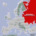
 Hladnirat1950do1960.gif 657 × 654; 498 KB
-
 HladniratEvropa45do50.gif 657 × 654; 329 KB
-
 Linija enos midija.png 979 × 580; 201 KB
-
 Lu-map-SRcyr.png 330 × 354; 25 KB
-
 Central serbia districts-sr-cyr.png 850 × 882; 90 KB
-
 Map Bih entities cyr.png 1,103 × 1,044; 67 KB
-
 Novi Surcin.png 364 × 410; 32 KB
-
 Oblasti bruneia.png 599 × 488; 79 KB
-
 Romania (modern) Map.jpg 600 × 448; 50 KB
-
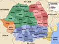 Romania administrative map.png 917 × 678; 165 KB
-
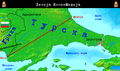
 Termopile i Salamina 480.g.pne.gif 747 × 561; 53 KB
-
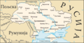 Ukrajina(cir).png 634 × 324; 64 KB
-

-
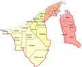
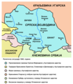 Vojvodina03-sr.png 638 × 738; 67 KB
-
 Vojvodina10-sr.png 1,035 × 948; 126 KB
-
 Vojvodina18 19 cen-sr.png 2,000 × 1,563; 194 KB
-
 Vojvodstva Poljske.png 1,024 × 956; 186 KB
-
 Vojvodstvo srbija okruzi 1849 02.png 769 × 746; 64 KB
-
 Vojvodstvo srbija okruzi 1850 02.png 769 × 828; 74 KB
-
 Vrbaska banovina1929 1941-sr.png 826 × 658; 51 KB
-
 Vrbaska banovina1931-sr.png 863 × 663; 65 KB
-
 Vrbaska banovina1939-sr.png 863 × 666; 63 KB
-
 Zemunska Nahija mapa.jpg 707 × 794; 50 KB
-
 Šajkaška-sr.png 692 × 771; 48 KB
-
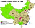 Административна подела Кине.jpg 857 × 699; 93 KB
-
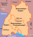 Баден - Вюртемберг, 1945 - 1952 годы.png 266 × 295; 26 KB
-
 Галовица Мапа.png 3,250 × 2,438; 884 KB
-
 Дистрибуција становништва у Азербејџану.png 960 × 600; 146 KB
-
 Драчки округ.jpg 1,016 × 1,258; 224 KB
-
 Железничка мрежа Бугарске.png 780 × 477; 96 KB
-
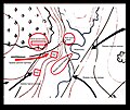 Иванковац-скица.jpg 2,500 × 2,097; 1.23 MB
-
 Иванковац.jpg 574 × 654; 253 KB
-
 Источни фронт од јуна 1941 до децембра 1941.png 1,201 × 920; 237 KB
-
 Источни фронт од августа 1943 до децембра 1944.PNG 1,201 × 921; 264 KB
-
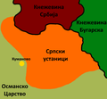 Кумановски устанак.png 600 × 557; 50 KB
-
 Мапа Даријенског расцепа.svg 436 × 441; 72 KB
-
 МапаРесавскогКраја.jpg 3,200 × 2,384; 3.71 MB
-
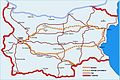 Мрежа путева у Бугарској.jpg 901 × 604; 81 KB
-
 Недичева Србија - Wiki.png 6,000 × 6,830; 1.75 MB
-
 Пацифик.png 330 × 330; 17 KB
-
 Пример позиционог гласања.png 1,600 × 2,533; 144 KB
-
 Рейнланд - Пфальц, административное деление.png 430 × 557; 418 KB
-
 САОБРАЋАЈНА КАРТА КРАЉЕВИНЕ СРБИЈЕ - btv1b53030046g (1 of 2).jpg 10,727 × 9,806; 13.11 MB
-
 САОБРАЋАЈНА КАРТА КРАЉЕВИНЕ СРБИЈЕ - btv1b53030046g (2 of 2).jpg 11,975 × 9,839; 13.61 MB
-
 Српске земље у 10. и 11. веку.png 1,432 × 922; 1.46 MB
-
 Српске земље у 11. веку.png 1,403 × 1,080; 2.02 MB
-
 Српске кнежевине 8. и 9. век.png 1,800 × 1,397; 4.17 MB
-
 Српске кнежевине у 9. и 10. веку.png 1,800 × 1,397; 4.18 MB
-
 Српско царство (мапа).png 784 × 849; 78 KB
-
 Српско царство.png 479 × 350; 134 KB
-
 Српско Царство.png 1,104 × 969; 1.5 MB
-
 Стојадиновић-павелић.png 836 × 778; 19 KB
-
 Тектонске плоче Мексика.png 717 × 607; 163 KB
-
 Тектонске плоче.png 688 × 461; 168 KB


_Map.jpg)


.png)


.jpg)
.jpg)


.png)


