Category:Maps from The Earth and Its Inhabitants, Vol. XII
Jump to navigation
Jump to search
Media in category "Maps from The Earth and Its Inhabitants, Vol. XII"
The following 200 files are in this category, out of 384 total.
(previous page) (next page)-

-

-

-

-

-

-

-

-

-

-

-

-

-

-

-

-

-

-

-
-

-

-

-

-
-

-

-

-

-

-

-

-

-

-

-

-

-

-

-

-

-

-

-

-

-

-

-

-

-

-

-

-

-

-

-

-

-

-

-

-

-

-

-

-

-

-

-

-

-

-

-

-

-

-

-

-

-

-

-

-

-

-

-

-

-

-

-

-

-

-

-

-

-

-

-

-

-

-

-

-

-

-

-

-

-

-

-

-

-

-

-

-

-

-

-

-

-

-

-

-

-

-

-

-

-

-

-

-

-

-

-

-

-

-

-

-

-

-

-

-

-

-

-

-

-

-

-

-

-

-

-

-

-

-

-

-

-

-

-

-

-

-

-

-
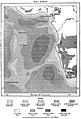
 Timbo and the sources of the Bafino.png 407 × 375; 71 KB
-
 AFR V3 D022 Depths of the Azorian Atlantic.jpg 457 × 603; 49 KB
-
 AFR V3 D029 Atlantic Winds and Currents.jpg 2,009 × 2,427; 866 KB
-
 AFR V3 D032 Depths of the South African Atlantic.jpg 2,125 × 3,126; 1.74 MB
-
 AFR V3 D034 Mean Annual Direction of the Winds in the South African Atlantic.jpg 2,057 × 1,618; 395 KB
-
 AFR V3 D035 Summer Winds in the South African Atlantic.jpg 2,055 × 1,643; 442 KB
-
 AFR V3 D036 Currents of the South Atlantic and Lines of Icebergs.jpg 2,088 × 2,287; 633 KB
-
 AFR V3 D040 Volcanic Axis of the Azores.jpg 2,061 × 1,823; 837 KB
-
 AFR V3 D050 San-Miguel - Azores.jpg 1,960 × 1,423; 499 KB
-
 AFR V3 D051 Val das Furnas - Azores.jpg 2,038 × 2,763; 1.76 MB
-
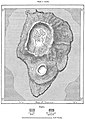
 AFR V3 D052 Sete Cidades - Pona-Delgada - Azores.jpg 2,075 × 2,774; 1.33 MB
-
 AFR V3 D056 Ponta Delgada - Azores.jpg 2,083 × 2,062; 736 KB
-
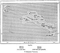
 AFR V3 D057 Central Islands of the Azores Archipelago.jpg 2,029 × 1,781; 672 KB
-
 AFR V3 D060 Island of Corvo - Azores.jpg 2,137 × 2,999; 1.48 MB
-
 AFR V3 D065 Archipelago of Madeira.jpg 2,024 × 2,043; 846 KB
-
 AFR V3 D066 Eastern Peninsula of Madeira.jpg 2,073 × 2,187; 843 KB
-
 AFR V3 D075 Funchal and Socorridos Valley - Madeira.jpg 2,054 × 2,888; 1.39 MB
-
 AFR V3 D080 The Canary islands - left side of map in colour.jpg 2,866 × 4,594; 1.39 MB
-
 AFR V3 D080-081 The Canary islands- in colour.jpg 5,685 × 4,273; 2.87 MB
-
 AFR V3 D081 The Canary islands - right side of map in colour.jpg 2,866 × 4,594; 1.34 MB
-
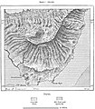 AFR V3 D084 Teyde Peak - Canary Islands.jpg 2,000 × 2,289; 1.11 MB
-
 AFR V3 D093 Recent Lavas of Lanzarote - Canary Islands.jpg 2,032 × 1,418; 593 KB
-
 AFR V3 D096 Cirque de Tejeda - Canary Islands.jpg 2,066 × 1,727; 819 KB
-
 AFR V3 D097 North-East Slope of Gran Canaria.jpg 2,039 × 2,548; 1.19 MB
-
 AFR V3 D098 Las Palmas and Port of La Luz - Canary Islands.jpg 1,436 × 2,634; 860 KB
-
 AFR V3 D102 Northern extremity of Teneriffe.jpg 2,061 × 1,870; 798 KB
-
 AFR V3 D103 Gomera - Canary Islands.jpg 2,098 × 2,100; 955 KB
-
 AFR V3 D104 La Palma - Canary Islands.jpg 1,817 × 2,818; 1.23 MB
-
 AFR V3 D106 Hierro - Canary Islands.jpg 2,070 × 2,032; 945 KB
-
 AFR V3 D109 Cape Verd Islands.jpg 2,048 × 2,097; 832 KB
-
 AFR V3 D115 Santo-Antam and Sam Vincente - Cape Verde.jpg 2,016 × 2,334; 949 KB
-
 AFR V3 D116 Part of the Volcanic Plateau in Santo-Antam - Cape Verde.jpg 2,108 × 1,944; 1.19 MB
-
 AFR V3 D121 Praia - Cape Verde Islands.jpg 2,008 × 1,777; 606 KB
-
 AFR V3 D126 Tristam de Cunha.jpg 2,173 × 2,675; 1.2 MB
-
 AFR V3 D132 Island of St. Helena.jpg 2,059 × 2,373; 914 KB
-
 AFR V3 D139 Ascension Island.jpg 2,209 × 2,093; 818 KB
.jpg)
.jpg)
.jpg)
.jpg)
.jpg)
.jpg)
.jpg)
.jpg)
.jpg)
.jpg)
.jpg)
.jpg)
.jpg)
.jpg)
.jpg)
.jpg)
.jpg)
.jpg)
.jpg)
.jpg)
.jpg)
.jpg)
.jpg)
.jpg)
.jpg)
.jpg)
.jpg)
.jpg)
.jpg)
.jpg)
.jpg)
.jpg)
.jpg)
.jpg)
.jpg)
.jpg)
.jpg)
.jpg)
.jpg)
.jpg)
.jpg)
.jpg)
.jpg)
.jpg)
.jpg)
.jpg)
.jpg)
.jpg)
.jpg)
.jpg)
.jpg)
.jpg)
.jpg)
.jpg)
.jpg)
.jpg)
.jpg)
.jpg)
.jpg)
.jpg)
.jpg)
.jpg)
.jpg)
.jpg)
.jpg)
.jpg)
.jpg)
.jpg)
.jpg)
.jpg)
.jpg)
.jpg)
.jpg)
.jpg)
.jpg)
.jpg)
.jpg)
.jpg)
.jpg)
.jpg)
.jpg)
.jpg)
.jpg)
.jpg)
.jpg)
.jpg)
.jpg)
.jpg)
.jpg)
.jpg)
.jpg)
.jpg)
.jpg)
.jpg)
.jpg)
.jpg)
.jpg)
.jpg)
.jpg)
.jpg)
.jpg)
.jpg)
.jpg)
.jpg)
.jpg)
.jpg)
.jpg)
.jpg)
.jpg)
.jpg)
.jpg)
.jpg)
.jpg)
.jpg)
.jpg)
.jpg)
.jpg)
.jpg)
.jpg)
.jpg)
.jpg)
.jpg)
.jpg)
.jpg)
.jpg)
.jpg)
.jpg)
.jpg)
.jpg)
.jpg)
.jpg)
.jpg)
.jpg)
.jpg)
.jpg)
.jpg)
.jpg)
.jpg)
.jpg)
.jpg)
.jpg)
.jpg)
.jpg)
.jpg)
.jpg)
.jpg)
.jpg)
.jpg)
.jpg)
.jpg)
.jpg)
.jpg)
.jpg)
.jpg)
.jpg)
.jpg)
.jpg)
.jpg)
.jpg)
.jpg)
.jpg)
.jpg)


.jpg)
.jpg)