Category:Maps by Tobias Conrad Lotter
Jump to navigation
Jump to search
Subcategories
This category has the following 2 subcategories, out of 2 total.
Media in category "Maps by Tobias Conrad Lotter"
The following 107 files are in this category, out of 107 total.
-
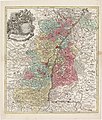
1740 Seutter Map of Swabia and Wirtenberg, Germany - Suevicus-Seutter-1740 Reprint.jpg 6,802 × 5,911; 6.14 MB
-
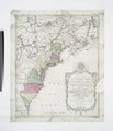
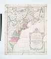
1756 Lotter Map of Eastern Pennsylvania, & New Jersey cropped from Geographicus-1756.jpg 3,600 × 2,700; 4.38 MB
-
1758 plan Wrocławia.jpg 6,580 × 4,797; 24.77 MB
-
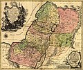
1759 map Holy Land and 12 Tribes.jpg 2,000 × 1,676; 1.74 MB
-
Lobeck-Lotter Africa 1760 UTA.jpg 2,057 × 1,643; 1.43 MB
-
1769 map of Eastern Europe by Tobias Conrad Lotter.jpg 23,743 × 11,575; 34.34 MB
-
1770 map of the Mediterranean Sea by Tobias Conrad Lotter.jpg 20,904 × 8,607; 28.3 MB
-
1778 map of Southern Africa by Tobias Conrad Lotter.jpg 13,729 × 11,803; 22.38 MB
-
Alte Hamburger Poststrasse K. Lotter 1758.jpg 3,408 × 2,272; 3.13 MB
-
Amt Grossen Hayn Region Mückenberg 1.jpg 3,494 × 2,132; 2.03 MB
-
Amt Grossen Hayn.jpg 13,040 × 8,124; 29.18 MB
-
Asia Concinnata Secundum Observationes Academiae Regalis Scientiarum.jpg 15,117 × 11,930; 36.5 MB
-
Augsburg-Karte Matthäus Seutter ca. 1730.jpg 3,038 × 2,632; 3 MB
-
Augspurg Matthäus Seutter ca. 1720 (flattened).jpg 2,613 × 2,245; 2.93 MB
-
AUGSPURG Matthäus Seutter ca. 1720.jpg 3,114 × 2,672; 2.89 MB
-
Basic Cartouche in an Africa map by Lotter.jpg 2,996 × 3,055; 1.42 MB
-
Borussiae regnum.jpg 1,173 × 817; 909 KB
-
Ca. 1750 celestial map by Tobias Conrad Lotter.jpg 14,068 × 11,814; 46.31 MB
-
Candia.jpg 531 × 450; 41 KB
-
Cartouche in a 1769 Turko-Russian war map by Lotter.jpg 3,681 × 3,015; 1.89 MB
-
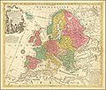
Europa Delineata juxta Observationes.jpg 14,539 × 12,306; 38.97 MB
-
Exactissima Ducatus Carniolae, Vindorum Marchiä et Histriae 1760.jpg 7,435 × 6,324; 10.14 MB
-
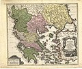
Graecia nova et mare Aegeum (c.1740).jpg 2,400 × 2,028; 1.22 MB
-
Grand Duchy of Lithuania WDL143.png 1,174 × 1,024; 2.68 MB
-
Hemisphaerium Boreale - Hemisphaerium Australe.jpg 3,168 × 2,425; 2.44 MB
-
Hildesheim-Plan-1760.jpg 1,600 × 1,370; 1.29 MB
-
Historische Innviertler Karte (1779).jpg 1,562 × 1,333; 1.33 MB
-
Kaart van Zeeland.jpg 8,207 × 6,901; 8.76 MB
-
Karte 5 FB Paderborn18. Jahrhundert Seuter.jpg 1,920 × 1,706; 2.03 MB
-
Kartenblatt Florida Mexiko 9116.jpg 3,525 × 3,067; 2.49 MB
-
Land van Ravenstein.jpg 480 × 480; 360 KB
-
LASB K Hellwig 0064.jpg 7,711 × 6,523; 7.52 MB
-
LASB K Hellwig 0109.jpg 7,527 × 6,210; 8.69 MB
-
LASB K Hellwig 0177.jpg 6,252 × 7,368; 12.35 MB
-
LASB K Hellwig 0202.jpg 11,013 × 9,165; 23.63 MB
-
LASB K Hellwig 0352.jpg 8,180 × 6,577; 8.18 MB
-
LASB K Hellwig 0369.jpg 7,596 × 6,276; 14.79 MB
-
LASB K Hellwig 0376.jpg 7,575 × 6,300; 6.64 MB
-
LASB K Hellwig 0705.jpg 3,384 × 2,709; 3.37 MB
-
LASB K Hellwig 0739.jpg 3,540 × 2,646; 3.32 MB
-
LASB K Hellwig 0762.jpg 2,610 × 3,468; 3.59 MB
-
Magni Turcarum Dominatoris Imperium per Europam, Asiam, et Africam by Tobias Conrad Lotter.jpg 14,259 × 12,407; 45.35 MB
-
Magni Turcarum Dominatoris Imperium per Europam, Asiam, et Africam.jpg 8,197 × 6,559; 20.51 MB
-
Magnus ducatus Lithuania, 1780.jpg 6,809 × 5,768; 12.84 MB
-
Map of the World WDL7.png 1,450 × 1,024; 3.01 MB
-
Mappa totius mundi - Norman B. Leventhal Map Center at the BPL.jpg 2,000 × 1,492; 3.26 MB
-
Mappa Totius Mundi Adornata juxta Observationes Dnn Academiae Regalis Scientarum.jpg 15,557 × 11,233; 41.28 MB
-
Partie Orientale de la Nouvelle France ou du Canada.jpg 4,090 × 4,668; 7.95 MB
-
Planisphaerium coeleste. A.C. Seutter delin. Andr. Silbereisen Sculps (world map 1744).jpg 5,051 × 3,814; 5.64 MB
-
Principatus Teschenensis 1758.jpg 4,776 × 3,994; 13.06 MB
-
Recens edita totius Novi Belgii, in America Septentrionali siti (2673905113).jpg 2,000 × 1,614; 3.49 MB
-
Rhode Berlin 1772 (Lotter) (Bernauer Tor).jpg 1,651 × 963; 1.04 MB
-
Rhode Berlin 1772 (Lotter) (cropped).jpg 2,461 × 1,584; 2.54 MB
-
Rhode Berlin 1772 (Lotter) (georeferenced).jpg 5,750 × 4,290; 4.74 MB
-
Rhode Berlin 1772 (Lotter).jpg 7,573 × 5,878; 18.12 MB
-
Seutter Berlin die Praechtigst. u. maechtigste Hauptstatt.. 1738.jpg 11,670 × 9,539; 28.39 MB
-
Seutter Berlin die Praechtigst. u. maechtigste Hauptstatt.. 1738b.jpg 4,631 × 4,008; 11.4 MB
-
Silesia 1758.jpg 13,700 × 11,631; 29.81 MB
-
T C Lotter Wien Vorstädte.jpg 3,717 × 4,243; 1.85 MB
-
UBBasel Map 1750-1750 Kartenslg Schw Cl 12.tif 11,282 × 9,113, 2 pages; 294.18 MB
-
UBBasel Map 1750-1750 Kartenslg Schw Cl 13.tif 11,973 × 9,338, 2 pages; 319.9 MB
-
Vialikaje Kniastva Litoŭskaje. Вялікае Княства Літоўскае (T. Lotter, 1770).jpg 3,223 × 2,724; 3.3 MB
-
Vialikaje Kniastva Litoŭskaje. Вялікае Княства Літоўскае (T. Lotter, 1780).jpg 3,988 × 3,342; 5.39 MB


