Category:Maps by Simeon De Witt
Jump to navigation
Jump to search
English: Simeon De Witt (1756 – 1834) was the Geographer and Surveyor-General of the Continental Army during the American Revolution and Surveyor General of the State of New York for the fifty years from 1784 until his death.
Media in category "Maps by Simeon De Witt"
The following 13 files are in this category, out of 13 total.
-
A map of the State of New York (4584053064).jpg 2,000 × 1,624; 3.66 MB
-
A map of the State of New York - by Simeon De Witt, Surveyor General. NYPL434396.tiff 4,900 × 4,220; 59.17 MB
-
A map of the State of New York - by Simeon De Witt, Surveyor General. NYPL484226.tiff 5,095 × 4,413; 64.33 MB
-
A map of the State of New York - by Simeon De Witt, Surveyor General. NYPL484227.tiff 5,691 × 5,032; 79.18 MB
-
Albany1794.jpg 1,000 × 1,265; 543 KB
-
CNY Military Tract.png 492 × 599; 606 KB
-
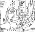
DeWittmapofAlbany1790.jpg 600 × 540; 127 KB
-
Halsey Old NY Frontier Patent Map small.png 2,326 × 2,110; 653 KB
-
Halsey Old NY Frontier Patent Map.png 4,589 × 4,071; 1.77 MB
-
Map of the State of New York, by Simeon De Witt, 1802.jpg 15,947 × 19,962; 60.4 MB
-
Simeon DeWitt Central NY Military Tract c.1792.png 1,137 × 1,384; 1.76 MB
-
Simeon DeWitt Otsego County NY c.1792.png 729 × 1,044; 431 KB
-
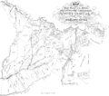
Simeon DeWitt Twenty Townships c.1792.png 960 × 907; 487 KB


