Category:Maps by Sebastian Münster
Jump to navigation
Jump to search
Subcategories
This category has the following 6 subcategories, out of 6 total.
M
Media in category "Maps by Sebastian Münster"
The following 171 files are in this category, out of 171 total.
-
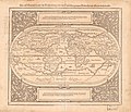
1532 map of the world by Sebastian Münster.jpg 13,062 × 9,232; 29 MB
-
1537 map of the world by Sebastian Munster.jpg 13,364 × 8,920; 21.13 MB
-
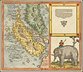
Münster Africa 1538 UTA.jpg 2,504 × 1,630; 2.95 MB
-
Munster Tabula Novarum Insularum 1540 UTA.jpg 3,674 × 2,835; 1.93 MB
-
Münster Aphricae Tabula I 1540 UTA.jpg 2,955 × 2,366; 7.1 MB
-
Münster Aphricae Tabula II 1540 UTA.jpg 2,931 × 2,387; 6.95 MB
-
Münster Aphricae Tabula III 1540 UTA.jpg 4,384 × 3,587; 6.94 MB
-
Münster Tavola & discrizzione universale di tutta l'Africa 1540 UTA.jpg 4,506 × 3,600; 16.33 MB
-
1540 Sebastian Münster map locating Kyiv.jpg 1,600 × 1,265; 1.13 MB
-
1540NwWorldMapNHMDF.JPG 3,872 × 2,592; 3.02 MB
-
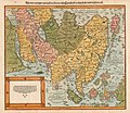
1542 map of Asia by Sebastian Münster.jpg 9,040 × 7,056; 13.02 MB
-
1544 Ptolemaic world map by Sebastian Münster.tif 6,288 × 4,674; 84.11 MB
-
1545 engraving of Noah's Ark.jpg 1,984 × 1,534; 575 KB
-
1545 Ptolemy's 5th European Map by Sebastian Munster.jpg 8,969 × 7,272; 14.16 MB
-
Münster Africa 1550 UTA.jpg 1,958 × 1,630; 2.69 MB
-
Münster Algiers 1550 UTA.jpg 2,182 × 1,796; 3.76 MB
-
Münster Typus Orbis Universalis 1550 UTA.jpg 4,525 × 3,367; 3.25 MB
-
1550 map of Asia by Sebastian Münster.jpg 8,878 × 6,907; 13.08 MB
-
1550 Ptolemaic world map by Sebastian Münster.jpg 5,093 × 3,880; 2.85 MB
-
Novae lnsulae XXVI Nova Tabula. Front..jpg 600 × 481; 377 KB
-
1552 Ptolemy's 7th Asian Map by Sebastian Münster.jpg 4,534 × 3,437; 3.66 MB
-
1552 Ptolemy's 9th Asian Map by Sebastian Münster.jpg 4,460 × 3,409; 3.27 MB
-
1552 S Munster Polonia et Vngaria XX raremaps.jpg 1,563 × 1,200; 2.38 MB
-
1552 Transsylvania XXI Nova Tabula.jpg 2,048 × 1,593; 1.23 MB
-
1558 maps of the Americas by Sebastian Münster.jpg 4,000 × 3,139; 4.01 MB
-
1561 map of the Americas by Sebastian Münster.jpg 9,079 × 7,187; 16.89 MB
-
SAPUNOV(1893) -84- p607.jpg 1,667 × 1,237; 1.34 MB
-
Affricae Tabula Nova.jpg 9,679 × 8,386; 19.07 MB
-
Africa - DPLA - 398f805116499b17f3eba644c0037c66.jpg 1,000 × 795; 307 KB
-
Aphricae Tabula IIII.jpg 1,431 × 1,078; 2.11 MB
-
Africa XXV. Nova Tabula.jpg 4,505 × 3,622; 4.32 MB
-
Africa, Lybia, Morland mit allen kunigsreichen so zu unsern zeiten darin gefunden werden.jpg 8,766 × 6,914; 17.16 MB
-
Altera Generalis Tab Secundum Ptol by Sebastian Münster.jpg 9,195 × 7,014; 14.44 MB
-
Aphricae Tabula 4.jpg 9,152 × 7,134; 16.12 MB
-
Aphricae Tabula I.jpg 9,436 × 7,330; 13.28 MB
-
Aphricae Tabula II.jpg 8,732 × 7,263; 12.95 MB
-
Aphricae Tabula IIII by Sebastian Münster.jpg 9,320 × 7,388; 13.24 MB
-
Armeniamap2.jpg 1,907 × 1,485; 513 KB
-
Tabula Asiae VI.jpg 1,620 × 1,300; 2.6 MB
-
Babylonia, zwey Arabia mit Bergen, Wassern und Stetten.jpg 8,810 × 7,819; 14.25 MB
-
Back side of map Novae lnsulae XXVI Nova Tabula. CTASC.jpg 600 × 484; 314 KB
-
Basic cartouche on an Africa map by Muenster (2).jpg 1,685 × 2,095; 929 KB
-
Basic cartouche on an Africa map by Muenster.jpg 1,449 × 1,188; 612 KB
-
Constantinopel - from Münster'S Cosmographia universalis (cropped).jpg 3,549 × 1,849; 1.3 MB
-
Constantinopel - from Münster'S Cosmographia universalis.jpg 4,524 × 7,415; 5.49 MB
-
Das heilig Lande mit Ausztheilung der zwoelff Geschlechter. LOC 2006629144.jpg 4,967 × 4,289; 3.56 MB
-
Das heilig Lande mit Ausztheilung der zwoelff Geschlechter. LOC 2006629144.tif 4,967 × 4,289; 60.95 MB
-
Das Heilig Landt mit Auftheilung der zwolff Geschlechter.jpg 8,944 × 7,889; 17.92 MB
-
Das heylig Jüdisch land mit auftheilung der zwölf geschlechter — um 1579.jpg 8,759 × 6,808; 17.74 MB
-
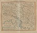
Der Rhein in Schweiz Schwarzwald und Elsass.jpg 1,571 × 1,238; 1.11 MB
-
Die Gartenlaube (1895) b 772.jpg 2,034 × 1,464; 968 KB
-
Die Heilige Statt Jerusalem Contrafehtet nach Form und Gestalt wie sie Ietz Erbauwen ist.jpg 9,176 × 6,719; 15.53 MB
-
Die Statt Rom.jpg 9,783 × 7,062; 17.26 MB
-
Europa antigua.jpg 494 × 303; 51 KB
-
Europa Regina by Sebastian Münster.jpg 2,236 × 3,687; 8.49 MB
-
Europa regina by Sebastian Münster.jpg 4,512 × 7,212; 7.62 MB
-
Gemaniae-Tabula-(Sebastian-Muenster).jpg 1,200 × 923; 599 KB
-
General tafel begreifend der gantzen undern weldt beschrenbung.jpg 8,843 × 6,892; 19.14 MB
-
General Tafel begreifend der gantzen unsern Weldt Beschreybung.jpg 8,495 × 6,622; 16.03 MB
-
Geographia universalis by Sebastian Munster.jpg 542 × 402; 56 KB
-
Grynaeus's Novus Orbis Regionum.jpg 2,000 × 1,436; 1.63 MB
-
Heidelberger Bezirk Sebastian Münster 1528.jpg 1,826 × 2,134; 942 KB
-
Ierusalem, ciuitas sancta, olim metropolis regni Iudaici, hodie euro colonia Turcae.jpg 9,145 × 6,872; 14.51 MB
-
India Extrema XXIIII Nova Tabula.jpg 9,270 × 7,335; 18.91 MB
-
Italia XIX Nova Tabula.jpg 9,448 × 7,356; 18.42 MB
-
La Figure Du Monde Universel.jpg 9,286 × 7,135; 16.41 MB
-
Map of Singapore, Sumatra, Malaysia, Straits of Malacca by Sebastian Münster.jpg 8,922 × 7,669; 16.33 MB
-
Melita map by Sebastian Munster (Basel, ca. 1550).jpg 442 × 672; 129 KB
-
Moderna Europae Descriptio.jpg 8,973 × 6,919; 16.44 MB
-
Muenster - Kranjska z Istro, Gorisko, Furlanijo.jpg 1,608 × 1,493; 866 KB
-
Münster Marburg.jpg 3,513 × 2,048; 6.13 MB
-
Münster-Petri map of Africa.jpg 4,595 × 3,975; 4.71 MB
-
Münster-Petri map of Asia.jpg 4,583 × 3,981; 4.62 MB
-
Münster-Petri map of Europe.jpg 4,594 × 3,968; 4.76 MB
-
Münster-Petri map of the Americas.jpg 4,625 × 3,985; 4.3 MB
-
Münster-Petri Ptolemaic world map.jpg 4,590 × 3,918; 4.78 MB
-
Münster-Petri world map.jpg 4,614 × 3,926; 4.41 MB
-
Münsters skandinaviakart (24957076285).jpg 4,233 × 3,311; 7.61 MB
-
Nordenskiöld 1897 Figure 61 LOC Image 154.jpg 4,101 × 3,088; 2.23 MB
-
Nova Graecia XXII Nova Tabula.jpg 9,200 × 7,030; 9.26 MB
-
Novae Insulae Nova Tabula (New Map of the New World).jpg 1,400 × 1,078; 1.27 MB
-
Plan Augsburg 1550.jpg 7,929 × 6,193; 14.62 MB
-
Polonia Et Ungaria XX Nova Tabula.jpg 3,186 × 2,424; 1.56 MB
-
Ptolemaisch General Tafel, begreiffende die halbe Kugel der Welt.jpg 8,543 × 6,435; 14.74 MB
-
Sclauonia oder Windisch Land sampt Dalmatia 1548.jpg 2,240 × 1,680; 755 KB
-
Sclauonia oder Windisch Marck, Bossen, Crabaten 1548.jpg 2,442 × 1,938; 721 KB
-
Sclauonia oder Windisch Marck, Bossen, Crabaten 1550.jpg 2,324 × 2,095; 888 KB
-
Sebastian Munster - Tabvla europae VIII (Sarmatia).jpg 640 × 509; 87 KB
-
Sebastian munster 1550 wurzburg Ausschnitt X 001.jpeg 418 × 303; 59 KB
-
Sebastian Munster, Tabula Sarmatiae full size.jpg 9,468 × 7,488; 18.66 MB
-
Sebastian Munster, Tabula Sarmatiae.jpg 3,893 × 3,024; 4.5 MB
-
Sebastian Munster.jpg 300 × 235; 32 KB
-
Sebastian Münster - Descriptio totius Illyridis.jpg 1,535 × 1,200; 2.2 MB
-
Sebastian Münster Karte Bayern.jpg 3,460 × 1,888; 3.32 MB
-
Sebastian Münster. Map of Colchis and Caucasian Iberia. 1544.GIF 1,237 × 834; 138 KB
-
SebastianMünsterAusschnittRheinlaufkarteL1040596 (2).JPG 2,004 × 2,603; 2.1 MB
-
Silesia1zMünstera.jpg 1,267 × 1,813; 881 KB
-
Sumatra ein grosse Insel, so von den alten Geographen Taprobana genennet worden.jpg 9,796 × 8,320; 17.85 MB
-
Sumatra ein grosse Insel- so von den alten Geographen Taprobana genennet worden.jpg 9,367 × 8,246; 16.15 MB
-
Tabula Asiae I (1542).jpg 1,732 × 1,350; 684 KB
-
Tabula Asiae I - 1542.jpg 9,238 × 7,043; 15.64 MB
-
Tabula Asiae I.jpg 1,772 × 1,350; 569 KB
-
Tabula Asiae III by Sebastian Münster.jpg 9,410 × 7,322; 12.5 MB
-
Tabula Asiae III.jpg 8,955 × 6,933; 8.34 MB
-
Tabula Asiae V.jpg 9,448 × 7,238; 15.99 MB
-
Tabula Asiae VII.jpg 9,361 × 7,345; 16.02 MB
-
Tabula Asiae XI.jpg 8,893 × 6,888; 12.33 MB
-
Tabula Asiae XII, Taprobana insula.jpg 3,774 × 2,781; 4.22 MB
-
Tabula Europae IX by Sebastian Münster.jpg 9,029 × 7,247; 12.39 MB
-
Tabula Europae VII. Basilea, Sebastian Münster, 1550 circa.jpg 2,103 × 1,636; 1.25 MB
-
Tabula Europae X.jpg 9,277 × 7,213; 14.02 MB
-
Tabula nova Polonia, Ungariae, & Russiae.jpg 6,377 × 4,724; 4.86 MB
-
Tabvla Asiae I, Münster (Samsun).jpg 1,281 × 942; 988 KB
-
Tabvla Asiae I, Münster.jpg 6,775 × 5,158; 23.17 MB
-
Tavola dell' isole nuove, le quali son nominate occidentali, & indiane per diversi rispetti.jpg 8,976 × 7,018; 16.16 MB
-
Tavola della oriental region dell' Asia, che comprende l'estreme terre, & regni di quella.jpg 9,182 × 7,187; 15.59 MB
-
Tunis. - DPLA - 845455e531036168d05a2cd41b9f8c2e.jpg 693 × 1,000; 275 KB
-
Typus Orbis Ptol. Descriptus.jpg 9,129 × 7,038; 20.2 MB
-
Typus orbis universalis, Sebastian Munster 1550.jpg 1,778 × 1,278; 2.17 MB
-
Typus orbis universalis. LOC 84696976.tif 4,628 × 3,764; 49.84 MB
-
UBBasel Map 1542 Kartenslg Mappe 246-10 Alsatia.tiff 12,501 × 8,624, 2 pages; 308.47 MB
-
UBBasel Map 1544 Kartenslg Schw Ml 3 Rauracher Land samt Basel.tiff 14,683 × 6,809, 2 pages; 286.06 MB
-
UBBasel Map 1545 Kartenslg Schw Cu 6.tif 5,028 × 3,704, 5 pages; 266.56 MB
-
UBBasel Map 1550 Kartenslg Schw B 123 von dem Wifelsspurger Goew.tiff 4,777 × 3,828, 2 pages; 52.34 MB
-
UBBasel Map 1552 Kartenslg Schw Cu 7-1 Valesia.tiff 7,333 × 5,693, 2 pages; 119.46 MB
-
UBBasel Map 1552 Kartenslg Schw Cu 7-2 Valesia.tiff 7,111 × 5,825, 2 pages; 118.53 MB
-
UBBasel Map 1552 Kartenslg Schw Cu 8-1 Valesia.tiff 11,449 × 9,094, 2 pages; 597.43 MB
-
UBBasel Map 1552 Kartenslg Schw Cu 8-2 Valesia.tiff 11,475 × 9,167, 2 pages; 601.78 MB
-
UBBasel Map 1598 Kartenslg Schw A 67 Schweytzerlandt.tiff 7,585 × 5,896, 2 pages; 127.97 MB
-
UBBasel Map 1598 VB A2-1-47 Schweytzerlandt.tiff 7,057 × 5,358, 2 pages; 108.21 MB
-
UBBasel Map Basel-Landschaft Schwaben Schwäbischer Reichskreis 1573 VB A2-2-2.tif 5,223 × 7,693, 2 pages; 114.98 MB
-
Venetiarum amplissima & maritima urbs, cum multis circumiacentibus insulis.jpg 9,663 × 6,542; 16.81 MB
-
BASA-2115K-4-12-1(1)-Map of Europe.jpg 729 × 1,109; 257 KB
-
Henricpetri-Münster, Affricae Tabula Nova-Africa, Lybia Dozenlandt 1580 UTA.jpg 4,568 × 4,025; 8.33 MB
-
África Münster.jpg 1,024 × 809; 296 KB
-
Карта Птолемея - Сараматія Мюнстер 1571.jpg 3,373 × 2,629; 3.02 MB


