Category:Maps by Rigobert Bonne
Jump to navigation
Jump to search
Subcategories
This category has the following 6 subcategories, out of 6 total.
1
C
- Cartouches by Rigobert Bonne (14 F)
Media in category "Maps by Rigobert Bonne"
The following 144 files are in this category, out of 144 total.
-
1762 Bonne Map of Egypt - Geographicus - Egypt-bonne-1762.jpg 2,443 × 3,500; 2.23 MB
-
1770 Bonne Map of China, Korea, Japan and Formosa - Geographicus - China-bonne-1770.jpg 4,000 × 2,787; 3.09 MB
-
1771 Bonne Map of Central Asia - Geographicus - Tartarie-bonne-1770.jpg 4,000 × 2,808; 3.34 MB
-
1770 Bonne Map of Israel showing the Twelve Tribes - Geographicus - Israel-bonne-1770.jpg 4,000 × 2,847; 2.61 MB
-
1771 Bonne Map of Alsace and Lorraine, France - Geographicus - AlsaceLorraine-bonne-1771.jpg 3,500 × 2,554; 2.69 MB
-
1771 Bonne Map of Arabia - Geographicus - Arabia-bonne-1771.jpg 4,000 × 2,697; 2.55 MB
-
1771 Bonne Map of Brie and Champagne, France - Geographicus - Champagne-bonne-1771.jpg 2,567 × 3,500; 2.94 MB
-
1771 Bonne Map of Dauphine and Provence, France - Geographicus - Provence-bonne-1771.jpg 2,549 × 3,500; 2.8 MB
-
1771 Bonne Map of France - Geographicus - FranceGov-bonne-1771.jpg 3,500 × 2,536; 2.45 MB
-
1771 Bonne Map of Guyenne and Gascony, France - Geographicus - Gascogne-bonne-1771.jpg 2,498 × 3,500; 2.94 MB
-
1771 Bonne Map of Ireland - Geographicus - Ireland-bonne-1771.jpg 4,000 × 2,896; 2.78 MB
-
1771 Bonne Map of Normandy, France - Geographicus - Normandie-bonne-1771.jpg 3,500 × 2,533; 2.94 MB
-
1771 Bonne Map of Paraguay, Uruguay, and Brazil - Geographicus - Paraguay-bonne-1771.jpg 2,653 × 3,500; 2.51 MB
-
1771 Bonne Map of Russia (2 maps) - Geographicus - Russia-bonne-1772.jpg 5,000 × 3,413; 4.77 MB
-
1771 Bonne Map of Switzerland - Geographicus - Switzerland-bonne-1771.jpg 3,500 × 2,415; 2.77 MB
-
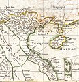
1771 Bonne Map of Tonkin and Cochinchina (Vietnam).jpg 1,154 × 1,189; 436 KB
-
1771 Bonne Map of Turkey, Syria and Iraq - Geographicus - Turkey-bone-1771.jpg 3,500 × 2,432; 2.34 MB
-
1772 Bonne Map of England and Wales - Geographicus - England-bonne-1772.jpg 3,500 × 2,548; 2.47 MB
-
1772 Bonne Map of Scotland - Geographicus - Scotland-bonne-1772.jpg 3,500 × 2,522; 2.16 MB
-
1776 Bonne Map of the Hudson Bay, Canada - Geographicus - HudsonBay-bonne-1776.jpg 4,000 × 2,803; 2.76 MB
-
Santini & Bonne Carte de la Guinee (Cote d'Or) 1779 UTA.jpg 7,597 × 5,675; 12.69 MB
-
Santini & Bonne Cote d'Or 1779 UTA.jpg 3,094 × 1,772; 2.11 MB
-
1779 - Carte de l' Empire de la Chine avec la Tartarie Chinoise.jpg 7,144 × 5,918; 6.63 MB
-
Bonne Partie Occidentale de l'Ancien Continent 1780 UTA.jpg 5,673 × 8,277; 8.59 MB
-
1780 Bonne Map of Alsace ^ Lorainne, France - Geographicus - AlcaseLoraine-bonne-1780.jpg 3,000 × 2,082; 1.46 MB
-
1780 Bonne Map of Arabia, Egypt ^ Ethiopia - Geographicus - Arabia-bonne-1780.jpg 2,500 × 1,654; 1.11 MB
-
1780 Bonne Map of Northern India - Geographicus - IndiaNorth-bonne-1780.jpg 3,500 × 2,345; 2.4 MB
-
1780 Bonne Map of Texas, Louisiana ^ New Mexico - Geographicus - Texas2-bonne-1780.jpg 3,000 × 2,002; 1.13 MB
-
1780 Bonne Map of the Environs of Paris, France - Geographicus - Paris-bonne-1780 (2).jpg 3,783 × 2,567; 5.93 MB
-
1780 Bonne Map of the Environs of Paris, France - Geographicus - Paris-bonne-1780.jpg 4,000 × 2,762; 2.09 MB
-
1780 Bonne Map of Venice in Western Italy - Geographicus - Venice-bonne-1780.jpg 3,000 × 2,085; 1 MB
-
1780 Raynal and Bonne Map of Africa - Geographicus - Afrique-bonne-1780.jpg 2,500 × 1,711; 1.33 MB
-
1780 Raynal and Bonne Map of Antilles Islands - Geographicus - IslesAntilles-bonne-1780.jpg 1,698 × 2,500; 1.18 MB
-
1780 Raynal and Bonne Map of Arabia and Abyssinia - Geographicus - Arabie-bonne-1780.jpg 2,500 × 1,723; 1.31 MB
-
1780 Raynal and Bonne Map of Asia - Geographicus - Asia-bonne-1780.jpg 2,500 × 1,720; 1.39 MB
-
1780 Raynal and Bonne Map of British Isles - Geographicus - IslesBritanniques-bonne-1780.jpg 1,724 × 2,500; 1.23 MB
-
1780 Raynal and Bonne Map of Central Asia - Geographicus - Georgie-bonne-1780.jpg 2,500 × 1,758; 1.41 MB
-
1780 Raynal and Bonne Map of Chile - Geographicus - Chili-bonne-1780.jpg 1,677 × 2,500; 1.26 MB
-
1780 Raynal and Bonne Map of China, Korea, and Japan - Geographicus - Chine-bonne-1780.jpg 1,686 × 2,500; 1.24 MB
-
1780 Raynal and Bonne Map of Cuba, West Indies - Geographicus - Cuba-bonne-1780.jpg 2,500 × 1,746; 1.31 MB
-
1780 Raynal and Bonne Map of Europe - Geographicus - Europe-bonne-1780.jpg 2,500 × 1,719; 1.37 MB
-
1780 Raynal and Bonne Map of France - Geographicus - France-bonne-1780.jpg 2,500 × 1,686; 1.27 MB
-
1780 Raynal and Bonne Map of Guinea - Geographicus - Guinee-bonne-1780.jpg 2,500 × 1,756; 1.09 MB
-
1780 Raynal and Bonne Map of Guyana and Surinam - Geographicus - Guyane-bonne-1780.jpg 1,728 × 2,500; 1.04 MB
-
1780 Raynal and Bonne Map of Holland and Belgium - Geographicus - Hollande-bonne-1780.jpg 2,500 × 1,753; 1.25 MB
-
1780 Raynal and Bonne Map of Italy - Geographicus - Italie-bonne-1780.jpg 1,682 × 2,500; 1.21 MB
-
1780 Raynal and Bonne Map of Jamaica, West Indies - Geographicus - Jamaique-bonne-1780.jpg 2,500 × 1,700; 1.05 MB
-
1780 Raynal and Bonne Map of Mexico and Texas - Geographicus - NouveauMexique-bonne-1780.jpg 2,500 × 1,685; 1.27 MB
-
1780 Raynal and Bonne Map of North America - Geographicus - Amerique-bonne-1780.jpg 2,500 × 1,691; 1.13 MB
-
1780 Raynal and Bonne Map of Northern Brazil - Geographicus - SeptBresil-bonne-1780.jpg 2,500 × 1,692; 1.26 MB
-
1780 Raynal and Bonne Map of Northern India - Geographicus - IndeSuperieure-bonne-1780.jpg 2,500 × 1,746; 1.27 MB
-
1780 Raynal and Bonne Map of Northern South America - Geographicus - Grenade-bonne-1780.jpg 2,500 × 1,693; 1.22 MB
-
1780 Raynal and Bonne Map of Peru - Geographicus - Perou-bonne-1780.jpg 1,673 × 2,500; 1.21 MB
-
1780 Raynal and Bonne Map of Russia - Geographicus - Russia-bonne-1780.jpg 2,500 × 1,712; 1.35 MB
-
1780 Raynal and Bonne Map of Southern India - Geographicus - Indes-bonne-1780.jpg 2,500 × 1,739; 1.08 MB
-
1780 Raynal and Bonne Map of the Two Hemispheres - Geographicus - Hemispheres-bonne-1780.jpg 2,500 × 1,457; 1.07 MB
-
1780 Raynal and Bonne Map of the World - Geographicus - Planisphere-bonne-1780.jpg 2,500 × 1,698; 1.32 MB
-
A map of Chinese Tartary, with Corea (NYPL b13919861-5207424).jpg 8,013 × 6,638; 44.64 MB
-
A map of Chinese Tartary, with Corea (NYPL b13919861-5207424).tiff 10,326 × 7,758, 2 pages; 229.46 MB
-
A map of independent Tartary, containing the countries of the Kalmuks and Uzbecks, with the Tibet (NYPL b13919861-5207420).tiff 10,326 × 7,758, 2 pages; 229.46 MB
-
China, divided into its great provinces, and the Isles of Japan (NYPL b13919861-5207423).jpg 8,045 × 6,648; 44.32 MB
-
China, divided into its great provinces, and the Isles of Japan (NYPL b13919861-5207423).tiff 6,439 × 4,519; 83.46 MB
-
Bonne - Afrique, cote orientale.jpg 5,390 × 3,971; 4.33 MB
-
Bonne - Carte hydro-geo-graphique des Indes Orientales.jpg 10,451 × 7,599; 15.59 MB
-
Bonne - Isle de France (Detail).jpg 1,045 × 1,231; 388 KB
-
Bonne georgie 1780.jpg 732 × 317; 131 KB
-
Brie Champenoise.jpg 1,741 × 1,408; 2.74 MB
-
Carte de L'Asie divisée en ses principaux Etats.jpg 9,000 × 6,400; 13.87 MB
-
Carte de lisle de la Jamaïque (4586546961).jpg 2,000 × 1,347; 2.41 MB
-
Jamaique - btv1b5970666d.jpg 11,632 × 7,888; 9.58 MB
-
Kingdoms of Persia and Georgia..jpg 2,542 × 1,806; 3.57 MB
-
Map of Antilles Isles. Wellcome L0002630EA.jpg 1,617 × 1,092; 959 KB
-
Map of Dominica Isle. Wellcome L0002630EB.jpg 1,620 × 1,106; 836 KB
-
Map of French Guiana. Wellcome L0002631EC.jpg 1,150 × 1,670; 889 KB
-
Resized-inu-afrmap-4014996-recto-master.png 4,045 × 2,863; 19.99 MB
-
Rigobert-Bonne-Atlas-de-toutes-les-parties-connues-du-globe-terrestre MG 0018.tif 3,536 × 5,263; 53.28 MB
-
Rigobert-Bonne-Atlas-de-toutes-les-parties-connues-du-globe-terrestre MG 0019.tif 5,154 × 3,528; 52.06 MB
-
Rigobert-Bonne-Atlas-de-toutes-les-parties-connues-du-globe-terrestre MG 0023.tif 3,564 × 5,353; 54.62 MB
-
Rigobert-Bonne-Atlas-de-toutes-les-parties-connues-du-globe-terrestre MG 0031.tif 3,597 × 1,833; 25.16 MB
-
Rigobert-Bonne-Atlas-de-toutes-les-parties-connues-du-globe-terrestre MG 9997.tif 5,250 × 3,588; 53.93 MB
-
The Canary Islands, with Madeira and Porto Santo (1780).jpg 408 × 600; 42 KB


