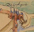
Category:Maps by Pieter and/or Jacob Sluyter
Jump to navigation
Jump to search
Maps by Pieter Sluyter (1514/15-1572) and/or Jacob Sluyter, brothers, sixteenth-century Dutch surveyors and draughtsmen. Working for the Water board of Rijnland
Media in category "Maps by Pieter and/or Jacob Sluyter"
The following 6 files are in this category, out of 6 total.
-
Costverlorenpoort.jpg 949 × 649; 225 KB
-
Koepoort.jpg 845 × 701; 185 KB
-
Leiden map Sluyter.jpg 13,450 × 5,597; 9.88 MB
-
Lopsenpoort.jpg 956 × 650; 195 KB
-
Witte Poort.jpg 767 × 941; 255 KB
-
Zijlpoort.jpg 897 × 837; 233 KB


