Category:Maps by Jakob van der Schley
Jump to navigation
Jump to search
Media in category "Maps by Jakob van der Schley"
The following 179 files are in this category, out of 179 total.
-
Schley-Bellin Verfolg van de Kust van Guinee... 1747 UTA.jpg 5,310 × 2,987; 5.12 MB
-
1750 Schley Map of Ormus, Persian Gulf - Geographicus - Ormus-schley-1750.jpg 2,500 × 2,015; 1.78 MB
-
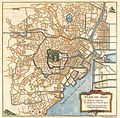
1752 Schely Plan or Map of Edo or Tokyo, Japan - Geographicus - EdoTokyo-schley-1752.jpg 2,500 × 2,461; 1.96 MB
-
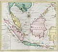
1773 map of Southeast Asia by Schley.jpg 3,295 × 3,489; 4.39 MB
-
1773 map of the Arabian Sea by Schley.jpg 2,416 × 3,055; 2.75 MB
-
AMH-6328-KB Map of a stretch of the West African coast.jpg 2,400 × 1,961; 761 KB
-
AMH-6905-KB Map of Essequebo and Demerary.jpg 2,400 × 1,327; 588 KB
-
AMH-6906-KB Map of Berbice.jpg 2,400 × 1,321; 429 KB
-
AMH-6909-KB Redoubt on Wieronje creek.jpg 1,757 × 2,400; 929 KB
-
AMH-6911-KB Map of a new fort near Nieuw Amsterdam, Berbice.jpg 2,400 × 1,674; 944 KB
-
AMH-6912-KB Map of Guiana.jpg 2,400 × 1,371; 731 KB
-
AMH-6913-KB Map of the rivers of Corentyn, Copename and Sarameca.jpg 2,400 × 1,352; 515 KB
-
AMH-6914-KB Map of Nieuw Amsterdam fort.jpg 1,757 × 2,400; 1,009 KB
-
AMH-6916-KB Map of Surinam.jpg 2,400 × 1,329; 524 KB
-
AMH-7874-KB Map of the Pacific Ocean, from Malacca to Japan.jpg 2,246 × 2,400; 1.03 MB
-
AMH-7875-KB Map of the southern part of the Atlantic Ocean.jpg 2,400 × 2,030; 916 KB
-
AMH-7876-KB Map of the world.jpg 2,400 × 1,905; 971 KB
-
AMH-7878-KB Map of the coast of Iran to the west coast of India.jpg 1,818 × 2,400; 793 KB
-
AMH-7880-KB Map of the Arab peninsula.jpg 2,400 × 2,130; 1,003 KB
-
AMH-7882-KB Map of Cape Verde with a view of the island of Goeree.jpg 1,696 × 2,400; 597 KB
-
AMH-7885-KB Map of Arguin Bay.jpg 1,734 × 2,400; 626 KB
-
AMH-7886-KB Map of the bay and island of Arguin.jpg 2,400 × 1,834; 766 KB
-
AMH-7888-KB Map of the island of Goeree.jpg 2,400 × 1,794; 788 KB
-
AMH-7889-KB Bird's eye view of Goeree.jpg 2,400 × 1,405; 705 KB
-
AMH-7892-KB Map of part of the west coast of Africa, near Cape Verde.jpg 1,742 × 2,400; 719 KB
-
AMH-7893-KB Map of part of the west coast of Africa, near the Senegal river.jpg 1,723 × 2,400; 607 KB
-
AMH-7894-KB Map following the course of the Senegal river, in two parts.jpg 2,400 × 1,884; 849 KB
-
AMH-7895-KB Map of the mouth of the Senegal river.jpg 1,700 × 2,400; 592 KB
-
AMH-7905-KB Map of the mouth of the Senegal river.jpg 1,715 × 2,400; 727 KB
-
AMH-7923-KB Map of part of the African east coast and Madagascar.jpg 2,400 × 2,115; 933 KB
-
AMH-7925-KB Map of part of the east coast of Africa.jpg 1,798 × 2,399; 735 KB
-
AMH-7926-KB View of Table Bay featuring a map of the bay and the fort.jpg 1,773 × 2,400; 823 KB
-
AMH-7927-KB Map of the Gulf of Bengal.jpg 2,400 × 2,045; 1,022 KB
-
AMH-7928-KB Map of Sumatra, Java, Borneo and Malaysia.jpg 2,400 × 2,048; 1.05 MB
-
AMH-7929-KB Map of Celebes, the Moluccas and the Philippines.jpg 1,763 × 2,400; 790 KB
-
AMH-7930-KB Map of Japan, China and Korea.jpg 2,400 × 1,815; 837 KB
-
AMH-7931-KB Map of the coast of Tonquin and Cochinchina.jpg 1,727 × 2,400; 579 KB
-
AMH-7932-KB Map of part of the West African coast.jpg 2,400 × 1,779; 756 KB
-
AMH-7934-KB Map of the coast of Sierra Leone to Cape Mount.jpg 1,611 × 2,400; 649 KB
-
AMH-7943-KB Map of the West African coast, from Cape das Palmas to Cape Tres Puntas.jpg 2,400 × 1,755; 642 KB
-
AMH-7945-KB Map of the Gold Coast.jpg 2,400 × 1,352; 687 KB
-
AMH-7949-KB Bird's eye view of the kingdom of Whidah or Juida.jpg 2,400 × 1,973; 1.12 MB
-
AMH-7950-KB Bird's eye view of the European trading posts at Sabi.jpg 2,400 × 1,759; 1.11 MB
-
AMH-7951-KB Map of the Benin Gulf.jpg 2,400 × 1,733; 719 KB
-
AMH-7952-KB Map of the Comoros.jpg 2,400 × 2,159; 787 KB
-
AMH-7954-KB Bird's eye view of Loango.jpg 2,400 × 1,885; 1.16 MB
-
AMH-7955-KB Map of the coasts of Congo, Angola and Benguela.jpg 2,400 × 1,944; 969 KB
-
AMH-7956-KB Map of the mouth of the Congo River.jpg 1,723 × 2,400; 594 KB
-
AMH-7957-KB Map of part of the Angolan coast.jpg 2,400 × 1,913; 677 KB
-
AMH-7958-KB Map of the Cape of Good Hope.jpg 2,400 × 1,899; 822 KB
-
AMH-7959-KB Map of Saldanha Bay.jpg 2,400 × 1,901; 886 KB
-
AMH-7960-KB Map of Table Bay.jpg 1,753 × 2,400; 743 KB
-
AMH-7961-KB Map of Cape Town and the fort De Goede Hoop (Good Hope).jpg 2,400 × 2,036; 1.09 MB
-
AMH-7963-KB Map of Anjuan.jpg 1,743 × 2,400; 637 KB
-
AMH-7964-KB Map of part of Mozambique.jpg 2,400 × 2,050; 839 KB
-
AMH-7965-KB Map of the mouth of the Canton River (cropped).jpg 1,752 × 2,336; 858 KB
-
AMH-7965-KB Map of the mouth of the Canton River.jpg 1,846 × 2,400; 891 KB
-
AMH-7966-KB Map of China and Korea.jpg 2,400 × 2,241; 1.29 MB
-
AMH-7971-KB Map of Formosa.jpg 2,400 × 1,862; 694 KB
-
AMH-7973-KB Map of China and Korea.jpg 2,400 × 1,842; 1.1 MB
-
AMH-7974-KB Map of the bay of Hocsieu.jpg 2,400 × 1,905; 796 KB
-
AMH-7976-KB Bird's eye view of the bay of Mauritius.jpg 2,400 × 2,186; 932 KB
-
AMH-7979-KB Map of St Helena's bay.jpg 1,803 × 2,400; 537 KB
-
AMH-7980-KB Map of Java.jpg 2,400 × 1,252; 580 KB
-
AMH-7981-KB Map of Malacca.jpg 1,725 × 2,400; 620 KB
-
AMH-7985-KB Bird's eye view map of the siege of Batavia in 1629.jpg 2,400 × 1,841; 1.12 MB
-
AMH-7986-KB Map of the island of Onrust.jpg 2,400 × 1,725; 806 KB
-
AMH-7988-KB Map of Punto Galle.jpg 1,687 × 2,400; 736 KB
-
AMH-7990-KB Map of the Moluccas.jpg 1,771 × 2,400; 591 KB
-
AMH-7992-KB Map of Machian and a bird's eye view of Bachian.jpg 1,680 × 2,400; 745 KB
-
AMH-7993-KB Map of Ceram, Ambon and the Banda islands.jpg 2,400 × 1,381; 616 KB
-
AMH-7994-KB Map of the island of Ambon.jpg 2,400 × 1,826; 850 KB
-
AMH-7995-KB Map of Amboina.jpg 2,400 × 1,897; 1.35 MB
-
AMH-7996-KB Map of the island of Boero.jpg 2,400 × 1,714; 926 KB
-
AMH-7997-KB Map of the Banda islands.jpg 2,400 × 2,162; 1.02 MB
-
AMH-7998-KB Map of Ceylon.jpg 2,176 × 2,400; 1 MB
-
AMH-8000-KB Bird's eye view of Jaffnapatnam.jpg 2,400 × 1,815; 1.01 MB
-
AMH-8001-KB Map of the Bay of Tricomale.jpg 2,400 × 1,865; 704 KB
-
AMH-8003-KB Map of Siam, Tonkin, Pegu, Ava and Arakan.jpg 2,302 × 2,400; 1.17 MB
-
AMH-8004-KB Map of the course of the river Tonquin.jpg 1,683 × 2,400; 672 KB
-
AMH-8006-KB Bird's eye view of the city of Judia in Siam.jpg 2,400 × 1,738; 1.14 MB
-
AMH-8007-KB Company Gardens at the Cape of Good Hope.jpg 2,400 × 1,733; 1,019 KB
-
AMH-8008-KB Map of the city of Siam.jpg 2,400 × 1,650; 816 KB
-
AMH-8009-KB Map of the Menam River, with Bangkok and Ayuthaya.jpg 1,650 × 2,400; 670 KB
-
AMH-8011-KB Map of the island of Sumatra.jpg 2,400 × 2,223; 1 MB
-
AMH-8013-KB Map of the southern part of India.jpg 2,400 × 2,249; 1.01 MB
-
AMH-8014-KB Floor plan of the fort Cananoor.jpg 2,400 × 1,820; 875 KB
-
AMH-8016-KB Floor plan of Fort Gelderland at Palliacatte.jpg 1,723 × 2,400; 778 KB
-
AMH-8017-KB Map of Bengale.jpg 2,400 × 2,070; 1.05 MB
-
AMH-8018-KB Map of North India.jpg 2,400 × 1,677; 945 KB
-
AMH-8019-KB Floor plan of the palace at Ragi Mohol and a map of the city of Mongher.jpg 1,759 × 2,400; 821 KB
-
AMH-8021-KB Floor plan of the fort at Cranganor.jpg 2,400 × 1,716; 831 KB
-
AMH-8022-KB Floor plan of the fort at Coylan.jpg 2,400 × 1,751; 961 KB
-
AMH-8023-KB Map of the theatre of war on the Cormandel coast.jpg 1,843 × 2,400; 877 KB
-
AMH-8024-KB Map of Madras and Fort St. George.jpg 2,400 × 1,629; 981 KB
-
AMH-8025-KB Map of Japan.jpg 2,400 × 1,768; 909 KB
-
AMH-8027-KB Map of Celebes.jpg 1,684 × 2,400; 609 KB
-
AMH-8028-KB Floor plan of Fort Rotterdam at Makassar.jpg 1,733 × 2,400; 595 KB
-
AMH-8029-KB Map of the island of Cayenne and environs.jpg 2,400 × 1,895; 948 KB
-
AMH-8030-KB Map of the city of Cayenne.jpg 2,400 × 1,922; 943 KB
-
AMH-8031-KB Map of the southern part of South America.jpg 1,608 × 2,400; 662 KB
-
AMH-8033-KB Map of the northern part of South America.jpg 2,400 × 1,701; 874 KB
-
AMH-8035-KB Map of the Atlantic and Indian Oceans.jpg 2,400 × 1,519; 891 KB
-
AMH-8038-KB Map of the winds in the Pacific Ocean.jpg 2,400 × 1,524; 880 KB
-
AMH-8039-KB Map of the Gulf of Mexico.jpg 2,400 × 1,968; 920 KB
-
AMH-8040-KB Map of Haiti and surrounding islands.jpg 2,400 × 1,676; 735 KB
-
AMH-8041-KB Map of part of the coast of Venezuela.jpg 2,400 × 1,747; 704 KB
-
AMH-8061-KB Map of Cape Corso with the British fort.jpg 2,400 × 1,793; 779 KB
-
AMH-8089-KB Map of Australia.jpg 2,400 × 1,816; 693 KB
-
AMH-8091-KB Floor plan of the palace of the king of Whidda at Sabi.jpg 1,730 × 2,400; 629 KB
-
AMH-8094-KB Map and view of the bay of Sierra Leone.jpg 2,400 × 1,773; 895 KB
-
AMH-8099-KB Map of the mouth of the Kalbar River.jpg 2,400 × 1,531; 615 KB
-
AMH-8104-KB Map of the Bay of Mozambique.jpg 1,796 × 2,400; 670 KB
-
AMH-8107-KB Map of a bay and island in Chile.jpg 2,400 × 2,046; 932 KB
-
B26055993F - Batavia.jpg 6,881 × 3,723; 6.83 MB
-
B26056009F - Nouvelle Carte de l'isle de Java.jpg 7,247 × 3,675; 5.22 MB
-
B26056035E - Carte des Isles de Java, Sumatra Borneo.jpg 5,758 × 5,136; 5.93 MB
-
B26056055G - Carte des environs de Batavia.jpg 5,493 × 4,050; 4.61 MB
-
B26056071E - Isles de Banda.jpg 5,007 × 4,636; 5.36 MB
-
B26056072F - Isle de Baly.jpg 4,659 × 4,244; 3.72 MB
-
B26056084I - Plan d'Amboine.jpg 5,839 × 4,705; 7.87 MB
-
B26056134E - Das eyland Baly oder klein Java.jpg 5,095 × 3,930; 5.51 MB
-
Bay von Hocsieu.jpg 1,203 × 890; 487 KB
-
Belagerung der Stadt Düsseldorf, Kupferstich, 1766.jpg 928 × 1,384; 585 KB
-
Bellin - Carte de la Tartarie Occidentale.png 1,987 × 1,500; 4.91 MB
-
Caart van Suriname - Schley direx. - btv1b8442378s.jpg 6,933 × 4,420; 3.56 MB
-
Camps topographiques de la campagne de MDCCLVII, en Westphalie. Plan No. 29 et No. 55.jpg 6,529 × 4,861; 40.38 MB
-
Carte des Isles du Japon - OTM- HB-KZL I 2 A 9 (31a).jpg 3,436 × 2,612; 3.2 MB
-
Kaart de Siam Tonkin etc by Schley-Bellin.jpg 3,317 × 3,497; 4.49 MB
-
Kaart van het eiland Sumatra, objectnr A 16228.tif 3,899 × 3,598; 29.38 MB
-
L' Isle Formosa.png 2,308 × 1,896; 9.23 MB
-
L'Isle de Gore Schley 1772.jpg 1,300 × 969; 1.76 MB
-
Lienkianghien.JPG 683 × 619; 110 KB
-
Map - Special Collections University of Amsterdam - OTM- HB-KZL I 2 A 9 (22).jpg 10,656 × 7,992; 25.69 MB
-
Map - Special Collections University of Amsterdam - OTM- HB-KZL I 2 A 9 (23).jpg 10,656 × 7,992; 25.88 MB
-
Map - Special Collections University of Amsterdam - OTM- HB-KZL I 2 A 9 (24a).jpg 10,656 × 7,992; 26.54 MB
-
Map - Special Collections University of Amsterdam - OTM- HB-KZL I 2 A 9 (24b).jpg 10,656 × 7,992; 26.54 MB
-
Map - Special Collections University of Amsterdam - OTM- HB-KZL I 2 A 9 (25a).jpg 10,656 × 7,992; 26.9 MB
-
Map - Special Collections University of Amsterdam - OTM- HB-KZL I 2 A 9 (25b).jpg 10,656 × 7,992; 26.9 MB
-
Map - Special Collections University of Amsterdam - OTM- HB-KZL I 2 A 9 (26a).jpg 10,656 × 7,992; 26.36 MB
-
Map - Special Collections University of Amsterdam - OTM- HB-KZL I 2 A 9 (26b).jpg 10,656 × 7,992; 26.36 MB
-
Map - Special Collections University of Amsterdam - OTM- HB-KZL I 2 A 9 (27a).jpg 10,656 × 7,992; 27.02 MB
-
Map - Special Collections University of Amsterdam - OTM- HB-KZL I 2 A 9 (27b).jpg 2,435 × 3,049; 2.72 MB
-
Map - Special Collections University of Amsterdam - OTM- HB-KZL I 2 A 9 (28).jpg 10,656 × 7,992; 27.36 MB
-
Map - Special Collections University of Amsterdam - OTM- HB-KZL I 2 A 9 (29).jpg 10,656 × 7,992; 25.02 MB
-
Map - Special Collections University of Amsterdam - OTM- HB-KZL I 2 A 9 (30).jpg 10,656 × 7,992; 28.06 MB
-
Map - Special Collections University of Amsterdam - OTM- HB-KZL I 2 A 9 (31b).jpg 10,656 × 7,992; 27.08 MB
-
Map - Special Collections University of Amsterdam - OTM- HB-KZL I 2 A 9 (34).jpg 10,656 × 7,992; 27.72 MB
-
Map of the southern part of India Schley, Jacobus van der Hondt, Pierre d'.jpg 1,920 × 1,800; 1.2 MB
-
Plan de la loge hollandaise d'Ougly. A° 1721. J. V. Schley direx - btv1b8442208s.jpg 5,963 × 4,380; 3.69 MB
-
Plan de La ville de Peking capitale de l empire de la Chine 1749 7878014.jpg 2,676 × 3,462; 1.47 MB
-
Plan du Bombardement de Dusseldorff, Commencée le 28me Juin 1758.jpg 970 × 1,417; 1.27 MB
-
Vietnam-1754.jpg 492 × 718; 64 KB
-
Villes de la province de Chensi 1749 21554948.jpg 5,269 × 3,418; 2.8 MB


