Category:Maps by IGN (ES)
Jump to navigation
Jump to search
Subcategories
This category has the following 4 subcategories, out of 4 total.
Media in category "Maps by IGN (ES)"
The following 7 files are in this category, out of 7 total.
-
Africa Occidental Española, 1952.jpg 2,517 × 2,913; 2.96 MB
-
Estrecho de Gibraltar, mapa físico.jpg 4,063 × 4,892; 9.73 MB
-
Las Américas, mapa físico (1990).jpg 3,682 × 5,805; 3.51 MB
-
Las Américas, mapa político (1990).jpg 7,358 × 11,619; 12.06 MB
-
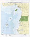
Mapa general de la República de Guinea Ecuatorial, 1983.jpg 9,911 × 11,888; 6.97 MB
-
Territorios españoles del Golfo de Guinea, 1952.jpg 800 × 554; 143 KB
-
Zona del Protectorado español en Marruecos, 1952.jpg 3,171 × 2,706; 2.38 MB


