Category:Maps by Heinrich Kiepert
Jump to navigation
Jump to search
Subcategories
This category has the following 6 subcategories, out of 6 total.
Media in category "Maps by Heinrich Kiepert"
The following 78 files are in this category, out of 78 total.
-
 1848 map of Central Asia by Heinrich Kiepert.jpg 11,845 × 14,157; 23.39 MB
-
 1853 map by Heinrich Kiepert - Karte des Türkischen Reichs in Asien.djvu 10,498 × 7,081; 6.98 MB
-
 1853 map of the Sea of Marmara.jpg 1,937 × 1,321; 883 KB
-
 1856 Kiepert Map of Lebanon - Geographicus - Lebanon-kiepert-1856.jpg 3,000 × 3,675; 2.45 MB
-
 1856 Kiepert Map of the Sinai Peninsula, Egypt - Geographicus - Sinai-kiepert-1856.jpg 3,500 × 4,449; 4.12 MB
-
 1858 map by H. Kiepert - Karte von Armenien, Kurdistan und Azerbeidschan.jpg 13,278 × 8,941; 32.97 MB
-
 1858 map by H. Kiepert - Karte von Armenien, Kurdistan und Azerbeidschan.png 13,278 × 8,941; 297.42 MB
-
 1861 map of Azerbaijan.jpg 7,696 × 7,130; 10.34 MB
-
 1862 map of Azerbaijan.jpg 6,822 × 6,244; 5.5 MB
-

-
 1884 map of the Asiatic Provinces of the Ottoman Empire by Heinrich Kiepert.jpg 38,355 × 23,403; 219.35 MB
-
 1895 map - Asiatische Türkei von Heinrich Kiepert.jpg 15,290 × 12,516; 63.56 MB
-
 1895 map of the Sea of Marmara.jpg 2,864 × 1,681; 2.01 MB
-

-
 Africa 1870.jpg 7,371 × 5,998; 10.63 MB
-
 Asien 1874.jpg 7,621 × 6,190; 13.7 MB
-
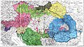 Austro-Ungaria si Romania (harta etnica).jpg 6,245 × 3,505; 6.73 MB
-

-
 Dalmatia&Moesia Superior.JPG 5,061 × 6,589; 28.23 MB
-
 Danube mouths 1867.JPG 4,064 × 3,088; 3.7 MB
-

-
 Das Fürstentum Montenegro im Jahre 1862.jpg 3,340 × 3,685; 9.34 MB
-
 Die Asiatische Türkei, die Kaukasusländer und West-Persien von H. Kiepert.jpg 8,277 × 6,713; 20.61 MB
-

-
 Dorf Fakhrali auf der Karte des Kaukasus (1852-53).jpg 1,257 × 1,021; 322 KB
-
 Drachenschlucht.png 805 × 1,203; 2.49 MB
-
 Ethnic map of Balkans - german 1876.jpg 2,028 × 2,004; 1.43 MB
-
 Ethnic map of Balkans Kiepert.1878.png 769 × 1,000; 1.16 MB
-
 Ethnological map by Kiepert 1876.jpg 1,122 × 881; 582 KB
-
 Europa 1519.JPG 3,042 × 2,424; 1.93 MB
-
 General Map of the Turkish War Theater.png 1,418 × 1,024; 2.75 MB
-
-
 Heinrich Kiepert 1841 map of Palestine (combined).jpg 5,627 × 12,456; 21.72 MB
-

-
-
 Jerusalem 1845.jpg 1,251 × 1,674; 500 KB
-
 Karte von Armenien, Kurdistan und Azerbeidschan (1852-53).jpeg 1,024 × 1,254; 389 KB
-
 Kiepert Asia Citerior 1892.jpg 11,358 × 8,939; 24.5 MB
-
 Kiepert Jerusalem 1880.jpg 2,427 × 1,895; 993 KB
-
 Kiepert Jerusalem surrounds 1880.jpg 2,480 × 1,989; 1.02 MB
-
 Kiepert map of Jerusalem Hebron Jericho Dead Sea 1876.jpg 2,636 × 1,937; 882 KB
-
 Kiepert Palestine North 1841.jpg 6,024 × 6,887; 7.57 MB
-
 Kiepert Palestine South 1841.jpg 6,105 × 6,913; 6.51 MB
-
 Kiepert Sinai map 1840.jpg 10,365 × 13,477; 34.42 MB
-
 Kiepert Sinai St Katherine map 1840 alternate.jpg 3,292 × 4,613; 5.33 MB
-
 Kiepert Sinai St Katherine map 1840.jpg 1,722 × 2,596; 1.22 MB
-
 Kiepert, Heinrich 1856 map of Hinter Indien (cropped).png 1,114 × 1,107; 2.51 MB
-
 KiepertSouthernPalestine1856.jpg 4,522 × 6,119; 12.29 MB
-
 Location of Cana according to Edward Robinson.png 453 × 357; 333 KB
-
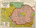
 Map of Great Armenia, 1869.jpg 910 × 603; 156 KB
-

-
-
 Map of the Asian provinces of the Ottoman Empire by Heinrich Kiepert.tif 17,757 × 11,641; 591.45 MB
-
 Map Wilhelmsthal.png 1,260 × 1,549; 5.03 MB
-
 Mauretania et Numidia.jpg 3,509 × 1,383; 494 KB
-
 New General Map of the Asian-Eastern Provinces of the Ottoman Empire - Without Arabia.png 1,690 × 1,024; 3.15 MB
-
 Nouvelle carte generale des provinces asiatiques de L'empire Ottoman (Kiepert, 1883).jpg 20,834 × 12,620; 79.34 MB
-

-
 Parts of Ottoman Empire Eastern Palestine Jordan Southern Syria.png 6,404 × 5,721; 50.86 MB
-
 Parts of Ottoman Empire Eastern Turkey.png 6,548 × 5,759; 72.61 MB
-
 Parts of Ottoman Empire Egypt Western Palestine.png 6,166 × 5,762; 46.49 MB
-
 Parts of Ottoman Empire Iraq Iran.png 6,226 × 5,740; 55.78 MB
-
 Parts of Ottoman Empire Northern Iran.png 6,263 × 5,736; 64.55 MB
-
 Parts of Ottoman Empire Western Turkey.png 6,264 × 5,770; 66.24 MB
-
 Pianta di Gerusalemme antica e moderna.jpg 2,100 × 2,942; 2.81 MB
-
 Plan von Jerusalem nach den Untersuchungen. 1845.jpg 10,212 × 13,600; 23.35 MB
-

-
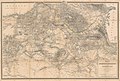
 Sanjak of Najd (Liva de Nedjed), Kiepert.jpg 1,209 × 779; 381 KB
-

-
-
 Sharm el Sheikh and the Strait of Tiran in the Kiepert Sinai map 1840 (cropped).jpg 2,639 × 1,787; 1.33 MB
-
 Southeastern Austria-Hungary (Kiepert).JPG 783 × 268; 104 KB
-
 Southern Austria-Hungary (Kiepert).JPG 1,322 × 504; 765 KB
-
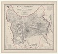
 The Asian Turkey map (Asiatische Türkei) 1872.jpg 1,000 × 781; 314 KB
-
 The Jewish tabernacle and priesthood (1874) (14781645942).jpg 1,962 × 3,014; 1.1 MB
-

-

-
 Weimarer Hand-Atlas - Arabien, 1848 (DRMC 2077045).jpg 8,685 × 11,660; 17.46 MB


.jpg)


.jpg)


_und_das_Kaiserthum_Japan.jpg)


.jpg)


.jpg)
.jpg)
_(cropped).jpg)

.jpeg)


.png)


.jpg)


,_Kiepert.jpg)
.jpg)
_1872.jpg)
_(14781645942).jpg)


.jpg)
.JPG)
.JPG)