Category:Maps by Georges Louis Le Rouge
Jump to navigation
Jump to search
Subcategories
This category has the following 5 subcategories, out of 5 total.
Media in category "Maps by Georges Louis Le Rouge"
The following 51 files are in this category, out of 51 total.
-
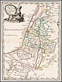 1746 map of Palestine by Georges Louis Le Rouge.jpg 5,251 × 6,893; 6.66 MB
-
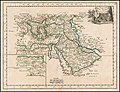 1748 map of the Turkish Empire by Georges Louis Le Rouge.jpg 6,887 × 5,267; 6.81 MB
-
 Mitchell-LeRouge Amerique Meridionale 1755 (1756) UTA.JPG 885 × 605; 119 KB
-

-
-
 1785 Zelande LeRouge 9x GAV copy.jpg 8,818 × 7,707; 21.8 MB
-
-
 Antigue une des Antilles aux Anglois. LOC 74691672.jpg 4,260 × 2,760; 1.43 MB
-
 Antigue une des Antilles aux Anglois. LOC 74691672.tif 4,260 × 2,760; 33.64 MB
-
 Battle of Zahájí (maps by Georges-Louis Le Rouge, c. 1743).png 928 × 632; 838 KB
-
 Ca. 1740 map of Vienna by Georges Louis Le Rouge.jpg 14,930 × 10,691; 32.78 MB
-
 Carolina septentrionale et meridionale en 4 feuilles, traduite de l'Anglois. LOC 73691624.tif 18,322 × 12,560; 658.39 MB
-

-
 Carte de la Moldavie dressée sur celle du Prince Cantinur... - btv1b532140208 (1 of 2).jpg 7,251 × 9,029; 13.67 MB
-
-
 Carte du Duché de Clèves et de Gueldre. Miles d'Allemagne 2 - btv1b8490206q.jpg 10,218 × 8,046; 12.81 MB
-
 Georges-Louis Le Rouge, Environs de Paris, 1730s - Gallica.jpg 8,220 × 6,556; 11.69 MB
-

-
 Havane. LOC 74690541.jpg 2,543 × 3,720; 958 KB
-
 Havane. LOC 74690541.tif 2,543 × 3,720; 27.07 MB
-
 Isle de St. Domingue. LOC 74691674.tif 5,088 × 3,828; 55.72 MB
-
 Karte - Grafschaft Pappenheim - Le Rouge - 1759.jpg 1,170 × 870; 265 KB
-

-
 L'Empire Des Turcs.jpg 6,831 × 5,287; 7.88 MB
-
 La Barbade une des Antilles aux Anglois, divisée par paroisses. LOC 74691675.jpg 3,670 × 3,476; 1.56 MB
-
 La Barbade une des Antilles aux Anglois, divisée par paroisses. LOC 74691675.tif 3,670 × 3,476; 36.5 MB
-

-

-

-

-

-

-
 LASB K Hellwig 0205.jpg 6,312 × 7,389; 7.25 MB
-
 LASB K Hellwig 0721.jpg 3,624 × 2,616; 3.02 MB
-
 LASB K Hellwig 0877.jpg 4,176 × 2,904; 2.87 MB
-
 Le Duche de Carniole 1742 II.jpg 14,544 × 11,973; 22.95 MB
-
 Le Duche de Carniole 1742.jpg 9,551 × 6,636; 10.54 MB
-
 Le Duché de Stirie 1742.jpg 8,094 × 6,549; 12.26 MB
-

-

-

-
 Plan de Besançon 1752.jpg 7,713 × 5,022; 6.93 MB
-
 Plan de la ville de Quebec - 1755.jpg 6,089 × 4,280; 10.5 MB
-
 Plan du Chateau et Jardins de Vaureal.jpg 1,524 × 1,054; 449 KB
-

-
 Prague in 1742 before the Austrian attack (G.-L. Le Rouge).jpg 3,905 × 3,414; 4.16 MB
-
 Quebec1775FrenchMap.jpg 3,616 × 2,724; 2.96 MB
-
 Territorialkarte von Schlesien - Le Rouge 1745 (cropped).png 5,239 × 4,069; 36.48 MB
-
 Territorialkarte von Schlesien - Le Rouge 1745.png 8,067 × 11,864; 117.46 MB
-
 Théatre de la Guerre en Finlande - 1742.jpg 3,271 × 2,874; 1.8 MB
-


_UTA.JPG)

_-_Geographicus_-_IndiaEast-lerouge-1759.jpg)

.jpg)

.png)

.jpg)
.jpg)
.jpg)


.jpg)


,_RP-P-2018-944.jpg)
.jpg)

.png)


.jpg)