Category:Maps by Edward Stanford
Jump to navigation
Jump to search
English: This category includes both maps personally created by Edward Stanford, as well as those that were published through his company Edward Stanford Ltd.
Subcategories
This category has the following 15 subcategories, out of 15 total.
Media in category "Maps by Edward Stanford"
The following 199 files are in this category, out of 199 total.
-
1859 map of Italy - Edward Stanford.jpg 2,100 × 2,470; 1.47 MB
-
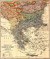
1877 - Ethnological map of European Turkey and Greece.tif 4,210 × 5,059; 50.34 MB
-
1877 - Stanford’s popular map of the seat of the Russo-Turkish War of 1877–78.jpg 8,534 × 6,016; 10.13 MB
-
DAVIS(1879) p030 MAP OF ASIA MINOR, SHEWING THE DISTRICT VISITED BY DAVIS.jpg 2,395 × 1,597; 2.3 MB
-
1880 Stanford's Map of Afghanisgan (crop).jpg 1,366 × 1,031; 464 KB
-
1880 Stanford's Map of Afghanisgan during the Second Anglo-Afghan War.jpg 6,000 × 4,728; 8.17 MB
-
1888-Edward-Stanford-borders-of-the-Chinese-empire-near-Bhutan.jpg 1,250 × 678; 394 KB
-
1896 map of the Sea of Marmara.png 2,617 × 2,100; 11.17 MB
-
1899 Julius Bien View of the Proposed Nicaragua Canal Route.jpg 6,000 × 3,931; 4.98 MB
-
1901 map of The Bosphorus and Constantinople (cropped).jpg 4,265 × 6,691; 6.88 MB
-
1901 map of The Dardanelles and the Troad (cropped).jpg 4,277 × 6,680; 4.51 MB
-
1901 maps of The Dardanelles and the Troad and The Bosphorus and Constantinople.jpg 8,657 × 6,820; 11.09 MB
-
1920 Maldives map BPL 12595 detail.png 1,069 × 748; 1.53 MB
-
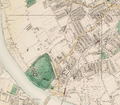
2 Marsham Street, London - Stanford Map of London, 1862.jpg 274 × 282; 30 KB
-
A map of British North Borneo (III).jpg 1,643 × 1,168; 385 KB
-
A map of British North Borneo LOC 2007627502.jpg 13,139 × 9,344; 14.51 MB
-
A map of British North Borneo LOC 2007630402.tif 13,687 × 9,140; 357.91 MB
-
A map of British North Borneo.jpg 9,901 × 6,637; 65.51 MB
-
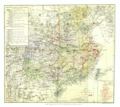
A Map of China (China's Spiritual Need and Claims, 1887).png 6,324 × 5,633; 52.7 MB
-
A Map of China (China's Spiritual Need and Claims, 1887).xcf 6,217 × 5,569; 92.34 MB
-
A map of China ; A map of foreign settlements at Shanghai, 1897 LOC 2006458803.jpg 13,193 × 9,279; 18.74 MB
-
A map of China ; A map of foreign settlements at Shanghai, 1897 LOC 2006458803.tif 13,193 × 9,279; 350.24 MB
-
A map of China LOC 2007633876.jpg 15,487 × 12,241; 22.65 MB
-
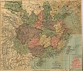
A map of China prepared for the China Inland Mission 1894.jpg 7,842 × 6,747; 22.58 MB
-
A map of part of Tibet 1904 50601846.jpg 12,051 × 8,091; 15.4 MB
-
Africa (1878) (14773212391).jpg 3,408 × 1,824; 989 KB
-
Africa (Edward Stanford, 1887).png 11,795 × 15,670; 214.93 MB
-
Area of Kashmir.png 1,366 × 667; 2.07 MB
-
Asiatic Archipelago.png 10,858 × 8,476; 86.85 MB
-
Bahamas 1901 Edward Stanford Atlas map.jpg 9,666 × 7,892; 8.1 MB
-
Balkan states 1899.jpg 937 × 1,417; 305 KB
-
Battersea station on Stanford's Map of London.jpg 1,319 × 1,040; 1.06 MB
-
Borneo WDL477.png 1,024 × 1,506; 2.22 MB
-
British and Dutch Borneo, 1898.png 495 × 639; 720 KB
-
Bukhara, Afghanistan, Baluchistan, Etcetera WDL12988.png 1,024 × 1,247; 2.5 MB
-
Central Africa (Edward Stanford, 1887).png 15,752 × 11,763; 234.82 MB
-
Chaman-Kandahar.jpg 960 × 763; 242 KB
-
Clapham Common and New Wandsworth Stations, Stanfords Map of London.jpg 783 × 750; 544 KB
-
Depressione del Kuma-Manyč - localizzazione.jpg 2,858 × 1,747; 2.41 MB
-
Edward Stanford 1877 - mistakes.JPG 1,350 × 1,589; 1.05 MB
-
Edward Stanford 1877.jpg 1,350 × 1,287; 1.17 MB
-
Edward Stanford 1904 (detail).jpg 2,827 × 1,534; 322 KB
-
Edward Stanford 1904.jpg 2,830 × 1,536; 818 KB
-
Edward Stanford, L'EUROPE EN 1860, 245551 original.jpg 2,761 × 1,978; 5.92 MB
-
European territorial claims on the coasts of the Red Sea 1885.tif 8,016 × 3,633; 27.9 MB
-
Fair oak park map.png 782 × 465; 767 KB
-
Falkland Islands map 1901 by Fitzroy et al.jpg 12,497 × 8,496; 11.33 MB
-
France. 1-1.900.800 30 english miles to 1 inch - btv1b53061918t.jpg 6,995 × 9,149; 12.68 MB
-
France. 1-3.801.600 60 english miles to 1 inch - btv1b8445014r.jpg 5,148 × 6,096; 5.44 MB
-
Fulham 1891.png 2,329 × 2,029; 8.63 MB
-
GeolMapGBritain.jpg 760 × 1,262; 294 KB
-
Geological map of Great Britain.jpg 1,036 × 1,614; 368 KB
-
Hellenism in the Near East 1918.jpg 1,403 × 1,721; 862 KB
-
Herald Office, London - Stanford Map of London, 1862.jpg 180 × 221; 52 KB
-
HMF Frankfort Stahlstich 1840 DSC 6252.jpg 3,308 × 2,716; 5.89 MB
-
Humaitá at bay.png 1,206 × 912; 1.29 MB
-
India 1920.jpg 2,000 × 1,499; 3.25 MB
-
Kalyan 1861.jpg 1,756 × 1,700; 673 KB
-
Kelat-Gazni.jpg 972 × 852; 333 KB
-
Kuram Valley (1880).jpg 1,123 × 840; 1,010 KB
-
La Prusse s'arrêtant ou La ligne exacte de Démarcation de l'Armistice - btv1b53230712n.jpg 5,594 × 4,892; 3.47 MB
-
Legal Quays map 1862.jpg 598 × 443; 103 KB
-
London, Stanford's two-inch map 1906 Wellcome V0013882.jpg 3,344 × 2,236; 4.05 MB
-
London; Stanford's two-inch map. Coloured lithograph, n.d. ( Wellcome V0013883.jpg 2,995 × 3,004; 5.12 MB
-
London; Stanford's two-inch map. Coloured lithograph, n.d. ( Wellcome V0013884.jpg 2,994 × 2,891; 5.4 MB
-
London; Stanford's two-inch map. Coloured lithograph, n.d. ( Wellcome V0013885.jpg 3,083 × 2,511; 4.81 MB
-
London; Stanford's two-inch map. Coloured lithograph, n.d. ( Wellcome V0013886.jpg 3,004 × 3,008; 5.68 MB
-
Malaysia and the Pacific archipelagoes BHL20474610.jpg 1,199 × 1,567; 260 KB
-
Map by Edward Stanford.jpg 3,999 × 2,664; 3.17 MB
-
Map of China - prepared for the China Inland Mission LOC 2006458459.jpg 13,169 × 11,443; 24.67 MB
-
Map of China - prepared for the China Inland Mission LOC 2006458459.tif 13,169 × 11,443; 431.14 MB
-
Map of China prepared for the China Inland Mission LOC 2006459040.jpg 13,434 × 11,321; 27.06 MB
-
Map of China prepared for the China Inland Mission LOC 2006459040.tif 13,434 × 11,321; 435.12 MB
-
Map of London tube stations - 1935 - Edward Stanford Ltd.jpg 1,920 × 1,518; 389 KB
-
Map of northern Arabia - in illustration of Lady Anne Blunt's journeys LOC 2013593020.jpg 5,231 × 4,425; 2.25 MB
-
Map of northern Arabia - in illustration of Lady Anne Blunt's journeys LOC 2013593020.tif 5,231 × 4,425; 66.22 MB
-
Map of Szechwan for the China Inland Mission.jpg 10,065 × 7,041; 25.67 MB
-
Map of Szechwan showing stations of CIM, CMS and BCMS.png 1,638 × 1,426; 4.73 MB
-
Map of the Empire of China - shewing the chief navigable waterways LOC 2007633436.jpg 10,152 × 9,504; 9.18 MB
-
Map of the Empire of China - shewing the chief navigable waterways LOC 2007633436.tif 10,152 × 9,504; 276.04 MB
-
Map of the Retreat of the Anthenians.png 1,038 × 1,503; 823 KB
-
Map- Stroud Green, London (Finsbury Park station 1862).jpg 950 × 753; 150 KB
-
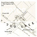
Map- Stroud Green, London (Stapleton Hall 1862).jpg 984 × 998; 135 KB
-
Map- Stroud Green, London (Tollington Park 1862).jpg 1,460 × 1,026; 203 KB
-
Nassau old town inset cropped from Bahamas 1901 Edward Stanford Atlas map.jpg 2,951 × 1,791; 809 KB
-
New Providence Island inset - cropped from Bahamas 1901 Edward Stanford Atlas map.jpg 4,436 × 2,370; 1.4 MB
-
Stanford's library map of North America (NYPL b20760570-5437648).jpg 7,672 × 9,859; 46.76 MB
-
Stanford's library map of North America (NYPL b20760570-5437648).tiff 7,760 × 10,328, 2 pages; 229.61 MB
-
Stanford's library map of North America (NYPL b20760570-5437649).jpg 7,760 × 9,641; 59.35 MB
-
Stanford's library map of North America (NYPL b20760570-5437650).jpg 7,735 × 9,549; 58.15 MB
-
Stanford's library map of North America (NYPL b20760570-5437651).jpg 7,760 × 9,731; 64 MB
-
Stanford's library map of North America (NYPL b20760570-5437651).tiff 7,760 × 10,328, 2 pages; 229.61 MB
-
Ottoman Middle East in 1900, Edward Stanford.jpg 8,412 × 6,586; 34.04 MB
-
Part of Spottsylvania (sic) County. LOC 2012589233.tif 6,432 × 5,162; 94.99 MB
-
Peach Horne Orkney Geological Map 1883 orkneysshetlandt00tudo 0234.jpg 1,468 × 2,067; 363 KB
-
Peach Horne Shetland Geological Map 1883.jpg 1,395 × 2,447; 421 KB
-
Persia and its Communications with The Black Sea The Mediterranean and The Red Sea.jpg 10,025 × 8,073; 14.06 MB
-
Persia with part of the Ottoman Empire, 1872.jpg 10,864 × 8,494; 16.44 MB
-
Plan of Shanghai LOC 2011593551.jpg 13,421 × 7,767; 17.97 MB
-
Plan of Shanghai LOC 2011593551.tif 13,421 × 7,767; 298.24 MB
-
Portsmouth, Portsea, Landport and Southsea - btv1b8445012x.jpg 7,320 × 8,964; 8.27 MB
-
Russia in Europe, Edward Stanford, 1864.jpg 1,088 × 1,558; 496 KB
-
Sannikov Land Stanford map.jpg 391 × 428; 42 KB
-
Shetland map from Orkneysshetlandt00tudo 0474.jpg 702 × 1,256; 150 KB
-
Siege of Massilia 49 BC.jpg 1,754 × 1,104; 133 KB
-
Southeastern Austria-Hungary (Stanford).JPG 254 × 84; 32 KB
-
Southern Austria-Hungary (Stanford).JPG 440 × 150; 89 KB
-
Spa Road station map 1872.png 380 × 492; 169 KB
-
Stanford 1891 Chelsea bridges.jpg 700 × 474; 145 KB
-
Stanford 1891 Chelsea bridges.png 700 × 474; 698 KB
-
Stanford Map, 1901, Outer London Map.jpg 10,035 × 7,531; 84.03 MB
-
Stanford's library map of the world on Mercator's projection (14719827052).jpg 2,000 × 1,131; 2.03 MB
-
Stanford's Map of the British Metropolis and Suburbs - btv1b530996799.jpg 9,510 × 8,424; 20.9 MB
-
Stanford's map of the english lake district. 1 inch to 1 statute mile - btv1b53062113w.jpg 8,329 × 9,809; 16.54 MB
-
Stanford's Map of Western Asia (cropped-Hasa).png 948 × 1,278; 2.35 MB
-
Stanford's map of western Asia LOC 2013593030.jpg 7,677 × 6,053; 7.86 MB
-
Stanford's map of western Asia LOC 2013593030.tif 7,677 × 6,053; 132.95 MB
-
Stanford's Map of Western Asia.png 7,677 × 6,053; 84.03 MB
-
Stanford's railway & county Map of the United States and Territories - btv1b53233197z.jpg 17,322 × 11,460; 34.33 MB
-
Stanfords Map of Western Asia.jpg 7,677 × 6,053; 16.02 MB
-
Stanford’s General Map of the World, 1922.jpg 12,057 × 7,708; 16.32 MB
-
Stanford’s Geographical Establishment, What Germany Wants 1917 Cornell CUL PJM 1199 01.jpg 6,840 × 4,632; 4.29 MB
-
The Antarctic Regions. LOC 2002624039.jpg 8,333 × 6,542; 5.91 MB
-
The Antarctic Regions. LOC 2002624039.tif 8,333 × 6,542; 155.97 MB
-
The battle fronts of Europe LOC 2016432164.jpg 4,468 × 2,961; 1.77 MB
-
The battle fronts of Europe LOC 2016432164.tif 4,468 × 2,961; 37.85 MB
-
The Danubian Principalities, Prepared From The Vienna Map in 21 Sheets.jpg 32,510 × 33,257; 302.33 MB
-
The Dardanelles and The Troad ; The Bosphorus and Constantinople LOC 2012593212.jpg 8,711 × 6,442; 10.33 MB
-
The Eastern question in Europe and Asia LOC 2013593034.tif 8,551 × 6,336; 155.01 MB
-
The Euphrates Valley - Syria, Kurdistan, et cetera by Edward Stanford Ltd. - WDL.png 1,638 × 1,024; 3.03 MB
-
The Euphrates Valley - Syria, Kurdistan, etc. LOC 2013593032.jpg 8,752 × 5,468; 7.43 MB
-
The Euphrates Valley - Syria, Kurdistan, etc. LOC 2013593032.tif 8,752 × 5,468; 136.92 MB
-
The North sea. Close's fishermen's charts of the British isles... - btv1b53169956m.jpg 12,752 × 18,039; 34.06 MB
-
The Russo-Afghan Frontier. 1 - 6 589 440 . Garrison Towns. Fortified posts - btv1b8443791b.jpg 10,932 × 7,356; 12.28 MB
-
The Suleiman mountains of Afghan Frontier of British India (1879), by Major Wilson.jpg 2,000 × 2,518; 880 KB
-
Tourist's map of North Wales - btv1b53062126n.jpg 10,662 × 8,284; 14.4 MB
-
Tourist's map of South Wales - btv1b530619448.jpg 10,419 × 8,296; 14.32 MB
-
Turkishstraits.jpg 6,237 × 4,188; 4.22 MB
-
Walls of Rome 6th century (cropped).png 1,157 × 819; 215 KB
-
Walls of Rome 6th century.png 1,200 × 853; 174 KB
-
West China (Szechwan) Diocese map.png 7,952 × 5,304; 34.76 MB
-
Westminster Hospital location - Stanford map of London 1862.jpg 529 × 450; 86 KB
-
Westminster map 1862.jpg 1,440 × 1,408; 707 KB
-
Wimbledon map.jpg 2,218 × 2,585; 4.6 MB
-
World War I battle fronts of Europe overlaid over a map of the United States.jpg 2,234 × 1,481; 571 KB
-
Zoom Ahanta Gold Coast 1873.png 1,120 × 815; 1.65 MB
-
Карта Османской империи, 1872 г.jpg 1,000 × 779; 267 KB
-
План Николаева 1855.jpg 3,165 × 3,020; 1.44 MB
-
Политическая карта Азии начало XX века.jpg 3,194 × 2,128; 1.54 MB


