Category:Maps by Bernard Ratzer
Jump to navigation
Jump to search
Subcategories
This category has only the following subcategory.
Media in category "Maps by Bernard Ratzer"
The following 32 files are in this category, out of 32 total.
-
1776NY300dpi.jpg 3,897 × 5,343; 13.66 MB
-
AMH-8622-NA Map of the area around New York.jpg 1,636 × 2,400; 504 KB
-
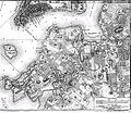
BrooklynMap1766 Wallabout Bay.jpg 1,822 × 1,570; 1.56 MB
-
BrooklynMap1766.jpg 1,882 × 1,629; 3.11 MB
-
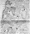
Greenwich Village map circa 1760 - Project Gutenberg eText 16907.jpg 1,000 × 1,151; 290 KB
-
Map showing the west shore of the North or Hudson River, LOC 75693271.jpg 4,812 × 5,983; 3.55 MB
-
Map showing the west shore of the North or Hudson River, LOC 75693271.tif 4,812 × 5,983; 82.37 MB
-
NYCGreatFire1776.jpg 3,512 × 2,325; 12.33 MB
-
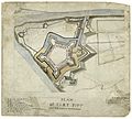
Plan of Fort Pitt, 1761.jpg 4,512 × 4,068; 1.25 MB
-
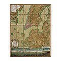
Plan of the City of New York by Bernard Ratzer, 1767.jpg 8,192 × 8,192; 11.81 MB
-
Plan of the city of New York by Ratzer, 1776.jpg 2,202 × 1,446; 1.08 MB
-
Plan of the city of New York in North America by Ratzer, 1776.jpeg 563 × 760; 104 KB
-
Ratzer lower Manhattan 1.jpg 5,892 × 3,932; 9.98 MB
-
Ratzer lower Manhattan 2.jpg 5,435 × 3,684; 9.02 MB
-
Ratzer Map 1767.jpg 706 × 477; 390 KB
-
Ratzer map of New York City.jpg 12,352 × 16,598; 63.02 MB
-
Stuyvesant Farm from The Plan of the City of New York in North America by Ratzer 1770.jpg 1,956 × 2,360; 2.63 MB


