Category:Maps by Adam Carr
Jump to navigation
Jump to search
Media in category "Maps by Adam Carr"
The following 127 files are in this category, out of 127 total.
-
1901 Australian federal election.svg 512 × 331; 13.58 MB
-
2004ElectionsIndonesia.png 1,500 × 590; 142 KB
-
2005 Votes.png 937 × 810; 63 KB
-
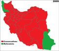
2009 Iranian Votes.png 401 × 346; 65 KB
-
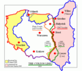
Ac polandmap.gif 617 × 513; 15 KB
-
Ac.prussiamap3.png 716 × 425; 49 KB
-
Acprussiamap2.gif 510 × 357; 27 KB
-
Acrussiamap.png 696 × 487; 23 KB
-
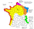
Axis Occupation of France.png 2,000 × 1,898; 223 KB
-
Bangkokplaces.png 914 × 637; 39 KB
-
Carte du Murray et de ses affluents2.jpg 581 × 452; 106 KB
-
Congressional Districts map (South Florida - 2004).gif 884 × 592; 22 KB
-
Connecticut1796.png 755 × 603; 5 KB
-
CuartaParticiónDePolonia1939.svg 622 × 510; 45 KB
-
Delaware1796.png 481 × 603; 4 KB
-
DeutscheLandverluste.svg 730 × 550; 61 KB
-
Electoral divisions of Australia, 2004 (New South Wales).gif 1,022 × 597; 24 KB
-
Electoral divisions, Brisbane, Australia.gif 955 × 608; 21 KB
-
Electoral divisions, Melbourne Australia.gif 1,064 × 597; 18 KB
-
Electoral divisions, New South Wales.gif 1,022 × 597; 24 KB
-
Electoral divisions, South Australia (as of 2004).gif 940 × 638; 16 KB
-
Electoral divisions, Tasmania and Territories of Australia.gif 940 × 608; 17 KB
-
France 40-44.GIF 794 × 671; 50 KB
-
France 40-44.png 3,176 × 2,869; 461 KB
-
France ww2 el.gif 748 × 605; 23 KB
-
Frontera Tailandia-Malasia.png 468 × 319; 8 KB
-
FronterasDePolonia19201947.svg 622 × 510; 203 KB
-
Georgia1796.GIF 570 × 603; 9 KB
-
Germanborders (ru).svg 730 × 550; 218 KB
-
Germanborders-zh-classical.png 679 × 478; 13 KB
-
Germanborders.gif 683 × 498; 15 KB
-
Germanborders.png 683 × 498; 18 KB
-
Germanborders.svg 730 × 550; 75 KB
-
Greek history from 1832.GIF 868 × 624; 29 KB
-
Greek history.png 868 × 624; 29 KB
-
Greekhistory el.gif 868 × 624; 118 KB
-
Greekhistory-zh-classical.png 868 × 624; 23 KB
-
Karte Polen (1945).png 533 × 513; 54 KB
-
Kentucky1796.GIF 882 × 603; 8 KB
-
Maine1796.GIF 539 × 603; 9 KB
-
Map Greece expansion 1832-1947-cs-2.svg 734 × 962; 111 KB
-
Map Greece expansion 1832-1947-hr.svg 730 × 959; 100 KB
-
Map of Poland (1945) corr.png 531 × 513; 80 KB
-
Map of Poland (1945) HE.png 617 × 513; 13 KB
-
Map of Poland (1945) rus.png 527 × 509; 9 KB
-
Map of Poland (1945)-pl-.png 617 × 513; 11 KB
-
Map of Poland (1945).png 594 × 513; 13 KB
-
Map of Unter den Linden, Berlin.gif 878 × 577; 28 KB
-
Map102007.gif 950 × 587; 13 KB
-
Map12007.gif 950 × 582; 21 KB
-
Map22007.gif 950 × 582; 24 KB
-
Map2a.gif 949 × 607; 20 KB
-
Map32007.gif 950 × 582; 19 KB
-
Map42007.gif 950 × 586; 16 KB
-
Map52007.gif 950 × 586; 22 KB
-
Map62007.gif 950 × 586; 21 KB
-
Map72007.gif 950 × 588; 20 KB
-
Map82007.gif 950 × 589; 17 KB
-
Map92007.gif 950 × 586; 10 KB
-
Maryland1796.GIF 859 × 603; 12 KB
-
Massachusetts1796.GIF 895 × 603; 13 KB
-
Murray darling murrumbidgee map.gif 581 × 452; 10 KB
-
Murray river (Australia) map-blank.svg 730 × 569; 31 KB
-
Murray river (Australia) map-Eng de.svg 730 × 569; 223 KB
-
Murray river (Australia) map-Eng.svg 730 × 569; 225 KB
-
Murray river (Australia) map-es.svg 730 × 569; 45 KB
-
Murray river (Australia) map-fr.svg 730 × 569; 45 KB
-
Murray river (Australia) map-mk.svg 730 × 569; 356 KB
-
Murrayriver.gif 583 × 454; 11 KB
-
National2007.GIF 941 × 1,083; 54 KB
-
Newhampshire1796.GIF 533 × 603; 7 KB
-
Newjersey1796.GIF 536 × 602; 8 KB
-
Newyork1796.GIF 846 × 603; 12 KB
-
Northcarolina1796.GIF 813 × 603; 10 KB
-
NSWmetro2010.gif 956 × 589; 23 KB
-
NSWmetro2013.gif 956 × 589; 23 KB
-
NSWstate2010.gif 956 × 588; 22 KB
-
NSWstate2013.gif 956 × 588; 21 KB
-
Oder-Neisse 1945.gif 586 × 552; 15 KB
-
Oder-Neisse 1945.svg 572 × 536; 528 KB
-
Oder-neisse-ar.gif 827 × 535; 50 KB
-
Oder-neisse-line border.gif 839 × 544; 28 KB
-
Oder-neisse.gif 827 × 535; 25 KB
-
Pennsylvania1796.GIF 861 × 603; 13 KB
-
Pennsylvania1797.GIF 861 × 603; 15 KB
-
Poland electoral disctricts 2005.GIF 948 × 605; 28 KB
-
Polszczyzna kresowa.png 650 × 548; 21 KB
-
Portphillip.gif 671 × 527; 20 KB
-
Prussiamap-es.svg 976 × 818; 879 KB
-
Prussiamap.gif 577 × 415; 18 KB
-
Qldmetro2010.gif 952 × 585; 21 KB
-
QLDmetro2013.gif 952 × 585; 21 KB
-
Qldstate2010.gif 950 × 585; 21 KB
-
QLDstate2013.gif 950 × 585; 21 KB
-
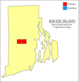
Rhodeisland1796.GIF 585 × 603; 9 KB
-
Riverina (Australia) map-blank.svg 730 × 569; 41 KB
-
Riverina (Australia) map-fr.svg 730 × 569; 53 KB
-
Romaniamap3.gif 636 × 454; 16 KB
-
Russia-Subdivisions with Crimea.png 733 × 487; 46 KB
-
Russia-Subdivisions.png 696 × 487; 22 KB
-
SAstate2010.gif 950 × 583; 17 KB
-
SAstate2013.gif 950 × 583; 17 KB
-
Siamese territorial concessions (1867-1909).gif 301 × 514; 36 KB
-
Southcarolina1796.GIF 692 × 603; 10 KB
-
Souththailand.GIF 196 × 262; 5 KB
-
Souththailandmap.GIF 468 × 319; 8 KB
-
Taiwanmap.gif 358 × 508; 10 KB
-
Tasstate2010.gif 950 × 583; 11 KB
-
TASstate2013.gif 950 × 583; 11 KB
-
Tennessee1796.GIF 929 × 603; 7 KB
-
Territorial Expansion of Greece from 1832–1947.gif 868 × 624; 49 KB
-
Territories2010.gif 950 × 584; 14 KB
-
Territories2013.gif 950 × 584; 14 KB
-
Vermont1796.GIF 529 × 603; 7 KB
-
VIC Kew District 1967-76.png 2,401 × 2,401; 237 KB
-
Vichy France ukr.gif 800 × 605; 30 KB
-
Vichyfrance-ar.gif 748 × 605; 31 KB
-
Vichyfrance.GIF 748 × 605; 22 KB
-
Vicmetro2010.gif 950 × 586; 16 KB
-
VICmetro2013.gif 949 × 582; 20 KB
-
Vicstate2010.gif 950 × 582; 19 KB
-
VICstate2013.gif 950 × 582; 19 KB
-
Victoria20061.gif 1,051 × 751; 25 KB
-
Victoria20062.gif 1,050 × 750; 27 KB
-
Victoria20063.gif 1,050 × 750; 29 KB
-
WAstate2013.gif 950 × 582; 20 KB


