Category:Maps about the history of Bordeaux
Jump to navigation
Jump to search
Media in category "Maps about the history of Bordeaux"
The following 6 files are in this category, out of 6 total.
-
Ark 27705 330636101 DELCARTON 1 37 v0001.jpg 3,092 × 2,380; 1.25 MB
-
Carte des puits à Bordeaux au Moyen Age.jpg 2,246 × 3,215; 1.07 MB
-
Palais Gallien Cadastre.jpg 581 × 559; 107 KB
-
Plan physique de Bordeaux à l'époque Gallo-Romaine.jpg 1,084 × 1,356; 437 KB
-
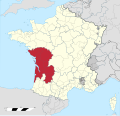
Province de Bordeaux 1789.svg 2,000 × 1,922; 787 KB


