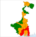
Category:Maps about the COVID-19 pandemic in West Bengal
Jump to navigation
Jump to search
Media in category "Maps about the COVID-19 pandemic in West Bengal"
The following 5 files are in this category, out of 5 total.
-
COVID19 WB Zones.png 1,328 × 2,004; 194 KB
-
India West Bengal COVID-19 deaths map.svg 768 × 1,159; 202 KB
-
India West Bengal COVID-19 map.svg 768 × 1,159; 204 KB
-
West Bengal Red zones in Corona.png 4,001 × 4,174; 430 KB
-
WestBengalDistricts numberedDeaths.png 1,200 × 1,811; 268 KB


