Category:Maps about the COVID-19 pandemic in Asia
Appearance
Subcategories
This category has the following 34 subcategories, out of 34 total.
A
C
G
I
K
M
P
S
T
U
V
Media in category "Maps about the COVID-19 pandemic in Asia"
The following 16 files are in this category, out of 16 total.
-
COVID-19 cases per 100,000 people as of December 10, 2020.svg 1,200 × 970; 2.57 MB
-
COVID-19 coronavirus pandemic in Asia.gif 878 × 584; 692 KB
-
COVID-19 Death Cases in Asia.svg 2,738 × 2,240; 5.61 MB
-
COVID-19 deaths per million residents as of December 10, 2020.svg 1,200 × 870; 2.05 MB
-
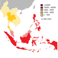
COVID-19 di Asia Tenggara.png 2,000 × 2,000; 300 KB
-
COVID-19 outbreak Asia per capita cases map.svg 1,440 × 1,050; 1.18 MB
-
COVID-19 outbreak Asia per capita deaths map.svg 1,440 × 1,050; 1.18 MB
-
COVID-19 Outbreak Cases in Asia.svg 975 × 800; 590 KB
-
COVID-19 Outbreak Cases in East Asia.svg 1,417 × 1,063; 1.67 MB
-
COVID-19 Outbreak Cases Map in Asia.svg 2,738 × 2,240; 5.63 MB
-
COVID-19 outbreak E Asia per capita cases map.svg 1,440 × 1,620; 494 KB
-
COVID-19 Outbreak Map in Asia.png 975 × 742; 176 KB
-
COVID-19 pandemic in Southeast Asia.jpg 1,996 × 1,652; 236 KB
-
COVID-19 pandemic Southeast Asia map.svg 1,000 × 888; 182 KB
-
The Pandemic COVID-19 cumulative cases in Southeast Asia.svg 492 × 378; 148 KB
-
רובעים ירושלים הגבלת פעילות.png 602 × 858; 628 KB


