Category:Map of Europe images that should use vector graphics
Jump to navigation
Jump to search
This is a subcategory of Category:Images that should use vector graphics. You can add images to this category using the template {{Convert to SVG|Map of Europe}}.
Subcategories
This category has the following 7 subcategories, out of 7 total.
- Topographic maps of Wales (33 F)
R
Media in category "Map of Europe images that should use vector graphics"
The following 186 files are in this category, out of 186 total.
-
1cpcp1 June 2019.png 2,700 × 2,700; 290 KB
-
2006Transnistria-map.png 324 × 376; 22 KB
-
2014-Justitie-1250.png 1,250 × 1,660; 283 KB
-
2022 04 16 - KARTE WG – um 580 n.Chr. - END.png 2,752 × 2,551; 3.66 MB
-
3 карта.png 670 × 532; 83 KB
-
4 карта.png 670 × 532; 84 KB
-
4KANARCHY20.png 3,840 × 2,160; 459 KB
-
4KANGELOS.png 3,840 × 2,160; 415 KB
-
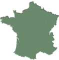
564X573-Carte France geo verte.png 564 × 573; 88 KB
-
A-Swedish-View-Continental-Europe.png 415 × 422; 14 KB
-
Absolute Strasbourg Europe 07.jpg 918 × 791; 97 KB
-
Acer campestre range.png 4,250 × 2,362; 300 KB
-
Allium pervestitum range.png 1,837 × 1,655; 129 KB
-
Anguis-distribution.png 743 × 553; 181 KB
-
Arion-vulgaris-map-eur-nm-moll.jpg 570 × 573; 248 KB
-
Atlantic-North Sea Continental Divide.png 2,118 × 1,516; 672 KB
-
AtlBalk550.jpg 318 × 327; 154 KB
-
Aurubis Standorte.png 612 × 720; 171 KB
-
Autoroutes Nord-Sud et viaduc de Millau.JPG 1,753 × 1,635; 1,011 KB
-
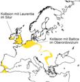
Avalonia heute basement europa.png 1,124 × 1,156; 94 KB
-
Beaker culture.png 450 × 450; 76 KB
-
BEL-GER-FRA-NED.png 467 × 466; 14 KB
-
Beneluxa-members-observers.png 1,141 × 780; 258 KB
-
Bloc de l'Est.png 909 × 856; 348 KB
-
Bricorstore location.png 1,600 × 1,200; 428 KB
-
Carolingian territorial divisions, 843.png 497 × 594; 84 KB
-
Carolingian territorial divisions, 870.png 497 × 594; 72 KB
-
Carta ocean e mars europa oc.pdf 1,752 × 1,239; 987 KB
-
Cernfounders.png 1,236 × 1,245; 27 KB
-
CharlesofAnjouempire.png 889 × 549; 35 KB
-
Cold war europe economic alliances map en.png 1,165 × 1,200; 379 KB
-
ConstantineEmpire.jpg 747 × 493; 59 KB
-
CyanistesCaeruleusDistribution.png 1,268 × 792; 122 KB
-
Deutschlandlied-Geographie.png 416 × 230; 12 KB
-
Deuxième croisade.JPG 1,024 × 768; 151 KB
-
Dialectes occitans provençaux en Europe.png 1,534 × 1,009; 248 KB
-
Distribution F.magna EuropeII.png 1,093 × 795; 350 KB
-
Distribution of Myotis alcathoe.png 1,556 × 1,111; 361 KB
-
East prussia weimar and 3rd reich.jpg 706 × 600; 56 KB
-
Empire carolingien 768-811.jpg 1,400 × 1,180; 713 KB
-
Endofprotectprebornlife.png 2,644 × 1,524; 231 KB
-
Equidistant cylindrical blank map of Europe.png 2,250 × 1,650; 48 KB
-
EU-Glob opta presentation.png 800 × 763; 685 KB
-
EU-nonexistenantwerp.pdf 4,025 × 3,364; 907 KB
-
Europa geografisch karte de 1.png 1,596 × 1,043; 227 KB
-
Europa Organisationen.png 1,596 × 1,043; 232 KB
-
Europa-mapa polityczna.png 4,476 × 3,947; 1.45 MB
-
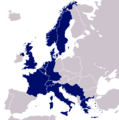
EuropaNATOWP1959.png 1,165 × 1,200; 353 KB
-
Europe (fond de carte).png 1,981 × 1,526; 34 KB
-
Europe 1748-1766 en.png 3,872 × 2,761; 1.26 MB
-
Europe Asia transcontinental.png 1,268 × 996; 47 KB
-
Europe Balkans Macedonia geo.jpg 726 × 609; 146 KB
-
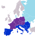
Europe before 1989, western, estern, neutral-countries.png 300 × 281; 61 KB
-
Europe c. 1700.png 1,550 × 1,118; 1.02 MB
-
Europe Completed Motorways.png 2,000 × 1,604; 507 KB
-
Europe Council Founders 2022.png 3,836 × 2,835; 1.47 MB
-
Europe countries map de.png 1,475 × 1,200; 609 KB
-
Europe countries map en 1993-2006.png 1,475 × 1,200; 661 KB
-
Europe countries map en.png 1,475 × 1,200; 612 KB
-
Europe GDP 2007.png 751 × 840; 400 KB
-
Europe germanic languages.PNG 552 × 544; 14 KB
-
Europe outline map.png 1,817 × 1,120; 299 KB
-
Europe primary cultures.png 1,077 × 768; 352 KB
-
Europe time zones map de.png 1,475 × 1,200; 986 KB
-
Europe time zones map en.png 1,475 × 1,200; 981 KB
-
Europe, 1700—1714.png 1,590 × 1,086; 1.07 MB
-
Europe, 1714.png 1,590 × 1,086; 986 KB
-
European Championships U23 in Athletics Hosts.png 1,200 × 1,000; 51 KB
-
European Neighbourhood Policy.png 334 × 266; 9 KB
-
European railtrafficregions.png 891 × 782; 28 KB
-
Europeans and Arabs in Brazil.jpg 496 × 357; 29 KB
-
EuropeanWildcat distribution.jpg 1,000 × 615; 607 KB
-
EuropeMap1328-ar.png 1,075 × 1,168; 917 KB
-
EuropeParis75000.PNG 916 × 682; 44 KB
-
Europäische-Wasserscheiden-NO.jpg 1,200 × 1,184; 743 KB
-
Eurovision uk withdraw.xcf 680 × 540; 203 KB
-
Eurovision winners map.png 1,200 × 1,000; 124 KB
-
EurovisionParticipants1992.png 958 × 682; 182 KB
-
EurovisionParticipants1994.png 958 × 678; 126 KB
-
Germany and Poland borders during the 20th century Wlegend.png 500 × 711; 66 KB
-
Hub&Spoke.jpg 450 × 480; 25 KB
-
Northern Ireland - Counties.png 1,677 × 1,426; 229 KB
-
TSP Deutschland 3.png 326 × 350; 15 KB
-
WestCorkMap22.jpg 719 × 379; 121 KB
-
"Political Europe" CIA World Factbook.jpg 454 × 600; 331 KB
-
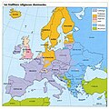
AtlEurRelig.jpg 1,498 × 1,500; 383 KB
-
BEST Map of Europe.pdf 1,239 × 1,754; 752 KB
-
BorrisleighCivilParish.jpg 458 × 532; 217 KB
-
BorrisleighCivilParishImproved.jpg 550 × 532; 219 KB
-
Campen campieren.jpg 1,063 × 668; 127 KB
-
Carta UE occitan.pdf 1,752 × 1,239; 1.22 MB
-
Carte Europe Fr Pl.JPG 287 × 158; 10 KB
-
CCR SE Euroa e Turchia - RCC SE Europe and Turkey.jpg 710 × 494; 97 KB
-
Central Europe End 5th Century Blank X.jpg 1,088 × 763; 482 KB
-
Circum-mediterannean sccs cultures.jpg 751 × 563; 231 KB
-
Das Radio Ton Sendegebiet.jpg 2,257 × 2,343; 1.61 MB
-
Democratic Ideals and Reality, 1919 Fig 28 p 154.jpg 1,380 × 1,070; 160 KB
-
Densité du bétail en Union Européenne.jpg 423 × 311; 26 KB
-
Die Unglaube in Schlesien urk. belegt zwischen 1338 und 1600.jpg 812 × 446; 135 KB
-
Egypt, Rome, Carthage and Numidia.jpg 2,360 × 1,924; 533 KB
-
Europa 1800 franceza.jpg 1,432 × 976; 290 KB
-
Europa 1939.jpg 809 × 475; 97 KB
-
Europa leer Meer flacher EZA-Länder 201311 mLegende endg de.jpg 807 × 540; 74 KB
-
Europakarte.jpg 842 × 595; 87 KB
-
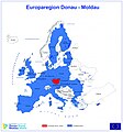
Europaregion Donau-Moldau in der Europakarte.jpg 714 × 768; 253 KB
-
Europe 1815 map de.png 2,284 × 1,503; 1.07 MB
-
Europe 1815 map en.png 2,284 × 1,503; 1.08 MB
-
Europe centrale, Peter Jordan.png 935 × 898; 80 KB
-
EUROPE REGIONS.jpg 807 × 561; 333 KB
-
EuropeRosype.jpg 541 × 542; 129 KB
-
EUSKAL-130-MODEL.JPG 3,290 × 2,393; 600 KB
-
Euskalkien mapa(1998).jpg 3,290 × 2,393; 259 KB
-
Example of the influence occurrence data can have on a predicted distribution map.tif 4,042 × 2,830; 3.72 MB
-
Eym 2014.jpg 680 × 539; 89 KB
-
EZA-Länder 201210.jpg 807 × 540; 158 KB
-
Facebookbenutzer.jpg 974 × 718; 148 KB
-
Germanic peoples 2.jpg 512 × 542; 195 KB
-
Gfx.jpg 331 × 196; 15 KB
-
Gunpowder Empire Map.JPG 1,761 × 1,262; 136 KB
-
Hermioni.jpg 1,296 × 874; 200 KB
-
HIGHCO MAP.jpg 723 × 829; 388 KB
-
Kaarten - Topografische kaarten - 30033514 - RCE.jpg 1,091 × 1,200; 123 KB
-
KARTE.jpg 2,400 × 1,611; 674 KB
-
Kazan2015 map.jpg 3,543 × 2,639; 1.99 MB
-
Lage der Stadt Dieburg im Landkreis.jpg 738 × 599; 141 KB
-
Lage der Stadt Griesheim im Landkreis.jpg 738 × 599; 140 KB
-
Lage der Stadt Groß-Bieberau im Landkreis.jpg 738 × 599; 141 KB
-
Lage der Stadt Groß-Umstadt im Landkreis.jpg 738 × 599; 143 KB
-
Lage der Stadt Pfungstadt m Landkreis.jpg 738 × 599; 141 KB
-
Lage der Stadt Reinheim im Landkreis.jpg 738 × 599; 141 KB
-
Lage der Stadt Weiterstadt im Landkreis.jpg 738 × 599; 141 KB
-
Lageplan PFLEGEN & WOHNEN HAMBURG GmbH.jpg 2,480 × 3,508; 1,004 KB
-
Lageplan v2.jpg 2,440 × 2,386; 904 KB
-
Leeds 2006.jpg 787 × 600; 116 KB
-
Leeds 2007.jpg 787 × 600; 115 KB
-
Leeds 2010.jpg 787 × 600; 116 KB
-
Leeds 2011.jpg 787 × 600; 116 KB
-
LeedsCC2008.jpg 787 × 600; 115 KB
-
LeedsCC2012.jpg 787 × 600; 115 KB
-
Legis07.jpg 754 × 962; 119 KB
-
LocationCasaleMonferrato.jpg 800 × 400; 82 KB
-
Map congress of vienna-isl.jpg 1,292 × 1,000; 962 KB
-
Map of beneficiary countries.jpg 1,000 × 666; 107 KB
-
Map of EQUASS certified organisations.jpg 428 × 336; 39 KB
-
Map of Europe, 459 CE.png 2,602 × 1,393; 540 KB
-
Map of the Corgistani states.jpg 1,096 × 599; 249 KB
-
Mapa-mudo-europa.jpg 629 × 600; 87 KB
-
Mappa regione emilia romagna.jpg 6,927 × 3,736; 6.38 MB
-
Mehrnaben.jpg 540 × 450; 31 KB
-
MIGRATIONS.jpg 1,703 × 1,134; 664 KB
-
MS Regionen Maerz 2012.jpg 2,931 × 2,009; 1.48 MB
-
Napoli IN Provincia di Napoli..jpg 759 × 594; 88 KB
-
Napoli IN Provincia di Napoli.jpg 759 × 594; 90 KB
-
National & Regional ebec 2013.pdf 1,239 × 1,754; 557 KB
-
Old European hydronymic map for the root *al-, *alm- Krahe.jpg 904 × 544; 80 KB
-
Oscarylucia.jpg 199 × 254; 7 KB
-
ParishesInCashelAndEmly.jpg 613 × 485; 172 KB
-
ParishesInCashelAndEmlyWithLegend.jpg 1,222 × 485; 532 KB
-
ParishesInCashelAndEmlyWithLegend2.jpg 1,042 × 485; 486 KB
-
Percentage of land area of different European countries covered by Forest.pdf 4,260 × 3,581; 777 KB
-
Political map of Europe.pdf 1,275 × 1,650; 6.39 MB
-
Portada centros.jpg 1,870 × 2,736; 569 KB
-
Powerhouses dt 72dpi.jpg 609 × 607; 201 KB
-
Presidents15-M-2012.jpg 842 × 567; 264 KB
-
Progetto Ægea - AEgea Project - FIAT EMEA CAR.jpg 1,534 × 1,132; 513 KB
-
Pruschany-pos.jpg 966 × 797; 31 KB
-
PSI v roce 2012.jpg 872 × 626; 59 KB
-
PSM V50 D611 Europe cephalic index map.jpg 2,099 × 2,702; 761 KB
-
PSM V50 D784 Hair color frequency in europe.jpg 2,012 × 2,380; 691 KB
-
R1b subclades.jpg 500 × 408; 96 KB
-
R1b1a2a1a1b4 en Europe.jpg 2,270 × 1,609; 2.09 MB
-
RumsiskesTicket.jpg 1,253 × 494; 74 KB
-
RW-Karte.pdf 1,710 × 2,360; 253 KB
-
Saaremaa-pos.jpg 1,176 × 731; 34 KB
-
Saaremaa.jpg 5,224 × 4,726; 924 KB
-
Saxokarte01.jpg 1,242 × 745; 154 KB
-
SECA NORD&OSTSEE.jpg 1,440 × 900; 318 KB
-
SEPUROPE2.jpg 700 × 575; 158 KB
-
SoutheROPE4.jpg 949 × 1,021; 136 KB
-
SouthEUROPE.jpg 700 × 575; 162 KB
-
Styrie-at-AT-&-SI.jpg 298 × 208; 39 KB
-
TARIVisited.JPG 900 × 627; 53 KB
-
WGSRPD Southeast Europe2.jpg 4,544 × 3,823; 678 KB
-
WGSRPD Southwestern Europe.jpg 3,408 × 2,867; 1.82 MB


