Category:MapOSMatic
Jump to navigation
Jump to search
Media in category "MapOSMatic"
The following 25 files are in this category, out of 25 total.
-
 023432 2011-02-19 13-42 MontluonAllierAuvergne03100France.png 768 × 858; 752 KB
-
 023440 2011-02-19 17-06 NogentsurOiseOisePicardie60180France.png 3,372 × 2,351; 2.3 MB
-
 023441 2011-02-19 17-21 PontSainteMaxenceOisePicardie60700France.png 768 × 915; 470 KB
-
 078763 2013-05-09 11-33 PlateaudHelfautRgionNordPasdeCalaisFranceMaposmatic.png 5,669 × 2,539; 3.3 MB
-
 2010-01-19 Map Perpignan City.png 3,250 × 2,867; 5.3 MB
-
 2015, December 28, The Hague map.jpg 7,961 × 6,574; 20.27 MB
-
 Carte de Replonges.png 4,027 × 3,131; 1.69 MB
-
 Carte Saint-Maurice-de-Beynost - Ain - France.png 2,244 × 4,190; 1.7 MB
-
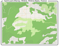 Carte-Saint-Just-d'Avray Rhône Rhône-Alpes France.png 2,098 × 1,643; 660 KB
-
 Ciudad de Neuquén.png 8,730 × 4,490; 10.2 MB
-
 Corviale.png 357 × 498; 89 KB
-
 Corviale.svg 446 × 624; 640 KB
-
 GPS-in-the-brain.png 5,562 × 2,922; 22.99 MB
-
 Issendolus situation map.png 234 × 252; 23 KB
-
 LaBoisseAinRhoneAlpes01120France.png 2,998 × 2,668; 1.91 MB
-
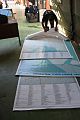 Large OSM poster maps in Tacloban Airport.jpg 640 × 960; 115 KB
-
 Le Hommet d'Arthenay avec les lieux.jpg 5,793 × 12,585; 18.84 MB
-
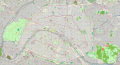
 Map of Bois de Boulogne.png 2,862 × 2,860; 4.75 MB
-
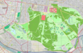 Map of Bois de Vincennes.png 3,479 × 2,220; 4.71 MB
-
 Map of Paris - MapOSMatic 2010.jpg 11,676 × 6,360; 30.96 MB
-
 Map of Paris - MapOSMatic 2010.png 12,312 × 6,996; 44.53 MB
-
 Paris 75 lle de France France.png 11,676 × 6,360; 50.24 MB
-
 Plan des Forts de Lyon première ceinture - OSM.png 5,761 × 5,147; 23.8 MB
-
 Stadtplan Eschweiler Rhld.png 5,074 × 9,155; 17.46 MB
-
 TroyesAubeChampagneArdenneFrance.png 1,390 × 1,680; 3.75 MB


