Category:Mansewood, Glasgow
Jump to navigation
Jump to search
Subcategories
This category has the following 2 subcategories, out of 2 total.
D
- Drill Hall, Auldhouse Road (5 F)
E
- Eastwood Parish Church (8 F)
Media in category "Mansewood, Glasgow"
The following 19 files are in this category, out of 19 total.
-
 BP petrol station, Thornliebank Road - geograph.org.uk - 5247504.jpg 1,600 × 1,045; 301 KB
-
 Brownhill Road housing - geograph.org.uk - 1178200.jpg 640 × 480; 135 KB
-
 Eastwood Old Cemetery (geograph 5247051).jpg 1,600 × 1,067; 585 KB
-
 Eastwood Old Cemetery, Glasgow - geograph.org.uk - 92237.jpg 640 × 480; 176 KB
-
 Flats on Barrmill Road (geograph 5247515).jpg 1,600 × 1,067; 387 KB
-
 Flats on Burnfield Road - geograph.org.uk - 5247519.jpg 1,600 × 999; 253 KB
-
 Former Toffolo Jackson premises - geograph.org.uk - 5246133.jpg 1,600 × 975; 266 KB
-
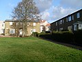 Houses on Burnfield Road - geograph.org.uk - 1178197.jpg 640 × 480; 133 KB
-
 Hutchesons Grammar Playing fields (geograph 5247080).jpg 1,600 × 973; 263 KB
-
 Looking south on Mansewood Road - geograph.org.uk - 1178202.jpg 640 × 480; 119 KB
-
 Mansewood and Merrylee - geograph.org.uk - 1178194.jpg 640 × 480; 122 KB
-
 Mansewood Road - geograph.org.uk - 1178208.jpg 640 × 480; 121 KB
-
 Mansewood1747-1755.jpg 768 × 768; 145 KB
-
 Map of Renfrewshire Sheet 013, Ordnance Survey, 1863-1864.jpg 10,737 × 7,188; 7.87 MB
-
 Map of Renfrewshire Sheet 013, Ordnance Survey, 1863-1864.tiff 10,737 × 7,188; 220.81 MB
-
 Railway Bridge, at end of Robslee Drive - geograph.org.uk - 5246422.jpg 1,600 × 1,067; 481 KB
-
 Thornliebank Road from Mansewood Road (geograph 6432472).jpg 2,736 × 3,648; 1.97 MB
-
 Thornliebank Road tenements - geograph.org.uk - 1178214.jpg 640 × 480; 127 KB
-
 Traffic calming scheme on Mansewood Road - geograph.org.uk - 1178207.jpg 640 × 480; 138 KB


.jpg)

.jpg)


.jpg)


.jpg)

