Category:Manchester Metrolink South Manchester line
Jump to navigation
Jump to search
tram line of the Manchester Metrolink   | |||||
| Upload media | |||||
| Instance of |
| ||||
|---|---|---|---|---|---|
| Location | Manchester, Greater Manchester, North West England, England | ||||
| Transport network | |||||
| Date of official opening |
| ||||
| |||||
Subcategories
This category has only the following subcategory.
Media in category "Manchester Metrolink South Manchester line"
The following 29 files are in this category, out of 29 total.
-
 Trafford Bar Metrolink station (3).JPG 4,320 × 3,240; 4.1 MB
-
 Bridge at Cornbrook Metrolink station.jpg 4,320 × 3,240; 3.12 MB
-
 Construction of The Metrolink at West Didsbury (geograph 4296596).jpg 1,600 × 1,200; 662 KB
-
 Didsbury Metrolink line - geograph.org.uk - 3860142.jpg 2,784 × 1,568; 2.24 MB
-
 End of the line - for now - geograph.org.uk - 2774873.jpg 640 × 480; 94 KB
-
 FirswoodMetrolinkConstruction.jpg 3,072 × 2,304; 1.86 MB
-
 Kingsway Railway Bridge - geograph.org.uk - 3860133.jpg 2,784 × 1,568; 2.22 MB
-
 Metrolink 2CC.png 500 × 361; 54 KB
-

-
 Metrolink extension to Chorlton.jpg 1,944 × 2,592; 1.33 MB
-
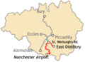 Metrolink phase south manchester line.png 500 × 361; 50 KB
-
 Metrolink phase3 complete.png 500 × 361; 62 KB
-
 Metrolink phase3a.png 500 × 361; 50 KB
-
 Metrolink phase3b.png 500 × 361; 55 KB
-
 Metrolink Trafford Line.png 500 × 361; 51 KB
-
 Metrolink Tram on Hardy Lane - geograph.org.uk - 4790739.jpg 1,197 × 763; 269 KB
-

-

-
 Outside Cornbrook Metrolink station (1).jpg 4,320 × 3,240; 3.11 MB
-
 Railway Cutting - geograph.org.uk - 5340387.jpg 4,000 × 2,992; 4.74 MB
-

-
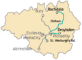
 South Manchester Line.png 581 × 777; 462 KB
-
-
 Tram Crossing Barlow Moor Road - geograph.org.uk - 4236969.jpg 640 × 427; 261 KB
-
 Tram lines on Mauldeth Road West - geograph.org.uk - 4518719.jpg 6,000 × 4,000; 4.34 MB
-
 Tram map of Manchester.svg 1,364 × 2,020; 6.4 MB
-
 Tram on Hardy Lane - geograph.org.uk - 4719959.jpg 1,280 × 853; 293 KB
-
 Viaduct near Cornbrook Metrolink station.jpg 4,320 × 3,240; 2.45 MB
-
.JPG)

.jpg)


.jpg)


,_Greater_Manchester_(geograph_3815626).jpg)