Category:Malltraeth
Jump to navigation
Jump to search
village in Anglesey, United Kingdom | |||||
| Upload media | |||||
| Instance of | |||||
|---|---|---|---|---|---|
| Location | Anglesey, Irish Sea | ||||
| Different from | |||||
 | |||||
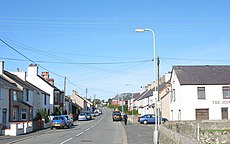
Cymraeg: Mae Malltraeth yn bentref ar arfordir gorllewinol Ynys Môn, ar ochr ogleddol aber Afon Cefni. Er ei fod yn bentref cymharol fychan mae yno ddwy dafarn, y Royal Oak a'r Joiners, a swyddfa'r post sydd hefyd yn siop.
English: Malltraeth (origin: Mall (corrupt, blasted, desolate, [Y fall - the devil]) + Traeth (beach)) is a small village in the southwest of Anglesey, in the area of Bodorgan. It is now at the end of a large bay, which used to extend much further inland, almost creating a second sea strait in the area (the Menai Strait broke through following the end of the ice age).
Subcategories
This category has the following 2 subcategories, out of 2 total.
M
- Malltraeth Viaduct (4 F)
Media in category "Malltraeth"
The following 43 files are in this category, out of 43 total.
-
Bullocks near Malltraeth Bridge - geograph.org.uk - 852385.jpg 640 × 400; 95 KB
-
Capel Sardis from Pont Malltraeth - geograph.org.uk - 852542.jpg 640 × 462; 55 KB
-
Capel Sardis, Malltraeth.jpg 467 × 346; 54 KB
-
Carreg-dwr, Paradwys - geograph.org.uk - 802452.jpg 640 × 480; 106 KB
-
Holyhead mainline - geograph.org.uk - 670459.jpg 640 × 423; 47 KB
-
Llifogydd ar Gors Ddyga, Malltraeth (1500159).jpg 1,256 × 1,250; 603 KB
-
Llifogydd ar Gors Ddyga, Malltraeth (1500160).jpg 1,254 × 1,250; 561 KB
-
Llifogydd ar Gors Ddyga, Malltraeth (1500161).jpg 1,250 × 1,255; 611 KB
-
Llifogydd ar Gors Ddyga, Malltraeth (1500162).jpg 1,251 × 1,250; 488 KB
-
Malltraeth (2).jpg 3,968 × 2,976; 2.29 MB
-
Malltraeth Pool - geograph.org.uk - 1031481.jpg 640 × 332; 21 KB
-
Malltraeth, Post Office. - geograph.org.uk - 146385.jpg 640 × 480; 78 KB
-
Malltraeth.jpg 640 × 400; 65 KB
-
Meadow alongside the Trefdraeth road - geograph.org.uk - 852558.jpg 640 × 480; 76 KB
-
Path at Pen-y-bont - geograph.org.uk - 852499.jpg 640 × 480; 50 KB
-
Pont Malltraeth - geograph.org.uk - 852536.jpg 640 × 480; 56 KB
-
Sardis Calvinistic Methodist Chapel - geograph.org.uk - 255216.jpg 640 × 426; 68 KB
-
Stonechat, Cors Ddyga, RSPB Ynys Mon, 2023.jpg 9,280 × 13,920; 15.4 MB
-
Tair cyfnither yn torheulo mewn bicinis ar Gob Malltraeth (1502260).jpg 1,258 × 1,250; 550 KB
-
Tair cyfnither yn torheulo mewn bicinis ar Gob Malltraeth (1502261).jpg 1,250 × 1,250; 558 KB
-
Tair cyfnither yn torheulo mewn bicinis ar Gob Malltraeth (1502262).jpg 1,250 × 1,259; 656 KB
-
Tair cyfnither yn torheulo mewn bicinis ar Gob Malltraeth (1502263).jpg 1,259 × 1,250; 639 KB
-
The High Street, Malltraeth - geograph.org.uk - 852470.jpg 640 × 480; 64 KB
-
The Joiners Arms, Malltraeth (geograph 5396829).jpg 3,184 × 2,123; 2.15 MB
-
The Royal Oak Inn, Malltraeth - geograph.org.uk - 852478.jpg 640 × 526; 80 KB
-
Track behind the High Street, Malltraeth - geograph.org.uk - 852546.jpg 640 × 480; 114 KB
-
Malltraeth Sands and Afon Cefni - geograph.org.uk - 509370.jpg 640 × 428; 62 KB


