Category:Maer, Staffordshire
Jump to navigation
Jump to search
English: Maer is a rural village in the Borough of Newcastle-under-Lyme, Staffordshire, England, to the west of the pottery manufacturing town of Stoke-on-Trent.
village and civil parish in Staffordshire, UK  | |||||
| Upload media | |||||
| Instance of | |||||
|---|---|---|---|---|---|
| Location | Newcastle-under-Lyme, Staffordshire, West Midlands, England | ||||
| Population |
| ||||
 | |||||
Subcategories
This category has the following 4 subcategories, out of 4 total.
Media in category "Maer, Staffordshire"
The following 159 files are in this category, out of 159 total.
-
 A house in Blackbrook - geograph.org.uk - 2728578.jpg 640 × 480; 68 KB
-
 A51 approaching Hollybank crossroads - geograph.org.uk - 2728585.jpg 640 × 480; 55 KB
-
 A51 at Berth Hill - geograph.org.uk - 2728537.jpg 640 × 480; 53 KB
-
 A51 at Sidway Hall - geograph.org.uk - 5111183.jpg 1,600 × 901; 621 KB
-

-
 A51 east of Blackbrook - geograph.org.uk - 2728570.jpg 640 × 480; 62 KB
-
 A51 near Maerfield Gate Farm - geograph.org.uk - 6170603.jpg 800 × 600; 87 KB
-
 A51 towards Nantwich - geograph.org.uk - 6170935.jpg 800 × 600; 98 KB
-
 A51 towards Nantwich - geograph.org.uk - 6170941.jpg 800 × 600; 144 KB
-
 A51 towards Nantwich - geograph.org.uk - 6170966.jpg 800 × 600; 95 KB
-
 A51 towards Nantwich at Weymouth - geograph.org.uk - 6170980.jpg 800 × 600; 93 KB
-
 A51 towards Nantwich, Blackbrook - geograph.org.uk - 6170955.jpg 800 × 600; 132 KB
-
 A51 west of Berth Hill - geograph.org.uk - 2728539.jpg 640 × 480; 46 KB
-
 A51 west of Hill Chorlton - geograph.org.uk - 2728552.jpg 640 × 480; 55 KB
-
 A51, Blackbrook - geograph.org.uk - 6170959.jpg 800 × 600; 127 KB
-

-

-
 A53 junction with A51 - geograph.org.uk - 3532287.jpg 640 × 475; 146 KB
-
 A53 near War Hill - geograph.org.uk - 2961459.jpg 1,024 × 768; 349 KB
-
 A53 through Sales Wood - geograph.org.uk - 5109060.jpg 1,600 × 900; 656 KB
-
 A53 towards Newcastle-under-Lyme - geograph.org.uk - 6170944.jpg 800 × 541; 85 KB
-
 A53 towards Newcastle-under-Lyme - geograph.org.uk - 6170946.jpg 800 × 600; 202 KB
-
 Aston Lane - geograph.org.uk - 5928266.jpg 1,600 × 901; 733 KB
-
 Barbour Retail Store, Blackbrook - geograph.org.uk - 6170942.jpg 800 × 495; 57 KB
-
 Barbour store in converted school - geograph.org.uk - 4292373.jpg 1,600 × 1,200; 342 KB
-
 Barn at Swan Farm - geograph.org.uk - 3881405.jpg 3,267 × 2,328; 2.99 MB
-
 Boarded Chapel Maerway Lane - geograph.org.uk - 3880755.jpg 3,607 × 2,502; 3.25 MB
-

-
 Brookfields Farm Shop next to A51 - geograph.org.uk - 1962738.jpg 640 × 480; 78 KB
-
 Bus stop on the A51, Blackbrook - geograph.org.uk - 6170943.jpg 800 × 600; 84 KB
-
 By Aston Village Hall - geograph.org.uk - 5928274.jpg 1,600 × 901; 686 KB
-
 Camp Hill - geograph.org.uk - 447698.jpg 640 × 480; 99 KB
-
 Close up, Elizabeth II postbox, Willoughbridge - geograph.org.uk - 6171440.jpg 2,521 × 3,546; 2.05 MB
-
 Cottages on the A51 - geograph.org.uk - 6170601.jpg 800 × 600; 129 KB
-
 Crossroads on the A51, Weymouth - geograph.org.uk - 6170984.jpg 640 × 480; 59 KB
-
 Direction Sign – Signpost in Maer - geograph.org.uk - 6538927.jpg 714 × 960; 235 KB
-

-

-
 Elizabeth II postbox, Willoughbridge - geograph.org.uk - 6171439.jpg 5,184 × 3,888; 6.25 MB
-

-
 Farm buildings at Swan Farm, Blackbrook - geograph.org.uk - 310074.jpg 640 × 428; 132 KB
-
 Farm buildings, Willoughbridge Farm - geograph.org.uk - 5111209.jpg 1,600 × 901; 645 KB
-
 Farm track towards War Hill - geograph.org.uk - 6170940.jpg 800 × 600; 145 KB
-
 Farmland off the A51, Sidway - geograph.org.uk - 6170965.jpg 800 × 600; 107 KB
-
 Field and footpath - geograph.org.uk - 646788.jpg 640 × 480; 69 KB
-
 Field oak tree - geograph.org.uk - 769123.jpg 640 × 512; 101 KB
-
 Field of stubble near Maer Hills - geograph.org.uk - 3881434.jpg 4,608 × 1,987; 4.3 MB
-
 Fields near Baldwin's Gate - geograph.org.uk - 6317456.jpg 4,128 × 2,006; 1.2 MB
-
 Footpath in Haddon Lane - geograph.org.uk - 557296.jpg 640 × 480; 141 KB
-
 Footpath in Haddon Lane - geograph.org.uk - 557310.jpg 640 × 480; 141 KB
-
 Footpath off A53 - geograph.org.uk - 511725.jpg 640 × 480; 138 KB
-
 Footpath off Willoughbridge Lane - geograph.org.uk - 6170991.jpg 800 × 600; 113 KB
-
 Footpath to Chapel Chorlton - geograph.org.uk - 6172742.jpg 800 × 600; 182 KB
-
 Footpath^ That's what you think - geograph.org.uk - 1954174.jpg 640 × 457; 234 KB
-
 Gated track to Maerfield Gate Farm - geograph.org.uk - 6170936.jpg 800 × 600; 194 KB
-
 Grassland near Willoughbridge Farm - geograph.org.uk - 6170989.jpg 800 × 600; 119 KB
-
 Grassland south of the A51 - geograph.org.uk - 6170939.jpg 800 × 600; 92 KB
-
 Grazing and woodland, Maerfield Gate - geograph.org.uk - 6170937.jpg 800 × 600; 88 KB
-
 Grazing near Clayalders Wood - geograph.org.uk - 6172747.jpg 800 × 600; 106 KB
-
 Grazing off the A51, Blackbrook - geograph.org.uk - 6170954.jpg 800 × 600; 130 KB
-
 High pressure gas pipeline marker - geograph.org.uk - 788678.jpg 480 × 640; 270 KB
-
 House at Blackbrook - geograph.org.uk - 3881402.jpg 1,809 × 1,071; 979 KB
-
 House by the A51 near The Bogs - geograph.org.uk - 2728542.jpg 640 × 480; 63 KB
-
 House near Weymouth Crossroads - geograph.org.uk - 3881387.jpg 4,596 × 3,029; 5.68 MB
-
 House on the A51, Weymouth - geograph.org.uk - 6170978.jpg 640 × 414; 68 KB
-
 Houses by the A51 - geograph.org.uk - 2728624.jpg 640 × 480; 61 KB
-
 Houses on the A51, Sidway - geograph.org.uk - 6170962.jpg 800 × 503; 66 KB
-
 In the Dorothy Clive Garden - geograph.org.uk - 6739574.jpg 3,072 × 2,048; 1.79 MB
-
 Junction by war memorial in Maer - geograph.org.uk - 3532278.jpg 640 × 413; 121 KB
-
 Kings Bank Tumulus, Maer - geograph.org.uk - 6809290.jpg 2,000 × 1,333; 2.18 MB
-
 Lane towards Maer - geograph.org.uk - 6172749.jpg 800 × 600; 89 KB
-
 Lanes off A51 near Hill Chorlton - geograph.org.uk - 513813.jpg 640 × 480; 94 KB
-
 Large Semi-Detached Property - geograph.org.uk - 3881398.jpg 4,203 × 2,145; 3.61 MB
-

-
 Looking toward Bates Farm - geograph.org.uk - 769126.jpg 640 × 511; 49 KB
-
 Luxury housing near Baldwins Gate - geograph.org.uk - 547364.jpg 640 × 480; 150 KB
-
 St Peter, Maer - geograph.org.uk - 769129.jpg 640 × 512; 78 KB
-
 Maer - St Peter's Church ^ Gatehouse - geograph.org.uk - 6083554.jpg 5,184 × 2,920; 4.72 MB
-
 Maer Church - geograph.org.uk - 208534.jpg 640 × 480; 104 KB
-
 Maer Hills - geograph.org.uk - 447871.jpg 640 × 491; 154 KB
-
 Maer Hills Notice - geograph.org.uk - 447885.jpg 480 × 640; 99 KB
-
 Maer Village Hall - geograph.org.uk - 787744.jpg 640 × 480; 219 KB
-
 Maer War Memorial - geograph.org.uk - 1962742.jpg 640 × 480; 126 KB
-
 Maers Hill Trigpoint and Mast - geograph.org.uk - 6809294.jpg 2,000 × 1,600; 4.8 MB
-
 Maerway Crossroads, Blackbrook - geograph.org.uk - 5111179.jpg 1,600 × 901; 689 KB
-
 Maerway Lane - geograph.org.uk - 533487.jpg 640 × 480; 114 KB
-

-
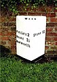
 Milepost at NGR SJ 7527 3984.jpg 496 × 702; 43 KB
-
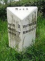
 Milepost at NGR SJ 7665 3897.jpg 492 × 701; 72 KB
-
 Milepost at NGR SJ 7724 3878.jpg 588 × 800; 167 KB
-
 Milepost at NGR SJ 7823 3884.jpg 492 × 701; 55 KB
-
 Milepost at NGR SJ 7853 3968.jpg 492 × 701; 82 KB
-
 Minn Bank, Willoughbridge - geograph.org.uk - 6170968.jpg 800 × 502; 152 KB
-
 Nantwich Road (A51) - geograph.org.uk - 6170949.jpg 800 × 600; 112 KB
-
 Near Radwood Farm - geograph.org.uk - 2108726.jpg 640 × 425; 49 KB
-
 Newcastle Way Tree, Maer - geograph.org.uk - 6809301.jpg 2,000 × 1,333; 3 MB
-

-
 Outlook from Dorothy Clive Garden - geograph.org.uk - 1319571.jpg 640 × 480; 96 KB
-
 Paddock opposite Willoughbridge Farm - geograph.org.uk - 5111205.jpg 1,600 × 901; 673 KB
-
 Path heading up to Camp Wood, Maer Hills - geograph.org.uk - 6083562.jpg 5,184 × 2,920; 6.46 MB
-
 Ploughed Field and Tree on Mound, Maer - geograph.org.uk - 6809282.jpg 2,000 × 1,333; 2.77 MB
-
 Ploughed Field near Maer Hills - geograph.org.uk - 3881426.jpg 4,578 × 2,289; 4.2 MB
-
 Radwood Farm - geograph.org.uk - 2108454.jpg 640 × 431; 90 KB
-
 Radwood Farm - geograph.org.uk - 2108464.jpg 640 × 425; 87 KB
-

-
 Road Junction - geograph.org.uk - 447897.jpg 640 × 480; 165 KB
-
 School Lane, Aston - geograph.org.uk - 5935299.jpg 1,600 × 901; 715 KB
-
 Sheep in field and train - geograph.org.uk - 547313.jpg 640 × 480; 97 KB
-
 Sign for Slaters Country Hotel and Inn - geograph.org.uk - 6170614.jpg 627 × 800; 112 KB
-

-
 Signage at Weymouth crossroads - geograph.org.uk - 5111191.jpg 1,600 × 901; 661 KB
-
 Slaters Country Hotel and Inn - geograph.org.uk - 6170609.jpg 800 × 494; 68 KB
-
 Stile on field path off Haddon Ln, Maer - geograph.org.uk - 6083553.jpg 5,184 × 2,920; 6.85 MB
-
 Sunken Lane - geograph.org.uk - 769132.jpg 512 × 640; 123 KB
-
 Swan Farm near Blackbrook - geograph.org.uk - 4904513.jpg 1,200 × 799; 399 KB
-
 Swan Farm, Blackbrook - geograph.org.uk - 310078.jpg 640 × 428; 122 KB
-
 Terrace Steps - geograph.org.uk - 6739576.jpg 2,048 × 3,072; 1.39 MB
-
 The A51 near Swan Farm - geograph.org.uk - 6317457.jpg 4,128 × 2,006; 2.65 MB
-
 The A53 looking West after Baldwins Gate - geograph.org.uk - 511692.jpg 640 × 480; 115 KB
-
 The Bogs - geograph.org.uk - 5110986.jpg 1,600 × 901; 779 KB
-
 The Dorothy Clive Garden - geograph.org.uk - 6739568.jpg 3,072 × 2,048; 2.11 MB
-
 The Swan With Two Necks - geograph.org.uk - 4904416.jpg 1,200 × 799; 256 KB
-
 The Swan With Two Necks - geograph.org.uk - 4904423.jpg 771 × 1,200; 223 KB
-
 The Swan with Two Necks - geograph.org.uk - 6239924.jpg 4,000 × 3,000; 2.23 MB
-
 The Swan With Two Necks, Blackbrook - geograph.org.uk - 6170947.jpg 800 × 600; 78 KB
-
 Track W from Hoghshead Wood, Maer - geograph.org.uk - 6083559.jpg 5,184 × 2,920; 6.02 MB
-
 Two types of lichen - geograph.org.uk - 5111214.jpg 1,600 × 901; 745 KB
-
 View from Minnbank - geograph.org.uk - 5935319.jpg 1,600 × 901; 747 KB
-
 View from Minnbank, 2 - geograph.org.uk - 5935324.jpg 1,600 × 901; 752 KB
-
 View from the Dorothy Clive Garden - geograph.org.uk - 6739582.jpg 3,072 × 2,048; 1.57 MB
-

-
 View south of the A53 - geograph.org.uk - 646798.jpg 640 × 480; 64 KB
-
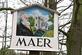 Village sign - geograph.org.uk - 335808.jpg 640 × 428; 142 KB
-
 War Hill, Maer - geograph.org.uk - 6809285.jpg 2,000 × 1,333; 2.21 MB
-
 Wesleyan chapel - geograph.org.uk - 5935336.jpg 1,600 × 901; 730 KB
-
 Wesleyan Chapel, Willoughbridge - geograph.org.uk - 6170970.jpg 800 × 600; 112 KB
-
 Weymouth crossroads, A51 - geograph.org.uk - 2728626.jpg 640 × 480; 50 KB
-
 Willoughbridge Lane - geograph.org.uk - 6170993.jpg 800 × 600; 136 KB
-
 Within the Dorothy Clive Garden - geograph.org.uk - 6739569.jpg 3,072 × 2,048; 4.06 MB
-
 Woodland beside Clayalders Wood - geograph.org.uk - 6172745.jpg 800 × 600; 94 KB
-
 Woodland beside the A53 - geograph.org.uk - 6170945.jpg 600 × 800; 222 KB
-
 Disused Railway Bridge Support - geograph.org.uk - 447960.jpg 640 × 480; 158 KB
-
 Dorothy Clive Garden - geograph.org.uk - 329951.jpg 570 × 426; 110 KB
-
 Field view near Willoughbridge Farm - geograph.org.uk - 553639.jpg 640 × 480; 101 KB
-
 Hill Above Maer - geograph.org.uk - 224039.jpg 640 × 480; 99 KB
-
 Holloway Farm - geograph.org.uk - 447900.jpg 640 × 514; 127 KB
-
 Lane to Aston off A51 - geograph.org.uk - 522545.jpg 640 × 480; 69 KB
-
 Minnbank - geograph.org.uk - 552978.jpg 640 × 480; 130 KB
-
 Mount Tabor Farm from Haddon Lane - geograph.org.uk - 207393.jpg 640 × 480; 75 KB
-
 Redundant Bridge Supports - geograph.org.uk - 447954.jpg 640 × 480; 166 KB
-
 Road to Radwood Farm - geograph.org.uk - 447704.jpg 640 × 457; 152 KB
-
 Roast Ostrich for Xmas - geograph.org.uk - 547304.jpg 640 × 636; 177 KB
-
 Stile in the lane - geograph.org.uk - 553620.jpg 480 × 640; 133 KB
-
 Swan with Two Necks public house - geograph.org.uk - 309990.jpg 640 × 428; 119 KB
-
 The Red Barn - geograph.org.uk - 447908 (cropped).jpg 282 × 316; 51 KB
-
 The Red Barn - geograph.org.uk - 447908.jpg 640 × 506; 161 KB
-
 Tractor at work - geograph.org.uk - 552986.jpg 640 × 400; 72 KB
-
 Tree Line - geograph.org.uk - 1980.jpg 640 × 480; 76 KB
-
 Western Meres Farm - geograph.org.uk - 207406.jpg 640 × 480; 91 KB


_-_geograph.org.uk_-_6170949.jpg)


.jpg)


