Category:M5 motorway in Gloucestershire
Jump to navigation
Jump to search
Subcategories
This category has the following 6 subcategories, out of 6 total.
A
- M5 motorway at Almondsbury (31 F)
- Almondsbury Interchange (23 F)
- Ashchurch Interchange (3 F)
G
- Gloucester Services (9 F)
M
- Michaelwood services (107 F)
Media in category "M5 motorway in Gloucestershire"
The following 135 files are in this category, out of 135 total.
-
Approaching junction 10 on the M5 - geograph.org.uk - 2673748.jpg 1,024 × 680; 67 KB
-
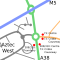
Aztec West Transport.svg 500 × 500; 20 KB
-
Bridge under the M5 by Hollywood Tower - geograph.org.uk - 118670.jpg 640 × 478; 179 KB
-
Fiddington Road Bridge over the M5 - geograph.org.uk - 2288717.jpg 640 × 265; 24 KB
-
Food miles - geograph.org.uk - 339222.jpg 640 × 480; 85 KB
-
Footbridge Over M5 - geograph.org.uk - 91384.jpg 640 × 480; 76 KB
-
Hallen Road passing under the M5 - geograph.org.uk - 118450.jpg 640 × 480; 189 KB
-
Joining the M5, northbound side - geograph.org.uk - 2051705.jpg 640 × 480; 63 KB
-
Junction 10 on the M5 - geograph.org.uk - 929299.jpg 640 × 426; 62 KB
-
M4 westbound near Junction 20 - geograph.org.uk - 2029324.jpg 3,036 × 2,010; 2.08 MB
-
M5 - geograph.org.uk - 196208.jpg 600 × 450; 74 KB
-
M5 - geograph.org.uk - 238980.jpg 640 × 480; 121 KB
-
M5 - geograph.org.uk - 63791.jpg 640 × 479; 91 KB
-
M5 - geograph.org.uk - 678128.jpg 640 × 480; 60 KB
-
M5 at Bredon - geograph.org.uk - 7041.jpg 640 × 480; 100 KB
-
M5 at Churchdown - geograph.org.uk - 1610232.jpg 640 × 426; 66 KB
-
M5 at junction 11a, northbound - geograph.org.uk - 2046213.jpg 640 × 480; 54 KB
-
M5 at junction 12, northbound - geograph.org.uk - 2045872.jpg 640 × 480; 53 KB
-
M5 at Upton St Leonards - geograph.org.uk - 2218808.jpg 1,024 × 681; 137 KB
-
M5 bridge - geograph.org.uk - 2329603.jpg 1,024 × 768; 195 KB
-
M5 Brookthorpe Services here soon^ - geograph.org.uk - 2046154.jpg 640 × 480; 58 KB
-
M5 crossing the Brockworth bypass - geograph.org.uk - 1543641.jpg 640 × 480; 38 KB
-
M5 during a blizzard - geograph.org.uk - 1154583.jpg 640 × 480; 40 KB
-
M5 from Brockworth Road bridge - geograph.org.uk - 1136472.jpg 640 × 481; 106 KB
-
M5 from the air - geograph.org.uk - 1222054.jpg 480 × 640; 49 KB
-
M5 heading north - geograph.org.uk - 314670.jpg 640 × 480; 61 KB
-
M5 Junction 10 - geograph.org.uk - 76457.jpg 640 × 479; 62 KB
-
M5 Junction 11 - geograph.org.uk - 5306.jpg 640 × 480; 52 KB
-
M5 junction 11a - geograph.org.uk - 1608872.jpg 640 × 426; 62 KB
-
M5 Junction 13 - geograph.org.uk - 1454050.jpg 640 × 380; 252 KB
-
M5 Junction 16 southbound - geograph.org.uk - 2030205.jpg 3,036 × 2,010; 1.81 MB
-
M5 junction 9 from the air - geograph.org.uk - 930467.jpg 640 × 426; 80 KB
-
M5 Motorway - 1 mile to junction 13 - geograph.org.uk - 2045841.jpg 640 × 480; 53 KB
-
M5 Motorway - Brockworth Road bridge - geograph.org.uk - 2046335.jpg 640 × 480; 53 KB
-
M5 motorway - geograph.org.uk - 103412.jpg 1,600 × 1,200; 824 KB
-
M5 Motorway - geograph.org.uk - 136479.jpg 640 × 479; 62 KB
-
M5 motorway - geograph.org.uk - 1608870.jpg 640 × 426; 61 KB
-
M5 Motorway - geograph.org.uk - 5291.jpg 480 × 640; 60 KB
-
M5 Motorway - geograph.org.uk - 5307.jpg 480 × 640; 46 KB
-
M5 Motorway - junction 9 bridges - geograph.org.uk - 2046460.jpg 640 × 480; 60 KB
-
M5 Motorway at junction 10 - geograph.org.uk - 2046410.jpg 640 × 480; 49 KB
-
M5 Motorway at junction 16 - geograph.org.uk - 2080847.jpg 640 × 480; 54 KB
-
M5 motorway Bristol.jpg 2,049 × 1,537; 573 KB
-
M5 Motorway Junction 11 - geograph.org.uk - 1170707.jpg 640 × 364; 42 KB
-
M5 Motorway near Barmer's Land Farms - geograph.org.uk - 2051777.jpg 640 × 480; 48 KB
-
M5 Motorway near Brookthorpe - geograph.org.uk - 2046133.jpg 640 × 480; 49 KB
-
M5 Motorway near Fiddington - geograph.org.uk - 2046450.jpg 640 × 480; 52 KB
-
M5 Motorway near Goldwick Farm - geograph.org.uk - 2045773.jpg 640 × 480; 67 KB
-
M5 Motorway near Middle Wick - geograph.org.uk - 2045761.jpg 640 × 480; 52 KB
-
M5 Motorway near Standle Farm - geograph.org.uk - 2045782.jpg 640 × 480; 61 KB
-
M5 Motorway near Tytherington - geograph.org.uk - 2051774.jpg 640 × 480; 55 KB
-
M5 Motorway near White House Farm - geograph.org.uk - 2046337.jpg 640 × 480; 56 KB
-
M5 Motorway Northbound Junction 11 - geograph.org.uk - 2721943.jpg 640 × 480; 62 KB
-
M5 motorway, junction 12, view east - geograph.org.uk - 1284994.jpg 640 × 483; 84 KB
-
M5 motorway, looking south - geograph.org.uk - 367213.jpg 640 × 480; 61 KB
-
M5 motorway, near Stinchcombe - geograph.org.uk - 367031.jpg 640 × 480; 64 KB
-
M5 motorway, near Stinchcombe - geograph.org.uk - 367035.jpg 640 × 480; 53 KB
-
M5 motorway.jpg 2,448 × 3,264; 1.36 MB
-
M5 near Patchway - geograph.org.uk - 1996405.jpg 1,024 × 663; 205 KB
-
M5 near Stoke Orchard - geograph.org.uk - 45934.jpg 640 × 426; 96 KB
-
M5 north - geograph.org.uk - 1499591.jpg 640 × 480; 228 KB
-
M5 north of Junction 11 - geograph.org.uk - 2329616.jpg 1,024 × 768; 123 KB
-
M5 northbound after the footbridge - geograph.org.uk - 2046328.jpg 640 × 480; 47 KB
-
M5 Northbound at MichaelWood - geograph.org.uk - 1217022.jpg 640 × 424; 51 KB
-
M5 northbound Junction 16 geograph-1993658-by-Andrew-Hackney.jpg 1,024 × 699; 206 KB
-
M5 south - geograph.org.uk - 1499594.jpg 640 × 480; 213 KB
-
M5 southbound sliproad, Junction 12 - geograph.org.uk - 1284992.jpg 640 × 398; 64 KB
-
M5 Underpass - geograph.org.uk - 167622.jpg 640 × 480; 114 KB
-
M5, from the Walton Cardiff to Fiddington road (2005).jpg 640 × 479; 69 KB
-
M5, just south of Junction 13 - geograph.org.uk - 343263.jpg 640 × 480; 99 KB
-
M5, looking south - geograph.org.uk - 898236.jpg 640 × 480; 109 KB
-
Power lines cross the M5 motorway - geograph.org.uk - 2046409.jpg 640 × 480; 51 KB
-
Pylons at junction 11a - geograph.org.uk - 2046217.jpg 640 × 480; 58 KB
-
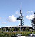
Rac.tower.arp.600pix.jpg 600 × 628; 112 KB
-
Saturday morning traffic on the M5 - geograph.org.uk - 898241.jpg 640 × 480; 83 KB
-
Tewkesbury Borough , M5 Motorway - geograph.org.uk - 5951420.jpg 6,000 × 4,000; 6.05 MB
-
The M5 approaching Junction 9 - geograph.org.uk - 710111.jpg 426 × 640; 58 KB
-
The M5 bridge over the River Avon - geograph.org.uk - 586082.jpg 640 × 426; 121 KB
-
The M5 motorway across Twyning Meadow - geograph.org.uk - 319350.jpg 640 × 426; 94 KB
-
The M5 Motorway at Staverton - geograph.org.uk - 929293.jpg 640 × 426; 67 KB
-
The M5 motorway, looking north - geograph.org.uk - 381349.jpg 640 × 480; 49 KB
-
The M5 motorway, near Upper Wick - geograph.org.uk - 367104.jpg 640 × 480; 56 KB
-
Thomas The Tank on the motorway - geograph.org.uk - 1285002.jpg 640 × 464; 113 KB
-
Twyning and the M5 from the air - geograph.org.uk - 930266.jpg 640 × 426; 64 KB
-
Under the M5 on the A38. - geograph.org.uk - 552889.jpg 640 × 341; 72 KB
-
View across the M5 - geograph.org.uk - 1082904.jpg 640 × 480; 94 KB
-
Waiting to head back North - geograph.org.uk - 831036.jpg 640 × 480; 87 KB
-
Welcome to Gloucestershire - geograph.org.uk - 2051838.jpg 640 × 480; 50 KB


