Category:Lyng, Norfolk
Jump to navigation
Jump to search
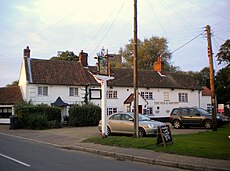
English: Lyng is a village and civil parish in the English county of Norfolk. It is situated on the River Wensum, some
village and civil parish in the English county of Norfolk | |||||
| Upload media | |||||
| Instance of | |||||
|---|---|---|---|---|---|
| Location | Breckland, Norfolk, East of England, England | ||||
| Population |
| ||||
| Area |
| ||||
| Said to be the same as | Lyng (Wikimedia duplicated page, civil parish) | ||||
 | |||||
Subcategories
This category has the following 10 subcategories, out of 10 total.
Media in category "Lyng, Norfolk"
The following 65 files are in this category, out of 65 total.
-
Anti-tank cubes by Lyng Mill - geograph.org.uk - 4274545.jpg 640 × 444; 263 KB
-
Cadders sunset.jpg 1,664 × 1,111; 482 KB
-
Cart sheds at Lyng House - geograph.org.uk - 4279473.jpg 640 × 480; 103 KB
-
Derelict shed - geograph.org.uk - 4279494.jpg 640 × 480; 188 KB
-
Elsing Road, Lyng - geograph.org.uk - 2236676.jpg 640 × 480; 131 KB
-
Farm hardstanding beside Blind Lane - geograph.org.uk - 4025571.jpg 640 × 480; 133 KB
-
Hases Lane Lyng Easthaugh - geograph.org.uk - 4279524.jpg 640 × 480; 97 KB
-
Kingfisher Apartments - geograph.org.uk - 3340331.jpg 3,648 × 2,736; 2.16 MB
-
Kingfisher Lakes - geograph.org.uk - 3340343.jpg 3,648 × 2,048; 2.25 MB
-
The winsome Wensum.JPG 3,088 × 2,056; 3.25 MB
-
Lyng (Norfolk) War Memorials - geograph.org.uk - 4773639.jpg 2,592 × 3,456; 3.2 MB
-
Lyng - Mill House ^ R Wensum - geograph.org.uk - 6014005.jpg 5,184 × 2,920; 6.75 MB
-
Lyng - St Margaret's Church - geograph.org.uk - 6014010.jpg 5,184 × 2,920; 5.84 MB
-
Lyng Road near Lyng - geograph.org.uk - 5010113.jpg 2,052 × 1,404; 2.7 MB
-
Lyng Road towards Lyng - geograph.org.uk - 5010107.jpg 2,256 × 1,496; 916 KB
-
Lyng village sign - geograph.org.uk - 6688646.jpg 2,760 × 2,760; 2.58 MB
-
Lyng village sign - geograph.org.uk - 6688647.jpg 4,608 × 3,072; 5.46 MB
-
Lyng, St Margaret - geograph.org.uk - 6364090.jpg 4,608 × 3,456; 3.97 MB
-
Meadowland looking towards The Clump - geograph.org.uk - 4279527.jpg 640 × 480; 102 KB
-
New reservoir at Lyng Easthaugh - geograph.org.uk - 4279515.jpg 640 × 480; 86 KB
-
Oil seed rape at Collen's Green. Lyng - geograph.org.uk - 4279493.jpg 640 × 480; 152 KB
-
On the Wensum Way, W of Cadder's Hill, Lyng - geograph.org.uk - 6013981.jpg 5,184 × 2,920; 5.63 MB
-
Path past the churchyard - geograph.org.uk - 899004.jpg 480 × 640; 185 KB
-
Path through the churchyard - geograph.org.uk - 899023.jpg 640 × 480; 161 KB
-
River Wensum below Lyng - geograph.org.uk - 3623017.jpg 640 × 438; 71 KB
-
Road junction at Collen's Green, Lyng - geograph.org.uk - 4279492.jpg 640 × 480; 134 KB
-
Rural road near Primrose Green - geograph.org.uk - 5541244.jpg 640 × 480; 65 KB
-
Sand, muck, lime and gravel - geograph.org.uk - 4025572.jpg 640 × 480; 134 KB
-
Stream by Lyng Mill - geograph.org.uk - 4274535.jpg 640 × 480; 253 KB
-
The Driveway To Sparham Hall - geograph.org.uk - 274697.jpg 640 × 480; 100 KB
-
The Lane To Lyng Quarry - geograph.org.uk - 296210.jpg 640 × 480; 101 KB
-
The River Wensum - geograph.org.uk - 899139.jpg 480 × 640; 155 KB
-
Two of four WWII anti tank blocks - geograph.org.uk - 899151.jpg 480 × 640; 171 KB
-
View along Blind Lane - geograph.org.uk - 4025570.jpg 640 × 438; 125 KB
-
Walnut Tree Farm - geograph.org.uk - 7129823.jpg 800 × 533; 115 KB
-
Wensum Way - grazing horses and Cadder's Hill near Lyng, - geograph.org.uk - 6109494.jpg 4,128 × 2,322; 2.38 MB
-
Wensum Way near Lyng - pond and Cadder's Hill - geograph.org.uk - 6109483.jpg 4,128 × 2,322; 552 KB
-
Wensum Way, near Lyng - geograph.org.uk - 6109500.jpg 4,128 × 2,322; 559 KB
-
Wheat crop by Willows Farm - geograph.org.uk - 4025568.jpg 640 × 480; 151 KB
-
Yet another neglected churchyard this one's at Lyng - geograph.org.uk - 5583960.jpg 3,456 × 2,592; 3.06 MB
-
Young crop field near Primrose Green - geograph.org.uk - 5541243.jpg 640 × 480; 56 KB
-
A Harvester - geograph.org.uk - 275302.jpg 640 × 480; 99 KB
-
A Turning For Lyng - geograph.org.uk - 274695.jpg 640 × 480; 63 KB
-
A View To A White House - geograph.org.uk - 296191.jpg 640 × 480; 81 KB
-
Duck And Dodge To Enter - geograph.org.uk - 275310.jpg 640 × 480; 99 KB
-
Field Access - geograph.org.uk - 296202.jpg 640 × 480; 92 KB
-
Hockering Green Road - geograph.org.uk - 274745.jpg 640 × 480; 100 KB
-
Holiday Homes - geograph.org.uk - 296206.jpg 640 × 480; 104 KB
-
Leys Farm - geograph.org.uk - 296240.jpg 640 × 480; 90 KB
-
Protecting Winter Wheat - geograph.org.uk - 274742.jpg 640 × 480; 96 KB
-
Sweeping Curves - geograph.org.uk - 296235.jpg 640 × 480; 71 KB
-
The Road From Lyng - geograph.org.uk - 274724.jpg 640 × 480; 96 KB
-
The Road To Easthaugh - geograph.org.uk - 274704.jpg 640 × 480; 96 KB
-
The Road To Elsing - geograph.org.uk - 275307.jpg 640 × 480; 98 KB
-
The Road To Hockering - geograph.org.uk - 296190.jpg 640 × 480; 81 KB
-
The Road To Lyng - geograph.org.uk - 296198.jpg 640 × 480; 106 KB
-
The Road To Willows Farm - geograph.org.uk - 296227.jpg 640 × 480; 99 KB
-
Wildlife Habitat - geograph.org.uk - 296231.jpg 640 × 480; 74 KB


