Category:Lung Ha Wan Road
Jump to navigation
Jump to search
| Object location | | View all coordinates using: OpenStreetMap |
|---|
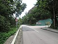
road in Sheung Sze Wan | |||||
| Upload media | |||||
| Instance of | |||||
|---|---|---|---|---|---|
| Location | Sai Kung District, New Territories, Hong Kong, PRC | ||||
 | |||||
中文:龍蝦灣路
Subcategories
This category has the following 3 subcategories, out of 3 total.
C
L
Media in category "Lung Ha Wan Road"
The following 4 files are in this category, out of 4 total.
-
 Cham Shan Monastery 01.jpg 4,608 × 3,456; 5.31 MB
-
 Cham Shan Monastery 06.jpg 4,608 × 3,456; 5.47 MB
-
 Cham Shan Monastery 07.jpg 4,608 × 3,456; 4.02 MB
-
 Cham Shan Monastery 08.jpg 2,304 × 1,728; 863 KB


