Category:Lullington, Somerset
Jump to navigation
Jump to search
English: Lullington is a village and civil parish just across the Mells River from Beckington and north east of Frome, in the Mendip district of Somerset, England.
village and civil parish in Somerset, UK  | |||||
| Upload media | |||||
| Instance of | |||||
|---|---|---|---|---|---|
| Location | Mendip, Somerset, South West England, England | ||||
| Population |
| ||||
 | |||||
Subcategories
This category has the following 4 subcategories, out of 4 total.
A
L
O
Media in category "Lullington, Somerset"
The following 130 files are in this category, out of 130 total.
-
 A bend in the lane, and a field entrance - geograph.org.uk - 5530644.jpg 640 × 480; 157 KB
-
 A couple of piles-up - geograph.org.uk - 6238051.jpg 3,296 × 2,472; 3.44 MB
-
 A quiet lunch near the lodge - geograph.org.uk - 6237562.jpg 3,296 × 2,472; 3.27 MB
-
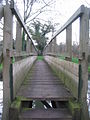
 A short path that is actually a bridge - geograph.org.uk - 6238373.jpg 2,472 × 3,296; 3.41 MB
-
 A Temple Lodge invitation - geograph.org.uk - 6237574.jpg 3,296 × 2,472; 3.23 MB
-
 A Victorian makeover - geograph.org.uk - 6238348.jpg 2,472 × 3,296; 3.17 MB
-
 A woolly landing^ - geograph.org.uk - 6237588.jpg 3,296 × 2,472; 3.57 MB
-
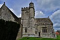
 All Saints, Lullington - geograph.org.uk - 6238345.jpg 3,296 × 2,472; 3.47 MB
-
 Benchmark on All Saints, Lullington - geograph.org.uk - 6236670.jpg 2,472 × 3,296; 3.3 MB
-
 Benchmark on Garden House - geograph.org.uk - 6237592.jpg 3,296 × 2,472; 3.35 MB
-
 Benchmark on Gloucester Lodge West - geograph.org.uk - 6236706.jpg 3,296 × 2,472; 3.43 MB
-
 Benchmark on Temple Lodge wall - geograph.org.uk - 6236680.jpg 3,296 × 2,472; 3.44 MB
-
 Benchmark on the estate bridge - geograph.org.uk - 6236674.jpg 2,472 × 3,296; 3.36 MB
-
 Benchmark on the island church - geograph.org.uk - 6236698.jpg 3,296 × 2,472; 3.48 MB
-
 Betwixt Woolverton and Bath - geograph.org.uk - 6238314.jpg 3,296 × 2,472; 3.44 MB
-
 Beware before^ - geograph.org.uk - 6237567.jpg 3,296 × 2,472; 3.39 MB
-
 Bridge over the stream in Laverton - geograph.org.uk - 2504262.jpg 640 × 480; 181 KB
-
 Cottages in Lullington - geograph.org.uk - 681284.jpg 640 × 480; 82 KB
-

-
 Entrance to Park Farm - geograph.org.uk - 325861.jpg 640 × 480; 25 KB
-
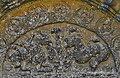
 Faces on All Saints - geograph.org.uk - 6238352.jpg 3,296 × 2,472; 3.47 MB
-
 Farm buildings in Lullington - geograph.org.uk - 5764491.jpg 2,048 × 1,536; 1.56 MB
-
 Farm track - geograph.org.uk - 2504253.jpg 640 × 480; 194 KB
-

-
 Footbridge near the church - geograph.org.uk - 6237583.jpg 3,296 × 2,472; 3.42 MB
-
 Garden House, Orchardleigh - geograph.org.uk - 6237593.jpg 3,296 × 2,472; 3.49 MB
-
 Gloucester Lodge West - geograph.org.uk - 6236707.jpg 3,296 × 2,472; 3.46 MB
-
 Horse Chestnut Blossom - geograph.org.uk - 1325638.jpg 640 × 426; 102 KB
-
 House in Lullington - geograph.org.uk - 5764510.jpg 2,048 × 1,536; 1.5 MB
-
 Houses in Lullington - geograph.org.uk - 439367.jpg 640 × 477; 110 KB
-
 Iron Mill - geograph.org.uk - 1326029.jpg 640 × 426; 101 KB
-
 Land behind Court Farm, Lullington - geograph.org.uk - 6600379.jpg 5,568 × 3,712; 7.21 MB
-
 Lane after the rain - geograph.org.uk - 2504256.jpg 640 × 480; 131 KB
-
 Lane heading to Lullington - geograph.org.uk - 5530646.jpg 640 × 480; 196 KB
-
 Lane to Park Farm - geograph.org.uk - 5530650.jpg 640 × 480; 166 KB
-
 Large battlements - geograph.org.uk - 6238069.jpg 2,472 × 3,296; 2.88 MB
-
 Leaving the fairway - geograph.org.uk - 6238056.jpg 3,296 × 2,472; 3.45 MB
-
 LongHouse Farm - geograph.org.uk - 1326018.jpg 640 × 426; 83 KB
-
 Lullington Lane - geograph.org.uk - 5786426.jpg 2,048 × 1,536; 1.52 MB
-
 Lullington Lane - geograph.org.uk - 5786428.jpg 2,014 × 1,490; 1.72 MB
-
 Lullington Lane, Oldford - geograph.org.uk - 5764393.jpg 2,048 × 1,536; 1.53 MB
-
 Lullington Lane, Oldford - geograph.org.uk - 5764395.jpg 2,048 × 1,536; 1.91 MB
-
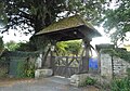
 Lullington lych gate - geograph.org.uk - 6238338.jpg 3,296 × 2,472; 3.36 MB
-
 Lullington Mill - geograph.org.uk - 1325970.jpg 640 × 426; 139 KB
-
 Lullington Mill - geograph.org.uk - 325930.jpg 640 × 480; 113 KB
-
 Lullington phone box - geograph.org.uk - 6237565.jpg 2,472 × 3,296; 3.32 MB
-
 Lullington pump - geograph.org.uk - 439375.jpg 640 × 477; 105 KB
-
 Lullington pump - geograph.org.uk - 6238330.jpg 3,296 × 2,472; 3.54 MB
-
 Lullington pump.jpg 640 × 480; 78 KB
-
 Lullington village - geograph.org.uk - 5764505.jpg 2,048 × 1,536; 1.49 MB
-
 Lullington village - geograph.org.uk - 5778919.jpg 2,048 × 1,536; 1.54 MB
-
 Lullington's water source - geograph.org.uk - 6238333.jpg 2,472 × 3,296; 3.28 MB
-
 Lullington, All Saints Church, Capital - geograph.org.uk - 5376749.jpg 3,679 × 2,455; 5.11 MB
-
 Lullington, All Saints Church, Corbel - geograph.org.uk - 5376741.jpg 3,678 × 2,456; 5.29 MB
-
 Lullington, All Saints Church, Corbel - geograph.org.uk - 5376746.jpg 3,678 × 2,456; 5.13 MB
-
 Lullington, All Saints Church, Fierce monster corbel - geograph.org.uk - 5376728.jpg 3,678 × 2,456; 4.99 MB
-

-
 Lullington, All Saints Church, South aspect - geograph.org.uk - 4962992.jpg 3,678 × 2,456; 4.89 MB
-
 Lullington, All Saints Church, The Norman font 1 - geograph.org.uk - 5376688.jpg 3,241 × 3,672; 7.19 MB
-
 Lullington, All Saints Church, The Norman font 2 - geograph.org.uk - 5376702.jpg 3,678 × 2,456; 6.47 MB
-
 Lullington, All Saints Church, The Norman font 3 - geograph.org.uk - 5376708.jpg 3,611 × 2,345; 5.06 MB
-
 Lullington, All Saints Church, The Norman font 4 - geograph.org.uk - 5376714.jpg 3,616 × 2,412; 4.9 MB
-
 Lullington, All Saints Church, The Norman north door capital - geograph.org.uk - 5376666.jpg 3,678 × 2,456; 6.33 MB
-
 Lullington, All Saints Church, The Norman north doorway - geograph.org.uk - 5376620.jpg 3,807 × 2,494; 6.79 MB
-
 Lullington, All Saints Church, The Norman north doorway - geograph.org.uk - 5376632.jpg 3,865 × 2,524; 7.72 MB
-
 Lullington, All Saints Church, The Norman north doorway - geograph.org.uk - 5376657.jpg 3,678 × 2,456; 7.32 MB
-
 Lullington, All Saints Church, The south porch - geograph.org.uk - 4962989.jpg 3,678 × 2,455; 6.01 MB
-

-

-

-
 Lullington, All Saints' churchyard - geograph.org.uk - 4960011.jpg 5,036 × 3,200; 7.61 MB
-
 Lullington, Gloucester Farm - geograph.org.uk - 4962983.jpg 5,123 × 3,200; 7.21 MB
-
 Lullington, Gloucester Farm - geograph.org.uk - 4962986.jpg 3,678 × 2,456; 4.24 MB
-

-

-
 Lullington, postbox № BA11 45 - geograph.org.uk - 4059021.jpg 480 × 640; 112 KB
-
 Lullington, The village from All Saints Church - geograph.org.uk - 4962998.jpg 4,956 × 3,075; 7.04 MB
-

-
 Maize field near Norton St. Philip - geograph.org.uk - 814464.jpg 640 × 481; 80 KB
-
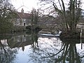
 Mells River reflections - geograph.org.uk - 325941.jpg 480 × 640; 96 KB
-
 Moon and pillbox - geograph.org.uk - 325948 crop.jpg 467 × 284; 41 KB
-
 Moon and pillbox - geograph.org.uk - 325948.jpg 640 × 480; 86 KB
-
 Must have been a hell of a shot^ - geograph.org.uk - 6237570.jpg 3,296 × 2,472; 3.5 MB
-
 North east aspect of All Saints - geograph.org.uk - 6238361.jpg 3,296 × 2,472; 3.58 MB
-

-
 Old road sign at Gloucester Lodge - geograph.org.uk - 3743883.jpg 2,000 × 1,406; 867 KB
-
 Orchardleigh golf course (3) - geograph.org.uk - 837535.jpg 640 × 465; 68 KB
-
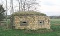
 Pillbox at Lullington - geograph.org.uk - 325945.jpg 640 × 480; 31 KB
-
 Pillbox at Lullington - geograph.org.uk - 325952.jpg 640 × 480; 99 KB
-
 Ploughed field near Lullington - geograph.org.uk - 807946.jpg 640 × 438; 81 KB
-
 Pond Head Plantation, Oldford - geograph.org.uk - 5764388.jpg 2,048 × 1,536; 1.47 MB
-
 Pre-Worboys sign in Lullington Lane - geograph.org.uk - 6238301.jpg 3,296 × 2,472; 3.28 MB
-
 Pumping station by the River Frome - geograph.org.uk - 5764386.jpg 2,038 × 1,522; 1.97 MB
-
 Putting practice and club house - geograph.org.uk - 824533.jpg 640 × 419; 63 KB
-
 Reflections on the Mells River - geograph.org.uk - 325937.jpg 640 × 480; 107 KB
-
 River Frome - geograph.org.uk - 439346.jpg 640 × 477; 119 KB
-
 Roman road, now a farm track - geograph.org.uk - 2509329.jpg 640 × 480; 163 KB
-

-
 St Mary's in Orchardleigh Park - geograph.org.uk - 6238399.jpg 3,296 × 2,472; 3.35 MB
-
 St Marys Lake - geograph.org.uk - 1310391.jpg 640 × 426; 156 KB
-
 Stained glass window, All Saints' church, Lullington - geograph.org.uk - 6612447.jpg 3,040 × 4,272; 5.41 MB
-
 Stained glass window, All Saints' church, Lullington - geograph.org.uk - 6613515.jpg 3,184 × 3,936; 5.51 MB
-
 Staplemead Creamery - geograph.org.uk - 5300436.jpg 640 × 428; 130 KB
-
 Telephone box, Lullington - geograph.org.uk - 1286574.jpg 640 × 480; 153 KB
-
 Temple Lodge, Orchardleigh Park - geograph.org.uk - 6236689.jpg 3,296 × 2,472; 3.49 MB
-
 Thatched cottage, Lullington - geograph.org.uk - 1286620.jpg 481 × 640; 113 KB
-
 Thatched cottages in Lullington - geograph.org.uk - 6237559.jpg 3,296 × 2,472; 3.44 MB
-
 The Downs grass airstrip - geograph.org.uk - 1319302.jpg 640 × 426; 60 KB
-
 The entrance to All Saints Church, Lullington - geograph.org.uk - 5764508.jpg 1,916 × 1,338; 1.65 MB
-
 The graveyard of St Mary's - geograph.org.uk - 6238374.jpg 2,472 × 3,296; 3.31 MB
-
 The house from the lake - geograph.org.uk - 6237586.jpg 3,296 × 2,472; 3.28 MB
-
 The Macmillan Way approaches Lullington - geograph.org.uk - 6238061.jpg 3,296 × 2,472; 3.5 MB
-
 The road from Gloucester Lodge West - geograph.org.uk - 6236677.jpg 3,296 × 2,472; 3.39 MB
-
 The view across the lake from the Temple bridge - geograph.org.uk - 6237577.jpg 3,296 × 2,472; 3.84 MB
-
 The west end is under repair - geograph.org.uk - 6238354.jpg 3,296 × 2,472; 3.39 MB
-

-
 Two faces of St Mary's church - geograph.org.uk - 6238380.jpg 3,296 × 2,472; 3.45 MB
-

-
 Uphill from the River Frome - geograph.org.uk - 6238368.jpg 3,296 × 2,472; 3.53 MB
-
 Vegetable growing near Lullington - geograph.org.uk - 1286797.jpg 640 × 481; 156 KB
-
 View across the Down - geograph.org.uk - 1319106.jpg 640 × 426; 102 KB
-
 View from Cock Road - geograph.org.uk - 798393.jpg 640 × 464; 70 KB
-
 View from Port Way - geograph.org.uk - 798410.jpg 640 × 439; 69 KB
-
 Weir and mill at Lullington - geograph.org.uk - 325931.jpg 640 × 480; 77 KB
-
 Wet field entrance - geograph.org.uk - 5300422.jpg 640 × 480; 104 KB
-
 Where the lake reaches the land - geograph.org.uk - 6237579.jpg 3,296 × 2,472; 4.42 MB
-
 Field west of Lullington - geograph.org.uk - 439378.jpg 640 × 477; 77 KB
-
 Footbridge over the Mells River - geograph.org.uk - 325934.jpg 640 × 480; 110 KB
-
 Footbridge over the Mells River ^2 - geograph.org.uk - 325935.jpg 480 × 640; 87 KB
-
 Staplemead creamery - geograph.org.uk - 85750.jpg 640 × 480; 58 KB


_-_geograph.org.uk_-_837535.jpg)


