Category:Los Lagos Region
Jump to navigation
Jump to search
Regions of Chile: Arica y Parinacota · Tarapacá · Antofagasta · Atacama · Coquimbo · Valparaíso · Santiago · O'Higgins · Maule · Ñuble · Biobío · Araucanía · Los Ríos · Los Lagos · Aysén · Magallanes
administrative division of Chile | |||||
| Upload media | |||||
| Instance of | |||||
|---|---|---|---|---|---|
| Location | Chile | ||||
| Capital | |||||
| Legislative body |
| ||||
| Population |
| ||||
| Area |
| ||||
| official website | |||||
 | |||||
Subcategories
This category has the following 20 subcategories, out of 20 total.
!
B
C
G
H
M
N
R
S
Pages in category "Los Lagos Region"
The following 2 pages are in this category, out of 2 total.
Media in category "Los Lagos Region"
The following 49 files are in this category, out of 49 total.
-
082 - Estuario del Reloncavi.jpg 1,600 × 1,200; 731 KB
-
Amanita Muscaria (189898517).jpeg 2,048 × 1,536; 1.16 MB
-
Ba San Pedro - San Antonio - panoramio.jpg 4,320 × 3,240; 4.27 MB
-
Ba8.jpg 2,166 × 914; 1.65 MB
-
BahíaSanPedro.jpg 1,024 × 768; 312 KB
-
CaletaManquemapu.JPG 1,024 × 768; 456 KB
-
Canal de Chacao Hualo.jpg 1,200 × 473; 85 KB
-
Canal de Chacao, desde un avión. Región de Los Lagos. Chile.jpg 6,120 × 4,799; 3.22 MB
-
Carretera Austral "Augusto Pinochet"- señaletica no oficial.jpg 4,032 × 3,024; 2.85 MB
-
Carretera Austral APU.jpg 2,592 × 1,944; 2.13 MB
-
Chile Región de Los Lagos CORE 2017.svg 512 × 263; 4 KB
-
CL Bahía Mansa 1202 (1) (17041465350).jpg 800 × 535; 99 KB
-
Disputa limítrofe de Alto Palena.svg 1,772 × 2,776; 1.29 MB
-
Erupción Volcán Calbuco (17062565578).jpg 4,000 × 2,248; 2.09 MB
-
Estuario de Reloncaví.jpg 1,024 × 768; 163 KB
-
Fiordo de Comau o Leptepu a Augusto Gubler en 1880.jpg 989 × 774; 209 KB
-
Flag of Los Lagos Region (-2013).svg 600 × 400; 33 KB
-
Flag of Los Lagos Region, Chile.svg 900 × 600; 535 bytes
-
Hotel termas de Puyehue.jpg 1,632 × 1,224; 369 KB
-
Isla huar.jpg 5,472 × 3,648; 5.15 MB
-
Isla Tenglo , Puerto Montt, Región de Los Lagos.jpg 960 × 640; 93 KB
-
Ladera llanquihue.jpg 1,280 × 960; 456 KB
-
Lago Blanco - panoramio.jpg 2,051 × 1,362; 722 KB
-
Lago General Pinto Concha.jpg 5,184 × 3,456; 7.18 MB
-
Lago Llanquihue Pissis.jpg 676 × 504; 68 KB
-
Lagos Andinos, Chile (10935790453).jpg 3,648 × 2,736; 3.31 MB
-
Las vertientes.jpg 2,069 × 1,465; 1.56 MB
-
Las Vertientes.jpg 500 × 375; 23 KB
-
Los Lagos Köppen.png 5,100 × 8,638; 515 KB
-
Michinmavida-volcano-from-the sw chile-region-de-los-lagos.jpg 1,600 × 1,134; 416 KB
-
Missearth06winner.jpg 533 × 800; 90 KB
-
Monte Verde 2012.jpg 4,000 × 3,000; 2.75 MB
-
NM23-764-236.JPG 4,016 × 4,016; 19.16 MB
-
Nueva Bandera Regional Los Lagos.png 685 × 460; 3 KB
-
Once Bellavista (4708566912).jpg 640 × 480; 194 KB
-
Parque Nacional Puyehue.jpg 5,184 × 3,456; 7.58 MB
-
Playa de Punta Lapa, Quellón, Chiloé. - panoramio.jpg 2,832 × 2,128; 1.16 MB
-
Puente Chacao.svg 970 × 173; 28 KB
-
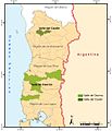
Región Vitícola Austral.jpg 1,040 × 1,212; 426 KB
-
Rio Aguas Calientes.jpg 2,048 × 1,536; 737 KB
-
Rio rahue 2009.jpg 3,264 × 2,176; 3.42 MB
-
Ruta 7 Chile 100km sign.jpg 2,816 × 2,112; 2.62 MB
-
San Jorge.jpg 784 × 477; 426 KB
-
Transbordadores en Pargua.jpg 3,872 × 2,592; 4.61 MB
-
Vista aerea Aguas Calientes.jpg 2,048 × 1,536; 2.23 MB
-
Volcancasablanca.jpg 2,816 × 2,112; 1.17 MB
-
Volcán Osorno en invierno.jpg 5,184 × 3,456; 5.01 MB
-
Volcán Puyehue, Chile.jpg 4,691 × 3,128; 4.1 MB
-
Wiki15.JPG 2,592 × 1,944; 1.94 MB


